 Français (France)
 English (UK)
 English (US)
 Deutsch (Deutschland)

Contents
The route at a glance: 96 miles in eight sections
The West Highland Way runs 96 miles (154 km) from Milngavie, on the edge of Glasgow, to Fort William [1]. It is normally hiked from south to north: the southern sections are the easier ones and prepare you for the more demanding northern half [1]. The official site splits the route into eight sections, and is clear that they are not meant as days. Plan your stage lengths by ability and fitness, and by what you want to see on the way [1].
The table gives each section’s official distance, with the terrain as the official section pages describe it [2, 3, 4, 5, 6, 7, 8, 9].
| Section | From, to | Miles (km) | Terrain, according to the official site |
|---|---|---|---|
| 1 | Milngavie to Drymen | 12 (19) | Footpaths, tracks and lanes with no major climbs |
| 2 | Drymen to Rowardennan | 15 (24) | Over Conic Hill (1,066 ft, 325 m), the only significant ascent; a low-level alternative exists |
| 3 | Rowardennan to Inverarnan | 14 (22.5) | Forestry track, then rocky path; challenging underfoot north of Inversnaid |
| 4 | Inverarnan to Tyndrum | 12 (19.5) | Well-surfaced paths and old military road; Crianlarich, the halfway point, is a short spur away |
| 5 | Tyndrum to Inveroran | 9 (14.5) | Good path with a few inclines; the most straightforward day on the Way |
| 6 | Inveroran to Kingshouse | 10 (16) | Rannoch Moor on the old Parliamentary Road; very exposed, no shelter until the Glencoe ski center |
| 7 | Kingshouse to Kinlochleven | 9 (14.5) | The Devil’s Staircase, about 1,800 ft (550 m), the highest point of the Way, then exposed moorland |
| 8 | Kinlochleven to Fort William | 15 (24) | Steep climb out of Kinlochleven, rough going through the Lairigmor, pavement into town |
The start is marked by an obelisk on Douglas Street in the center of Milngavie, and the finish by a bronze statue of a hiker in Gordon Square, Fort William [10]. The official site now also offers a marked “High Route” into Fort William, which stays 164 to 230 ft (50 to 70 m) above Glen Nevis and ends near the leisure center [9].
How many days does the West Highland Way take?
The official itineraries run from five to seven days, stopping at the main settlements [11]. The official FAQ says the hike takes six to seven days on average, which makes it a good week’s holiday [12]. The table lists the four official plans. In each, the daily miles add up to the full 96.
| Days | Overnight stops | Miles each day |
|---|---|---|
| 5 | Balmaha, Inverarnan, Bridge of Orchy, Kinlochleven | 20, 21, 19, 21, 15 |
| 6 | Balmaha, Inversnaid, Crianlarich, Inveroran, Kinlochleven | 20, 14, 13, 15, 19, 15 |
| 7 (first plan) | Drymen, Rowardennan, Inverarnan, Tyndrum, Inveroran, Kinlochleven | 12, 15, 14, 12, 9, 19, 15 |
| 7 (second plan) | Drymen, Rowardennan, Inverarnan, Tyndrum, Kingshouse, Kinlochleven | 12, 15, 14, 12, 19, 9, 15 |
Two warnings from the official pages shape any plan. The stretch from Inversnaid to Inverarnan is, for some hikers, much harder and slower than expected, so allow for it when you set the miles [11]. And if your dates are flexible, starting midweek makes it easier to find a room later in the hike [11]. The FAQ adds that at busy times you may find lodging more easily by not starting on a Saturday [12].
If you cannot take a week, the official site suggests splitting the route into shorter sections that can be linked by bus or train, for example Tyndrum to Fort William in four days, 43 miles in all [11].
Why the north end of Loch Lomond is slower than it looks
On paper, 14 miles from Rowardennan to Inverarnan is an ordinary day. The official description says otherwise: the section starts on forestry track, then becomes rougher, with rocky path, crags and boulders. Beyond Inversnaid it is challenging underfoot, and hikers are told to take care to avoid twisting an ankle [4].
There is a practical consequence, too. During and just after heavy rain, some stream crossings in this section may be impassable, and the official advice is to wait until flash flooding has subsided [4]. At Inversnaid the path crosses a footbridge over the waterfall, and from there waterbus services run to Tarbet and Inveruglas on the western shore, which opens up more places to stay. For Ardlui, the official site says to raise the marker buoy at the pier just south of Ardleish to signal the ferry [4].
Where to sleep, and how early to book
The official advice is to book your lodging at any time of year, because some places have limited availability [12]. The official lodging page lists, on the day we read it, 18 B&Bs (bed-and-breakfasts) and guesthouses, 15 bunkhouses and hostels, 11 hotels, 8 inns, 9 campsites and 13 baggage-transfer businesses, among other services [13]. The page says the list is not exhaustive, and that the businesses listed help fund the upkeep of the Way [13].
If one stop is full, the official site suggests taking transport back to your lodging of the previous night, and notes that you may get a better rate by staying more than one night [11]. We do not quote room prices here: the official site lists businesses but not their rates, so ask each one directly.
Getting to Milngavie, and home from Fort William
Milngavie has regular trains from Glasgow, and there is a train from Fort William back to Glasgow. There are also stations at Ardlui, Crianlarich, Tyndrum and Bridge of Orchy if you hike the route in sections. The Citylink bus from Glasgow to Fort William stops at Inverarnan, Crianlarich, Tyndrum, Bridge of Orchy, Glen Coe and Ballachulish [10]. To go back to Edinburgh from the finish, the official site points to Ember, an electric intercity bus service [10], whose own site lists routes linking Edinburgh, Glasgow, Oban, Fort William and Inverness [14]. The official site recommends Traveline Scotland for planning public transport [10].
By car, there is no dedicated parking lot at either end. You can park outside Milngavie train station, which has security cameras; it is currently free but could be busy at peak times. You can also park outside the police station, if you tell the police and give them your registration number and an emergency contact [10].
Camping on the West Highland Way: permits and wild camping
When you leave Drymen, you enter Loch Lomond & The Trossachs National Park. From there, camping and firelighting byelaws apply from March 1 to September 30: during that time you may camp only on campsites or in designated permit areas [2]. The official section pages repeat the warning on each section from Drymen to Tyndrum [6].
A camping permit costs £4.50 per tent per night. It allows up to three nights in one area, and you can book up to four weeks ahead [15]. A permit lets you camp anywhere within your chosen permit area rather than on a set pitch, and permit areas have no facilities. You can arrive from 1 p.m. and must leave by 11 a.m. [15].
Outside those dates the rules ease. For October 1, 2026 to February 28, 2027, the park says you do not need a permit in the busy loch shore areas, and its own campsites at Loch Chon, Loch Achray, Inchcailloch and Sallochy are closed [15]. The park is also reviewing its Camping Management Byelaws, with a public consultation announced for July to September 2026 [16]. Check the park’s camping pages for the current rules before you book a 2027 hike.
On fires, the official advice is to use a stove wherever possible. Do not light an open fire in prolonged dry periods, or in forests, woods, farmland, on peaty ground or near buildings [12] [17].
When to go, and what to expect from midges, ticks and weather
The official site says the Way can be hiked at any time of year, and that spring and autumn are especially beautiful. May is the most popular month, which puts the most pressure on beds [12].
Midges, tiny biting flies, are the other seasonal issue. According to the official FAQ they are usually a problem from June to August, and the midge season runs from May to September [12]. They are most active at dusk and dawn, gather around damp ground and warm still evenings, and do not like to fly in a breeze. They carry no disease, and the official advice is to use repellent and wear a midge head net [12]. VisitScotland adds that midge activity changes daily with wind and humidity, so it is worth checking a midge forecast [18].
Ticks need more care. The official FAQ advises long sleeves and long trousers, repellent, and a thorough check at the end of the day. To remove a tick, grasp it as close to the skin as possible with fine-tipped tweezers or a tick removal tool, and pull upwards slowly and firmly [12]. The NHS says ticks that may cause Lyme disease are found all over the UK, with the Scottish Highlands among the high-risk places. A rash can appear up to three months after a bite, but usually within one to four weeks [19].
Winter is a different hike. The official FAQ says the Way should be undertaken from November to March only by fit hikers with good winter navigation skills. Snow can affect all the high ground in the northern half, and the path can disappear completely, so a map and compass, and the ability to use them, are essential [12].
The northern half: Rannoch Moor and the Devil’s Staircase
Tyndrum is the last chance to stock up: there are no more stores until Kinlochleven, 28 miles further on [5]. The official pages describe the next section, from Inveroran across Rannoch Moor, as wild and remote, one of the last great wildernesses of Europe. The track is good, but the moor is very exposed and can be tricky in bad weather, with no shelter until the ski center [7].
From Kingshouse the Way heads toward Altnafeadh, then turns sharply right for the Devil’s Staircase, a zig-zag climb to a cairn at about 1,800 ft (550 m), the highest point of the Way [8]. The path is good underfoot, stony in places and easy to follow, but the official site warns that it can be very exposed in poor weather, especially on the moorland before Kinlochleven [8].
Cash, dogs, bikes and going solo
ATMs are listed at Milngavie, Drymen (the Spar shop), Crianlarich, Tyndrum, Kinlochleven and Fort William, and some machines may charge for withdrawals [12]. Dogs are welcome if they are under proper control and your lodging accepts them. The two enclosed fields on the east approach to Conic Hill are closed to dogs, even on a lead, for about six weeks of lambing from mid-April to the end of May, and a signposted alternative adds no time or distance [3] [12].
You can cycle the Way, but it was designed for hikers: underpasses have low headroom and the path between Rowardennan and Inverarnan is rocky and narrow, not suitable for bikes [12]. Hiking solo is fine, and the official FAQ points out that most people split the route into similar sections, so you often meet the same people each day [12]. For equipment, see our guides to dressing in three layers and using a compass and map.
Gear related to this article
No affiliation: no commission, no sponsored products.
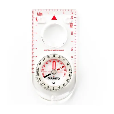
Suunto A-30 NH
A 1.1 oz baseplate compass with a magnifier and luminous markings, sold with metric or USGS map scales: for going back to the map when the blazes run out.
View on Amazon (opens in a new tab)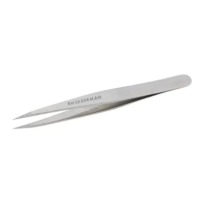
Tweezerman Point Tweezer
Stainless steel tweezers with finely tapered, hand-filed, aligned points: the fine tips grab a tick right at the skin, so you can pull straight up with steady pressure.
View on Amazon (opens in a new tab)
FAQ
How long does the West Highland Way take?
The official FAQ says six to seven days on average, and the official itineraries run from five to seven days. The five-day plan means days of 19 to 21 miles. The seven-day plans keep most days between 9 and 15 miles, with one longer day. Add a spare day if your dates are fixed and the weather is uncertain.
Do I need a permit to camp on the West Highland Way?
From Drymen, yes, between March 1 and September 30: the official section pages flag the byelaws from Drymen to Tyndrum, and you must use a campsite or a permit area. A permit costs £4.50 per tent per night. Outside those dates, the park says no permit is needed in its busy loch shore areas, but the Scottish Outdoor Access Code still applies.
Can I hike the West Highland Way in winter?
The official site says only fit hikers with good winter navigation skills should do it between November and March. Snow can cover the path on high ground in the northern half, so a map, a compass and the skill to use them are essential. The official site adds that many weeks between November and March are fine, and that wet, windy days are more common than snowstorms in milder winters.
When are the midges worst?
The official FAQ says midges are usually a problem from June to August, within a May to September season. They are most active at dusk and dawn and on still, damp, warm evenings, and they avoid a breeze. They carry no disease. Repellent and a head net are the official recommendation.
How do I get home from Fort William?
There is a train from Fort William to Glasgow, and a Citylink bus that runs the same way with stops along the route. The official site also mentions Ember, an electric intercity bus service, for going back to Edinburgh. It recommends Traveline Scotland for planning public transport. Check times before you book beds, because they can decide how long your last day is.
Sources
- West Highland Way, “The route”, accessed November 1, 2026. westhighlandway.org https://www.westhighlandway.org/the-route/ ↩
- West Highland Way, “Milngavie to Drymen”, accessed November 1, 2026. westhighlandway.org https://www.westhighlandway.org/the-route/milngavie-to-drymen/ ↩
- West Highland Way, “Drymen to Rowardennan”, accessed November 1, 2026. westhighlandway.org https://www.westhighlandway.org/the-route/drymen-to-rowardennan/ ↩
- West Highland Way, “Rowardennan to Inverarnan”, accessed November 1, 2026. westhighlandway.org https://www.westhighlandway.org/the-route/rowardennan-to-inverarnan/ ↩
- West Highland Way, “Tyndrum to Inveroran”, accessed November 1, 2026. westhighlandway.org https://www.westhighlandway.org/the-route/tyndrum-to-inveroran/ ↩
- West Highland Way, “Inverarnan to Tyndrum”, accessed November 1, 2026. westhighlandway.org https://www.westhighlandway.org/the-route/inverarnan-to-tyndrum/ ↩
- West Highland Way, “Inveroran to Kingshouse”, accessed November 1, 2026. westhighlandway.org https://www.westhighlandway.org/the-route/inveroran-to-kingshouse/ ↩
- West Highland Way, “Kingshouse to Kinlochleven”, accessed November 1, 2026. westhighlandway.org https://www.westhighlandway.org/the-route/kingshouse-to-kinlochleven/ ↩
- West Highland Way, “Kinlochleven to Fort William”, accessed November 1, 2026. westhighlandway.org https://www.westhighlandway.org/the-route/kinlochleven-to-fort-william/ ↩
- West Highland Way, “Getting to & from the route”, accessed November 1, 2026. westhighlandway.org https://www.westhighlandway.org/getting-started/getting-to-from-the-route/ ↩
- West Highland Way, “Suggested itineraries”, accessed November 1, 2026. westhighlandway.org https://www.westhighlandway.org/the-route/suggested-itineraries/ ↩
- West Highland Way, “Frequently asked questions”, accessed November 1, 2026. westhighlandway.org https://www.westhighlandway.org/getting-started/frequently-asked-questions/ ↩
- West Highland Way, “Accommodation and services”, accessed November 1, 2026. westhighlandway.org https://www.westhighlandway.org/location/ ↩
- Ember, home page (routes and live map), accessed November 1, 2026. ember.to https://www.ember.to/ ↩
- Loch Lomond & The Trossachs National Park, “Get a permit”, accessed November 1, 2026. lochlomond-trossachs.org https://www.lochlomond-trossachs.org/things-to-do/camping/get-a-permit/ ↩
- Loch Lomond & The Trossachs National Park, “Camping”, accessed November 1, 2026. lochlomond-trossachs.org https://www.lochlomond-trossachs.org/things-to-do/camping/ ↩
- NatureScot, Scottish Outdoor Access Code, “Camping”, accessed November 1, 2026. outdooraccess-scotland.scot https://www.outdooraccess-scotland.scot/practical-guide-all/camping ↩
- VisitScotland, “A guide to midges & ticks in Scotland”, accessed November 1, 2026. visitscotland.com https://www.visitscotland.com/planning/travel-information/midges-ticks ↩
- NHS, “Lyme disease”, accessed November 1, 2026. nhs.uk https://www.nhs.uk/conditions/lyme-disease/ ↩
- Mountain Weather Information Service, home page, accessed November 1, 2026. mwis.org.uk https://www.mwis.org.uk/ ↩
- Scottish Mountain Rescue, “Mountain safety & advice”, accessed November 1, 2026. scottishmountainrescue.org https://www.scottishmountainrescue.org/mountain-safety-advice/ ↩

Trail running, snow, water, nature and destinations
Nolwenn covers trail running, snow, water, nature and destinations for Outfarer. Curious about everything, from meteor showers to night-train schedules, she has a knack for digging up the one detail that changes everything, and nailing it in a single sentence.


 Arnaud Couderc