 Français (France)
 English (UK)
 English (US)
 Deutsch (Deutschland)

Contents
The Rota Vicentina at a glance: two routes of 13 stages
Fine sand underfoot, the Atlantic a few yards below, a wind that leaves salt on your lips. An hour in, your boots sink a little with every step and your calves start asking awkward questions. That, in one scene, is what’s ahead on a good part of the Rota Vicentina, the long-distance hiking route of southwest Portugal.
The Rota Vicentina isn’t a single trail. It’s a network of 750 km (466 miles) of walking paths, looked after by a local association [1]. Two long-distance routes form its backbone. The Fishermen’s Trail (Trilho dos Pescadores) follows the coast in 13 stages and 226.5 km (141 miles) [2]. The Historical Way (Caminho Histórico) goes inland, from village to village, in 13 sections and 263 km (163 miles) [3]. On top of those come 24 loop routes of 4 to 16 km (2.5 to 9.9 miles) [1]. A “stage” here means one day of hiking between two places where you can sleep, which is how everything below is counted.
Both routes can be hiked in either direction, and the association says the signage works both ways [2]. It recommends hiking them from September to June [2]. The Fishermen’s Trail runs through the Southwest Alentejo and Vicentine Coast Natural Park, which stretches along 110 km (68.4 miles) of coastline and covers about 131,000 hectares (about 324,000 acres) [4]. The region sits between Lisbon and the Algarve, and the association says it’s served by the Lisbon and Faro airports: Lisbon is the better gateway for the north of the region, Faro for the south, though onward transport is more flexible from Lisbon [6]. For another long coastal path, see the GR34 in Brittany.
The Fishermen’s Trail: 13 stages, sand, and cliffs
The Fishermen’s Trail runs along the ocean on paths locals once used to reach the beaches and fishing grounds [2]. It’s a single-track path, for hikers on foot only, that follows the cliffs with a great deal of sand, which the association says makes it more demanding physically [2]. It rates the trail “somewhat difficult” overall and describes its inland neighbor as easier [2]. The 13 stages are a day each, with a maximum of 22.5 km (14.0 miles) [2]. The stage page for Odeceixe to Aljezur lists 22.6 km, so treat the two figures as the same ballpark [5].
The total depends on which page you read: 226.5 km (141 miles) for the association [2], 221.7 km (138 miles) for the crossing’s listing on Outdooractive, the platform that hosts its tracks [5]. For planning, I start from the 13 stages in the table, which add up to about 221 km (137 miles).
| Stage | Distance | Stated time | Ascent / descent | Difficulty |
|---|---|---|---|---|
| 1. S. Torpes > Porto Covo | 6.34 miles (10.2 km) | 2 h 35 min | 75.5 / 0 ft (23 / 0 m) | Easy |
| 2. Porto Covo > Vila Nova de Milfontes | 12.2 miles (19.6 km) | 5 h 15 min | 249 / 233 ft (76 / 71 m) | Difficult |
| 3. Vila Nova de Milfontes > Almograve | 9.07 miles (14.6 km) | 3 h 45 min | 308 / 305 ft (94 / 93 m) | Difficult |
| 4. Almograve > Zambujeira do Mar | 13.4 miles (21.5 km) | 5 h 50 min | 531 / 531 ft (162 / 162 m) | Moderate |
| 5. Zambujeira do Mar > Odeceixe | 11.6 miles (18.7 km) | 5 h 40 min | 994 / 1,150 ft (303 / 352 m) | Difficult |
| 6. Odeceixe > Aljezur | 14.0 miles (22.6 km) | 5 h 50 min | 607 / 650 ft (185 / 198 m) | Difficult |
| 7. Aljezur > Arrifana | 10.6 miles (17.1 km) | 4 h 46 min | 732 / 584 ft (223 / 178 m) | Moderate |
| 8. Arrifana > Carrapateira | 12.1 miles (19.4 km) | 5 h 10 min | 909 / 978 ft (277 / 298 m) | Moderate |
| 9. Carrapateira > Vila do Bispo | 9.51 miles (15.3 km) | 4 h 18 min | 991 / 761 ft (302 / 232 m) | Moderate |
| 10. Vila do Bispo > Sagres | 12.6 miles (20.2 km) | 5 h 18 min | 374 / 587 ft (114 / 179 m) | Moderate |
| 11. Sagres > Salema | 12.2 miles (19.6 km) | 5 h 25 min | 1,140 / 1,220 ft (348 / 371 m) | Difficult |
| 12. Salema > Luz | 7.15 miles (11.5 km) | 3 h 24 min | 712 / 712 ft (217 / 217 m) | Moderate |
| 13. Luz > Lagos | 6.77 miles (10.9 km) | 3 h 25 min | 702 / 712 ft (214 / 217 m) | Easy |
Distances, times, cumulative ascent and descent, and difficulty ratings published by the association for each stage, main route [5]. The sea-level variants (Arrifana, Carrapateira, Salema) aren’t counted. The time is the one on the stage page. Miles and feet are converted and rounded.
Three stages stand out. The first, from S. Torpes to Porto Covo, is the shortest and easiest at 6.34 miles (10.2 km) [5]; the association also presents Porto Covo as the starting point of the trail for anyone arriving by coach [6]. The hardest is Sagres to Salema: 12.2 miles (19.6 km), 1,140 feet (348 m) of climbing and 1,220 feet (371 m) of descent, described as the toughest section of the trail [7]. The longest is Odeceixe to Aljezur, 14.0 miles (22.6 km) [5].
A word about heights: the association advises against the whole Fishermen’s Trail for anyone with vertigo or a fear of heights, because every stage runs along the cliffs at some point, and it suggests the Historical Way instead [1].
The Historical Way: inland villages and cork oaks
The Historical Way is a classic long-distance route, built mostly from country roads and rural paths through cork oak forests, hills, valleys, and streams [3]. It passes through the region’s main towns and villages and, in the association’s words, follows the pace of country life [3]. It’s registered as part of the GR 11/E9, a route the association says links Sagres with St. Petersburg, and it earned the European Leading Quality Trails, Best of Europe label in 2016 and again in 2020, awarded by the European Ramblers Association, except for the Sabóia to Odemira section [3].
The association rates it “easy” overall [3], but the stage from Cercal do Alentejo to S. Luís, with 1,470 feet (448 m) of climbing over 12.3 miles (19.8 km), is presented as the most mountainous section in the whole network [8]. Day stages are 25 km (15.5 miles) at most, except the connecting leg between Odemira and Sabóia, which is 33 km (20.5 miles) [3]. On Outdooractive, the main crossing shows 11 numbered stages totaling 212.6 km (132 miles) [9], so the association’s 13 sections and 263 km (163 miles) include connecting legs that the table below doesn’t cover.
| Stage | Distance | Stated time | Ascent / descent | Difficulty |
|---|---|---|---|---|
| 1. Santiago do Cacém > Vale Seco | 11.2 miles (18.1 km) | 4 h 45 min | 810 / 948 ft (247 / 289 m) | Easy |
| 2. Vale Seco > Cercal do Alentejo | 14.3 miles (23.0 km) | 5 h 50 min | 673 / 771 ft (205 / 235 m) | Easy |
| 3. Cercal do Alentejo > S. Luís | 12.3 miles (19.8 km) | 5 h 39 min | 1,470 / 1,440 ft (448 / 438 m) | Moderate |
| 4. S. Luís > Odemira | 15.3 miles (24.7 km) | 6 h 37 min | 751 / 1,280 ft (229 / 390 m) | Moderate |
| 5. Odemira > S. Teotónio | 11.8 miles (19.0 km) | 5 h 00 min | 876 / 305 ft (267 / 93 m) | Difficult |
| 6. S. Teotónio > Odeceixe | 10.4 miles (16.7 km) | 4 h 30 min | 564 / 1,090 ft (172 / 331 m) | Moderate |
| 7. Odeceixe > Aljezur | 12.2 miles (19.7 km) | 5 h 03 min | 568 / 558 ft (173 / 170 m) | Easy |
| 8. Aljezur > Arrifana | 7.33 miles (11.8 km) | 3 h 17 min | 653 / 505 ft (199 / 154 m) | Easy |
| 9. Arrifana > Carrapateira | 14.9 miles (23.9 km) | 6 h 30 min | 1,480 / 1,580 ft (450 / 483 m) | Moderate |
| 10. Carrapateira > Vila do Bispo | 13.3 miles (21.4 km) | 5 h 37 min | 840 / 610 ft (256 / 186 m) | Easy |
| 11. Vila do Bispo > Cape St. Vincent | 8.45 miles (13.6 km) | 3 h 24 min | 177 / 344 ft (54 / 105 m) | Easy |
Distances, times, cumulative ascent and descent, and difficulty ratings published by the association on each stage page, main route [9]. Connecting legs and variants aren’t counted. The time is the one on the stage page. Miles and feet are converted and rounded.
The two routes meet in places in the south: the first part of the Arrifana to Carrapateira stage of the Fishermen’s Trail follows the Historical Way, marked only in white and red [10]. That makes it easy to mix the two, coast one day and interior the next, which is exactly what the association encourages when it talks about combining them creatively [1].
Why sand slows down the Fishermen’s Trail
Between 60 and 70% of the Fishermen’s Trail is on sand, the association warns [2]. On that surface, each step loses part of its push: for the same effort, you move slower and tire your calves and ankles sooner. The stated times say as much. Porto Covo to Vila Nova de Milfontes is 12.2 miles (19.6 km) with just 249 feet (76 m) of climbing, and its stage page gives 5 h 15 min [11], about 2.3 mph (3.7 km/h) on an almost flat stage.
That stage is the textbook case. It crosses the vast dune area around Pessegueiro Island and the beaches of Aivados and Malhão; the stage page calls it a tiring day, especially when you start from Porto Covo, and says to carry at least 1.5 liters (50.7 fl oz) of water [11]. Between the beaches of Queimado and Malhão, the path isn’t fully signposted: you follow the broad sand track that skirts the dunes and read the signs. Only at low tide can you walk the beach instead [11]. To read a tide table, our guide to tide times and French coefficients walks you through the method.
So for planning, start from the stated times rather than a flat-ground pace, then add your breaks. Our hiking time guide explains how to turn distance and elevation gain into hours, and how to adjust the formula for slow ground.
Beaches, tides, and cliffs: when the route changes
Several stretches of the Fishermen’s Trail depend on the sea. Between Arrifana and Carrapateira, you have to cross Bordeira beach. If the sea state rules it out, the stage page tells you to climb to the Bordalete pine forest and follow the road to Carrapateira, or take the 21.5 km (13.4 miles) variant [10]. Between Carrapateira and Vila do Bispo, watch the sea at Amado and Murração beaches: if you can’t cross Murração from south to north, the fallback is the inland loop route [12]. On Salema to Luz, the Boca do Rio crossing has its own variant, 14 km (8.70 miles) long [13].
The route also moves for ground reasons. On the Zambujeira do Mar to Odeceixe stage, the original section was closed in September 2025 because of a landslide risk identified since 2022. A new permanent route crosses the Ribeira das Cobras on a wooden bridge, and getting to Amália beach is now a 600 m (1,970 ft) round trip [14]. The association says the GPX tracks on its site were updated [14]: an old file or an old guidebook can simply be wrong, which is why it’s worth downloading the interactive map and the current tracks [15].
Even in town, the trail has surprises. In Vila Nova de Milfontes, to reach Furnas beach you cross the road bridge over the Mira River, on the sidewalk and then on the shoulder, or you take a boat [16]. The association lists the boat as an option, and you need to check its schedule on the association’s website.
The natural park has its own rules: stay on existing paths, don’t smoke or light fires, and don’t pick anything [4]. The association adds that the Fishermen’s Trail is closed to bicycles, because park rules forbid riding off the existing dirt roads [1], and that trail running isn’t compatible with the care this fragile ecosystem needs [2].
When to go: September to June, not summer
The association recommends hiking from September to June and advises against long walks in July and August: in summer, temperatures climb above 30 °C (86 °F), the beaches are full, lodgings often require a stay of several days, and rates rise noticeably [1]. On July 2, 2026, it relayed a notice of very high rural wildfire risk [17]. Autumn is mild, the wind drops, and swimming is still possible in September [1]. Winter is the wettest period, with daytime highs that don’t usually fall below 11 °C (52 °F), according to the association [1]. In March, sunny days alternate with showers, and spring counts among the best times of year [1].
| Month | Sagres, high / low | Sagres, rain | Sines, high / low | Sines, rain |
|---|---|---|---|---|
| October | 72 / 59 °F (22.4 / 15.0 °C) | 2.42 in (61.4 mm) | 71 / 58 °F (21.9 / 14.6 °C) | 3.04 in (77.2 mm) |
| November | 66 / 53 °F (19.0 / 11.7 °C) | 3.23 in (82.0 mm) | 64 / 53 °F (18.0 / 11.4 °C) | 3.34 in (84.8 mm) |
| December | 63 / 50 °F (17.0 / 9.9 °C) | 2.96 in (75.2 mm) | 60 / 49 °F (15.8 / 9.3 °C) | 3.13 in (79.5 mm) |
| January | 61 / 47 °F (16.1 / 8.5 °C) | 2.10 in (53.3 mm) | 59 / 47 °F (14.9 / 8.4 °C) | 2.68 in (68.1 mm) |
| February | 61 / 48 °F (16.3 / 8.8 °C) | 1.91 in (48.5 mm) | 60 / 47 °F (15.6 / 8.5 °C) | 2.09 in (53.1 mm) |
| March | 64 / 51 °F (17.8 / 10.6 °C) | 1.92 in (48.8 mm) | 64 / 50 °F (17.6 / 9.9 °C) | 1.93 in (48.9 mm) |
| April | 66 / 54 °F (19.1 / 12.0 °C) | 1.37 in (34.7 mm) | 66 / 52 °F (18.9 / 11.1 °C) | 1.87 in (47.6 mm) |
| July | 77 / 63 °F (25.2 / 17.0 °C) | 0.04 in (1.0 mm) | 76 / 61 °F (24.7 / 16.1 °C) | 0.05 in (1.2 mm) |
Portuguese weather service (IPMA) climate normals, 1991-2020: Sagres at the south end [19], Sines just north of the Fishermen’s Trail [20]. High and low: averages of the daily maximum and minimum temperatures; rain: average monthly total. July is there as a benchmark. Fahrenheit and inches are converted and rounded.
Reading the table: December brings an average of 2.96 inches (75.2 mm) of rain at Sagres and 3.13 inches (79.5 mm) at Sines, against 0.04 inches (1.0 mm) in July at Sagres [19] [20]. Days with at least 1 mm (0.04 in) of rain average 8.0 in December at Sagres and 9.0 at Sines [19] [20]. Winter here is neither cold nor dry, so pack a rain jacket, as the association advises [1]. It points to the Portuguese weather service’s ten-day forecasts at IPMA and suggests rechecking them one or two days before you leave [1].
Off-season, services thin out. On Sagres to Salema, the beach bars can be closed in winter, so the only supplies are at the start and the end of the stage [7]. For every lodging, the association publishes the minimum stay, the languages spoken, the services, and the operating period, which are worth reading before you book [1].
Luggage and lodging: travel light, book early
Luggage transfers are this hike’s best friend. In practice, someone drives your bags to your next night’s lodging so you can hike with a small daypack. Most lodgings offer luggage and passenger transfers, with their own vehicles or through a partner carrier; you just ask when you book [1]. You can also contact the association’s partner taxis and carriers directly, with fares starting at €1.06 per kilometer (about €1.71 per mile) [21]. To estimate a trip, the association publishes a distance table between towns, updated in June 2024 [15].
As for sleeping, the rule is simple: camping, spending the night outdoors, fires, and gathering firewood are all banned on the Fishermen’s Trail, which lies inside the natural park [1], and the association points hikers to campgrounds instead [2]. That means you plan your days around where the beds are, not where the flat ground is. On the Historical Way, there are no designated camping areas, but you can ask landowners whether they’d allow a tent [1].
Getting around without a car: coach, train, and taxi
The regional public transit network doesn’t meet most hikers’ needs, the association warns. It points to Rede Expressos, the national coach (long-distance bus) network, for long distances and to its partner taxis for the rest [1]. From Lisbon, coaches leave from Sete Rios, a station in the city, for the region’s main towns, and the trip can take one to two hours longer than driving [6].
| Destination | Time | Landmark |
|---|---|---|
| Santiago do Cacém | 2 h 20 min | Start of the Historical Way |
| Porto Covo | 3 h | Usual start of the Fishermen’s Trail |
| São Teotónio | 4 h 20 min | End of Historical Way stage 5 |
| Aljezur | 5 h | End of Fishermen’s Trail stage 6 |
Indicative times from the Rota Vicentina association [6]. The landmarks are those of the stage tables above.
In the south, regional lines run by Vamus Algarve link Lagos with Cape St. Vincent, Sagres, Vila do Bispo, Aljezur, Rogil, and Odeceixe, and Rodoviária do Alentejo serves the stretch between Odeceixe and Santiago do Cacém [6]. Vamus also sells a tourist pass good on the whole Algarve intercity bus network [22]. By rail, the Faro to Lagos train takes about 1 h 45 min, with 9 departures a day between 7 a.m. and 8 p.m. From Lisbon, a train runs three times a day, between 10 a.m. and 5 p.m., to Santa Clara-Sabóia in about 2 h 15 min; that station is 27 km (16.8 miles) from São Teotónio, and Rodoviária do Alentejo buses run there Monday through Friday [6].
Before you go: water, ticks, alerts, and common sense
Before you zip up your backpack, here’s a short list drawn from the association’s recommendations:
- water, at least 1.5 liters (50.7 fl oz) per person, and food, because not every stage passes a café or a grocery store [1];
- hiking boots or sturdy shoes already broken in: flip-flops and sandals without support are discouraged [1], and our guide to hiking boot categories helps you choose;
- a rain jacket and a change of clothes for wet days [1], with the three-layer system for dressing in the cold;
- an eye out for ticks, present from spring to late autumn, on the ground and in the trees: check yourself in the evening [1]; see how to prevent tick bites;
- your dog is welcome, but the association recommends keeping it on a leash [1];
- the 1:50,000 map and the association’s guidebook [1], or the current GPX tracks [15];
- a plan others know about: hike with someone, and tell family, friends, or your lodging host your route [1].
Gear related to this article
No affiliation: no commission, no sponsored products.
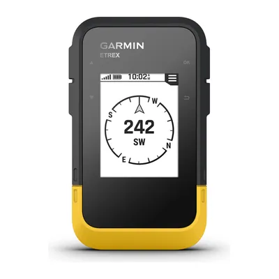
Garmin eTrex SE
A hiking GPS running on two AA batteries for up to 168 hours in standard mode, IPX7 waterproof, that shows geocaches once registered on Geocaching.com: your phone keeps its charge.
View on Amazon (opens in a new tab)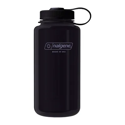
Nalgene Wide Mouth 32 oz
A 32 oz wide-mouth bottle in Tritan Renew, BPA- and BPS-free, leakproof and dishwasher-safe, 6.25 oz empty: the wide opening fills fast at a spigot and takes ice cubes.
View on Amazon (opens in a new tab)
Worth watching
Its chapters cover hiking on sand, luggage transport and accommodation options on the Fishermen’s Trail, and show what the stage tables in this guide cannot.

The video is hosted by YouTube (Google): nothing loads until you play it, and Google may then set cookies.
FAQ
How many days does the Fishermen’s Trail take?
The trail has 13 one-day stages, from 6.34 to 14.0 miles (10.2 to 22.6 km) depending on the stage pages, so allow 13 days of hiking, plus the trips there and back. Nothing obliges you to do it all. The stages can be hiked in either direction and picked one by one, combining them with the Historical Way if you like.
How do I get my luggage moved on the Rota Vicentina?
Most lodgings offer luggage and passenger transfers, with their own vehicles or a partner carrier’s. Ask when you book. You can also call the association’s partner taxis directly, with fares starting at €1.06 per kilometer (about €1.71 per mile), and estimate the cost with its distance table.
Can you camp on the Rota Vicentina?
Not on the Fishermen’s Trail: it lies inside the natural park, where camping, spending the night outdoors, building fires, and gathering firewood are banned. The association points hikers to campgrounds. On the Historical Way, there are no designated areas, but you can ask landowners whether they’d allow a tent.
When is the best time to hike the Rota Vicentina?
The association recommends September to June. Summer tops 30 °C (86 °F), the beaches are full, and lodging costs more. Autumn is mild, winter is the wettest period with daytime highs rarely under 11 °C (52 °F), and spring counts among the best times. Recheck the IPMA forecast a few days before you leave.
Can you run or bike the Fishermen’s Trail?
Not on a bike: the trail is for hikers on foot only, judged dangerous and closed to bikes, because park rules ban riding off existing dirt roads. For running, better not: the association says trail running isn’t compatible with this fragile ecosystem. The other walking trails in the network, away from the coast, can be biked with care.
Sources
- Rota Vicentina, “Help Guide,” the association’s FAQ (season, transport, luggage, accommodation, camping), accessed October 31, 2026. rotavicentina.com https://rotavicentina.com/en/help-guide/ ↩
- Rota Vicentina, “Fishermen’s Trail,” official page of the association, accessed October 31, 2026. rotavicentina.com https://rotavicentina.com/en/fishermens-trail/ ↩
- Rota Vicentina, “Historical Way,” official page of the association, accessed October 31, 2026. rotavicentina.com https://rotavicentina.com/en/historical-way/ ↩
- ICNF (Instituto da Conservação da Natureza e das Florestas), brochure of the Southwest Alentejo and Vicentine Coast Natural Park (in Portuguese), accessed October 31, 2026. icnf.pt https://www.icnf.pt/api/file/doc/82e9b8a54a40ef63 ↩
- Rota Vicentina on Outdooractive, “Fishermen’s Trail,” listing for the crossing and for the 13 stages, accessed October 31, 2026. outdooractive.com https://www.outdooractive.com/en/route/long-distance-hiking/fishermen-s-trail/801867043/ ↩
- Rota Vicentina, “The Region,” official page (climate, getting there by plane, train, and coach), accessed October 31, 2026. rotavicentina.com https://rotavicentina.com/en/the-region/ ↩
- Rota Vicentina on Outdooractive, “Sagres to Salema,” Fishermen’s Trail stage page, accessed October 31, 2026. outdooractive.com https://www.outdooractive.com/en/route/hiking-trail/faro/sagres-salema/801765497/ ↩
- Rota Vicentina on Outdooractive, “Cercal do Alentejo to S. Luís,” Historical Way stage page, accessed October 31, 2026. outdooractive.com https://www.outdooractive.com/en/route/hiking-trail/portugal/cercal-do-alentejo-s.-luis/801765438/ ↩
- Rota Vicentina on Outdooractive, “Historical Way,” listing for the crossing and for the stages, accessed October 31, 2026. outdooractive.com https://www.outdooractive.com/en/route/long-distance-hiking/historical-way/801866831/ ↩
- Rota Vicentina on Outdooractive, “Arrifana to Carrapateira,” Fishermen’s Trail stage page, accessed October 31, 2026. outdooractive.com https://www.outdooractive.com/en/route/hiking-trail/faro/arrifana-carrapateira/801765493/ ↩
- Rota Vicentina on Outdooractive, “Porto Covo to Vila Nova de Milfontes,” Fishermen’s Trail stage page, accessed October 31, 2026. outdooractive.com https://www.outdooractive.com/en/route/hiking-trail/setubal/porto-covo-vila-nova-de-milfontes/801765487/ ↩
- Rota Vicentina on Outdooractive, “Carrapateira to Vila do Bispo,” Fishermen’s Trail stage page, accessed October 31, 2026. outdooractive.com https://www.outdooractive.com/en/route/hiking-trail/faro/carrapateira-vila-do-bispo/801765495/ ↩
- Rota Vicentina on Outdooractive, “Salema to Luz,” Fishermen’s Trail stage page, accessed October 31, 2026. outdooractive.com https://www.outdooractive.com/en/route/hiking-trail/portugal/salema-luz/801765498/ ↩
- Rota Vicentina on Outdooractive, “Zambujeira do Mar to Odeceixe,” Fishermen’s Trail stage page, accessed October 31, 2026. outdooractive.com https://www.outdooractive.com/en/route/hiking-trail/beja/zambujeira-do-mar-odeceixe/801765490/ ↩
- Rota Vicentina, “Downloads,” full GPX tracks and distance table (updated June 2024), accessed October 31, 2026. rotavicentina.com https://rotavicentina.com/en/downloads/ ↩
- Rota Vicentina on Outdooractive, “Vila Nova de Milfontes to Almograve,” Fishermen’s Trail stage page, accessed October 31, 2026. outdooractive.com https://www.outdooractive.com/en/route/hiking-trail/beja/vila-nova-de-milfontes-almograve/801765488/ ↩
- Rota Vicentina, “Warning Map of the Rota Vicentina trails,” safety notices and warning map, association blog post, accessed October 31, 2026. blog.rotavicentina.com https://blog.rotavicentina.com/en/warning-map-of-the-rota-vicentina-trails/ ↩
- INEM (Instituto Nacional de Emergência Médica), home page, October 29, 2026 news item on the European emergency number 112, accessed October 31, 2026. inem.pt https://www.inem.pt ↩
- IPMA (Instituto Português do Mar e da Atmosfera), “Normal Climatológica 1991-2020, Sagres / Quartel da Marinha,” station 533 (in Portuguese), accessed October 31, 2026. ipma.pt https://www.ipma.pt/opencms/bin/file.data/climate-normal/cn_91-20_SAGRES.pdf ↩
- IPMA, “Normal Climatológica 1991-2020, Sines,” station 541 (in Portuguese), accessed October 31, 2026. ipma.pt https://www.ipma.pt/opencms/bin/file.data/climate-normal/cn_91-20_SINES.pdf ↩
- Rota Vicentina, “Transports,” partner taxis and transfers, accessed October 31, 2026. rotavicentina.com https://rotavicentina.com/en/transports/ ↩
- Vamus Algarve, home page of the Algarve intercity bus network (tourist pass), accessed October 31, 2026. vamus.pt https://vamus.pt/en/home-en/ ↩

Camping, backpacking, bushcraft and hiking
Guillaume Hoarau writes for Outfarer about camping, backpacking, bushcraft, and hiking. A survival-skills buff and a collector of vintage field manuals, he loves clear explanations, lists that actually help and other people’s stories, which he tells well.


 Nolwenn Bastide