 Français (France)
 English (UK)
 English (US)
 Deutsch (Deutschland)

Contents
The basic rule: 2.5 mph and 1,000 feet of climbing per hour
It’s 3 p.m., the sun is starting to slide toward the ridge, and the signpost puts the hut 2.5 miles (4 km) away. One hour of hiking? Two? In the mountains, distance alone can’t tell you: it’s mostly the climbs and descents that set the effort, as the French Hiking Federation (FFRandonnée) points out [1]. Luckily, two numbers are enough to get a solid estimate.
On flat or nearly flat ground, an average hiker covers about 4 kilometers an hour, just under 2.5 mph. Uphill, you allow about 300 meters (roughly 1,000 feet) of The sum of all the climbs on a route. A loop that climbs 1,300 feet (400 m), drops down, then climbs another 820 feet (250 m) has 2,130 feet (650 m) of elevation gain. per hour. These are the French Hiking Federation’s benchmarks for a hiker who is “neither a beginner nor a speedster,” breaks not included: 4 km/h on the flat, 300 to 350 m (about 1,000 to 1,150 feet) per hour uphill, and 400 to 500 m (about 1,300 to 1,600 feet) downhill [1].
The simplest calculation works out the two times separately, then adds them up, the way a recipe adds cooking time to prep time:
That’s the U.S. version, slightly rounded: in metric, it’s distance in kilometers divided by 4, plus elevation gain in meters divided by 300. For a 7.5-mile (12 km) hike with 1,500 feet (450 m) of elevation gain, you get 3 hours of hiking on the flat and about 1.5 hours for the climb: roughly 4.5 hours of actual hiking. This number doesn’t include stops: it only measures the time you spend moving.
Where these numbers come from
These benchmarks didn’t come out of nowhere. In 1892, in the journal of the Scottish Mountaineering Club, the Scottish mountaineer William Naismith proposed a rule that’s still well known in Britain [2]:
An hour for every three miles on the map, with an additional hour for every 2,000 feet of ascent.
His rule is faster than the French benchmarks: in his own words, it was meant for “men in fair condition” on “easy expeditions” [2]. In other words, fit hikers on straightforward routes: not necessarily you, with a heavy pack, on a rainy day. A century later, in 1993, the American geographer Waldo Tobler proposed a formula in which speed varies with the slope [3]. It gives about 3.1 mph (5 km/h) on the flat, a top speed of about 3.7 mph (6 km/h) on a gentle downhill, then a speed that drops quickly as the slope gets steeper.
Sometimes the signposts do the math for you. In Switzerland, the yellow signposts at trailheads and trail ends, at major junctions, and near points of interest often show how long the hike to each destination will take: an approximate time, without breaks [4]. Not all of them do: a signpost with times costs more to make, and a detour, after a landslide for instance, can make those times misleading [4]. In Germany and Austria, the times on signposts follow a standard, which we’ll come back to below.

The corrections that change everything
Breaks
No rule counts stops: photos, lunch, waiting for a hiking partner, checking the map. Add them separately. Allow about 10 minutes per hour of hiking, plus lunch: generous, and on purpose. The French Hiking Federation also recommends checking in with yourself often along the way, on both your effort and the time [5].
The descent
The simple calculation leaves it out, and that’s often where the estimate goes off track. The French Hiking Federation’s benchmarks do count it: 1,300 to 1,600 feet (400 to 500 m) of descent per hour [1]. On a gentle downhill, you hike a little faster than on the flat. On a steep one, you slow down noticeably: you have to place your feet, go easy on your knees, and make every step secure. The British author Eric Langmuir suggests subtracting about 10 minutes for every 1,000 feet (300 m) of gentle descent (a slope of 5 to 12°), and adding as much when the slope is steeper than 12° [6].
So should you add a descent time to the simple calculation, say the descent in feet divided by 1,600? No: the methods don’t combine times the same way, and mixing two of them skews the result. Pick one method and apply it in full. The simple calculation doesn’t count the descent; if it’s long or steep, use a method that includes it instead: the German standard, explained below, or Naismith’s rule with Langmuir’s corrections.
Pack, terrain, weather, and group
- A heavy backpack (backcountry camping, several days) slows you down noticeably, especially uphill.
- A rocky trail, a scree field, or snow cuts your speed sharply.
- Heat means more breaks, and rain makes descents slippery: the French Hiking Federation recommends adjusting your schedule to the weather [5].
- A group moves at the pace of its slowest hiker: that’s who the estimate should be built around.
A worked example: an 8.7-mile loop
Take an 8.7-mile (14 km) loop with 2,133 feet (650 m) of elevation gain and the same amount of descent. Depending on the method, the estimated time ranges from 4 hours to 5 hr 40 min:
| Method | Calculation | Time |
|---|---|---|
| Simple calculation (2.5 mph and 1,000 ft/h) | 3 hr 30 min on the flat, plus 2 hr 10 min of climbing | 5 hr 40 min |
| German standard DIN 33466 | 3 hr 30 min on the flat; 2 hr 10 min of climbing and 1 hr 18 min of descent, or 3 hr 28 min; 3 hr 30 min plus half of 3 hr 28 min | 5 hr 15 min |
| Naismith’s rule (1892) | 8.7 miles ÷ 3, plus 2,133 feet ÷ 2,000 | 4 hr |
Hiking time without breaks, rounded to the nearest 5 minutes; calculated on the metric values (14 km, 650 m).
None of them is “the right one”: the simple calculation is cautious uphill but leaves out the descent, Naismith’s rule assumes a strong hiker, and the German standard counts the descent but combines the times its own way. The best choice depends on you. The constants of each method and more worked examples are in the hiking time calculator.
That still leaves turning hiking time into a full day. Add about 10 minutes of breaks per hour of hiking and 45 minutes for lunch, and the 5 hr 40 min of the simple calculation turns into more than 7 hours out: leave at 9 a.m. and you’ll be back around 4:30 p.m.
Finding your own pace
The most reliable way to predict your hiking times is to measure yourself, as the French Hiking Federation also recommends [1]. On two or three hikes you know, note your actual hiking time, minus breaks, then compare it with the calculation.

- Work out the theoretical time with the rule of your choice.
- Time your actual hiking, without breaks.
- Divide the actual time by the theoretical time: that’s your correction factor.
If a hike estimated at 4 hours took you 4 hr 40 min of hiking, your factor is 1.17. From now on, multiply your estimates by that number: you’ll get times made for you, which you can fine-tune with every hike.
Gear related to this article
No affiliation: no commission, no sponsored products.
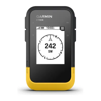
Garmin eTrex SE
A hiking GPS running on two AA batteries for up to 168 hours in standard mode, IPX7 waterproof, that shows geocaches once registered on Geocaching.com: your phone keeps its charge.
View on Amazon (opens in a new tab)
FAQ
How long does it take to hike 10 km (6.2 miles)?
On flat ground, at about 2.5 mph (4 km/h), allow roughly 2.5 hours of hiking, not counting breaks. Add 1,000 feet (300 m) of climbing and the simple calculation adds an hour. Then add about 10 minutes of breaks per hour of hiking, and round up to the next half hour.
How long does it take to climb 1,000 m (3,300 feet)?
Based on the French Hiking Federation’s benchmarks, an average hiker climbs 1,000 to 1,150 feet (300 to 350 m) per hour: allow between 2 hr 50 min and 3 hr 20 min for 3,300 feet (1,000 m) of elevation gain, not counting breaks. On a steep or rocky trail, or with a heavy pack, allow more.
What’s the average hiking speed?
Usually between 2 and 3 mph (3 to 5 km/h) on flat ground, depending on the terrain, your pack, and how you feel that day. Most rules use 2.5 mph (4 km/h), an average you correct with your own factor, measured over two or three hikes you know.
Should you count the descent in your hiking time?
Yes, especially when it’s steep: you move more slowly than you’d think. The French Hiking Federation allows 1,300 to 1,600 feet (400 to 500 m) of descent per hour, the German DIN 33466 standard 1,600 feet (500 m). Still, don’t add a descent time to the simple calculation: use a method that includes it, like the German standard, and apply it in full.
Do hiking apps estimate hiking time accurately?
They use similar formulas, sometimes adjusted to your past hikes. So does the French Hiking Federation’s rating tool, which gives an estimated time from a GPS track. These times give you a good ballpark figure, to correct with your own factor.
Sources
- French Hiking Federation (FFRandonnée), “Les itinéraires de randonnée” (in French), accessed October 21, 2026. ffrandonnee.fr https://www.ffrandonnee.fr/randonner/ou-pratiquer/les-itineraires-de-randonnee ↩
- William W. Naismith, “Cruach Ardran, Stobinian, and Ben More,” Scottish Mountaineering Club Journal, vol. 2, no. 3, September 1892, transcribed by the Glasgow Digital Library. gdl.cdlr.strath.ac.uk http://gdl.cdlr.strath.ac.uk/smcj/smcj009/smcj0090603.htm ↩
- Waldo Tobler, Three Presentations on Geographical Analysis and Modeling, Technical Report 93-1, NCGIA, University of California, Santa Barbara, 1993. escholarship.org https://escholarship.org/uc/item/05r820mz ↩
- Schweizer Wanderwege (Swiss hiking trails association), “Wieso hat es nicht auf allen Wegweisern Zeitangaben?” (in German), article published in amirando in 2012, posted online by the canton of Graubünden. gr.ch https://www.gr.ch/DE/institutionen/verwaltung/diem/tba/flv/Documents/sw-artikel_zeitangaben-wegweiser-2012.pdf ↩
- French Hiking Federation (FFRandonnée), “Recommandations pour la randonnée en montagne l’été” (in French), October 19, 2023, accessed October 21, 2026. ffrandonnee.fr https://www.ffrandonnee.fr/randonner/securite/recommandations-pour-la-randonnee-en-montagne-l-ete ↩
- Eric Langmuir, Mountaincraft and Leadership, the reference handbook of Mountain Training (UK), 1984; 4th edition, 2013. ↩
- DIN 33466 standard, Wegweiser für Wanderwege, Deutsches Institut für Normung, May 2004. dinmedia.de https://www.dinmedia.de/en/standard/din-33466/71697858 ↩
- Austrian Alpine Club (Österreichischer Alpenverein), “Wie berechnet man die Gehzeit auf Wanderwegen?” (in German), June 14, 2018. alpenverein.at https://www.alpenverein.at/portal/news/aktuelle_news_kurz/2018/2018_06_14_wie-berechnet-man-die-gehzeit-auf-wanderwegen.php ↩
- French Hiking Federation (FFRandonnée), “Cotation des randonnées pédestres” (in French), February 3, 2025, accessed October 21, 2026. ffrandonnee.fr https://www.ffrandonnee.fr/randonner/securite/cotation-des-randonnees-pedestres ↩

Camping, backpacking, bushcraft and hiking
Guillaume Hoarau writes for Outfarer about camping, backpacking, bushcraft, and hiking. A survival-skills buff and a collector of vintage field manuals, he loves clear explanations, lists that actually help and other people’s stories, which he tells well.


 Nolwenn Bastide
