 Français (France)
 English (UK)
 English (US)
 Deutsch (Deutschland)

Sunday night, the track downloads in two taps: a neat red line on the screen, a 9-mile loop, perfect. The next Saturday, that red line sends you up a slope no trail has ever crossed. It happens for real. In April 2026, two hikers crossing Franconia Ridge in New Hampshire’s White Mountains got disoriented in fading light and knee-deep snow and called for help; they were navigating with a hiking app, and told New Hampshire Fish and Game it was behind a lot of their confusion. Conservation officers talked them into turning back, then helped them down 2.2 miles of steep, icy trail in the middle of the night [1].
Planning your route comes down to three questions, in this order: where does the line come from, what does the map say, and what will you have left when your phone runs out of signal or battery? This guide expands on step 2 of our guide to planning a hike.
First, a reliable source for your route
The best line follows a trail someone maintains and marks. In the national parks, the Park Service suggests checking the park’s website or asking a ranger how hard a trail is, and rangers can recommend trails too; park alerts list trail closures, wildfire risks, and other hazards [2]. Once you’re out there, trail markers and blazes confirm you’re still on the right one.
Tracks shared by other hikers can help too, as long as you don’t take them on faith: cross-check them with the land manager. At Sequoia and Kings Canyon National Parks, in California, the park sends hikers to the visitor center closest to their trailhead for the latest on frontcountry trails, and warns not to rely on its online trail updates in spring, fall, and winter, when very few rangers are out on the trails [3]. Hiking in France? The mountain gendarmes of Luchon, in the Pyrenees, who have had to rescue hikers misled by a “fake” trail on their app, advise never relying on a single app [4].
On the map: the right scale
Few things beat a topo map spread out on the kitchen table, and it’s not just nostalgia talking. To follow a route on foot, the classic is the USGS 7.5-minute quadrangle, at 1:24,000: 1 inch on the map equals exactly 2,000 feet on the ground [6]. It’s the scale of most US topographic mapping, detailed enough to show footbridges, fence lines, and campgrounds; most of Alaska, where our cover photo was taken, was mapped at 1:63,360, or 1 inch to the mile [6]. Today’s US Topo maps keep the same 7.5-minute extents and cover the whole country, Alaska included since 2021; they’re free to download, or printed to order [7].
| Scale | 1 inch on the map | What it shows |
|---|---|---|
| 1:24,000 (7.5-minute) | 2,000 feet | Detailed: footbridges, fence lines, campgrounds |
| 1:100,000 | About 1.6 miles | More ground, with a reasonable level of detail |
| 1:250,000 | About 4 miles | Large areas, major features only |
From the U.S. Geological Survey. [6]
On the map, trace the route with your finger and note what matters: the elevation gain, by counting contour lines, the tricky stretches, water sources, shelters, and the trails that let you cut the hike short. Elevation gain and distance give you the time, which our guide to hiking time helps you estimate, and the trail’s difficulty rating tells you whether the terrain is within reach. Hiking in France? The Luchon gendarmes point out that recent 1:25,000 maps from IGN, France’s national mapping agency, are free to view on the Géoportail website [4].
The GPX file: what’s inside
GPX, short for GPS Exchange Format, is the go-to format for tracks: a lightweight XML format for swapping GPS data, waypoints, routes, and tracks, between applications [8]. It can hold three different things that often get mixed up [9]:
- Waypoints: a point of interest or a named feature, like a spring, a shelter, or a summit.
- A route: an ordered list of waypoints, a series of turn points leading to a destination.
- A track: an ordered list of points describing a path.
Here’s what matters to you: a track recorded on the move hugs the trail, switchback after switchback, while a route keeps only the turn points, and between two of them, nothing tells you where the trail actually goes. A track drawn by hand at home is only as good as the map it was drawn on, so draw it on a recent topographic map, and check it.
Hiking apps: what’s free, and what you pay for
A hiking app does three things: it shows a map, lets you draw or import a route on it, and shows where you are, even with no cell service if the map has been downloaded. What sets them apart is the map underneath, and what’s free. Here are the ones you’re most likely to run into on US trails, no claim to be complete. Our comparison of hiking apps sets out their maps, offline use and prices.
| App | Base maps | Offline | GPX files | Price |
|---|---|---|---|---|
| AllTrails | Not specified by the company | With AllTrails Plus or Peak | Import and export with a free account | Plus $35.99 a year |
| Gaia GPS (Outside) | 300+ maps with Premium, including National Geographic | With Premium | Import on the web; export as GPX, KML, or GeoJSON | Premium $59.90 |
| onX Backcountry | Topo, satellite, and hybrid maps | One offline map free; unlimited with Premium | Export at any level; import with Premium or Elite | Premium $29.99 a year; Elite $99.99 |
| CalTopo | Topo maps, including scanned USGS quads | With a paid subscription | Import and export GPX, KML, GeoJSON on the web, no account needed | Paid plans for offline use |
AllTrails is the big one, with more than a million ratings on the US App Store, where its Plus plan costs $35.99 a year [10]. It keeps offline maps for its Plus and Peak plans [11], but any member can import and export route files, GPX included, on the website or in the app [12, 13]. Gaia GPS, now part of Outside, lets you record, track, and navigate for free [14]; Premium adds more than 300 maps and offline downloads [15], from $59.90 on the App Store [16], and you can export your tracks and routes as GPX, KML, or GeoJSON from gaiagps.com [17].
onX Backcountry’s free version includes topo, satellite, and hybrid maps and one offline map; Premium, $29.99 a year, unlocks unlimited offline maps [18]. You can export your markups at any membership level, but importing takes Premium or Elite [19]. CalTopo imports and exports GPX, KML, and GeoJSON files on the web, whether your map is saved or not [20], but using its mobile app offline takes a paid subscription [21].
On your phone: offline maps and battery
Don’t count on cell service: there may be no coverage in the park, the Park Service warns [2]. Its Ten Essentials suggest using the NPS App or downloading a map onto your phone or GPS unit before you go, and packing an extra battery for your phone [22]. Searching for a signal drains a battery fast, so the Park Service recommends keeping it fully charged and turning the phone off, or switching to airplane mode, until you need it [2]. New Hampshire Fish and Game’s rescue reports show why: in November 2025, two hikers who had lost the trail under fresh snow on Mount Monadnock had only their phones for light, and the phones were dying [23].
Cold doesn’t help. Apple says its phones work best at ambient temperatures of 32 to 95 °F (0 to 35 °C), and that in very cold conditions battery life drops, temporarily, until the battery warms back up [24]. In winter or up high, keep your phone in an inside pocket rather than the top pocket of your pack, and take it out to check your position, not to follow the line nonstop.
On the trail: map first
The Park Service wants you to know how to use a topographic map, compass, or GPS unit before you head out, and to bring a physical map as a backup [22]. France’s sports ministry says it just as plainly in its summer mountain safety campaign: don’t rely on your phone alone, since there isn’t always coverage in the mountains [26]. A map and compass earn their keep the day fog rolls in, the French Hiking Federation notes [27]; our compass guide shows you how to take a bearing.
On the trail, check your position regularly: knowing where you are tells you whether you’re on schedule, and lets you decide in time to change your route, cut the hike short, or turn around. If you do get lost, the Park Service’s emergency plan says to find your location with your map, compass, GPS, or landmarks, and to retrace your steps if it’s safe; if you can’t, call 911 and stay put [28]. For that last case, our guide to calling for help without cell service is one to read before you leave, not on the trail.
A damaged trail? Report it
A missing blaze, a washed-out stretch, a trail that’s no longer there: let the agency that manages it know. At Sequoia and Kings Canyon, trail conditions are updated from reports by park staff and backcountry users, and the park invites hikers to email in what they find [3]. Reports like yours are what keep everyone else’s maps and tracks accurate.
A track well chosen, checked, and downloaded, plus a paper map for the day everything goes dark: with those three layers, the red line goes back to being what it should be, a guide and not a boss. For the rest of your pack, our day hike packing list covers it all.
Gear related to this article
No affiliation: no commission, no sponsored products.
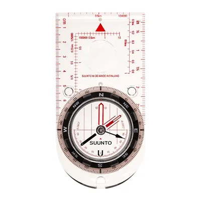
Suunto M-3 G
A baseplate compass with adjustable declination, useful where it tops 14°: set the offset once and skip the math on every bearing. Globally balanced needle, magnifier, 1.69 oz.
View on Amazon (opens in a new tab)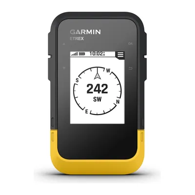
Garmin eTrex SE
A hiking GPS running on two AA batteries for up to 168 hours in standard mode, IPX7 waterproof, that shows geocaches once registered on Geocaching.com: your phone keeps its charge.
View on Amazon (opens in a new tab)
FAQ
What map should I use to plan a hike?
A 1:24,000 USGS topographic map, the 7.5-minute quadrangle, where 1 inch equals 2,000 feet: it’s the scale of most US topographic mapping, detailed enough to show footbridges and fence lines. Current US Topo maps cover the whole country and are free to download. They don’t show every trail yet, so pair them with the park’s or forest’s own trail map.
Can I follow a GPX track I found online?
Yes, once you’ve checked it. Lay it over a recent topographic map, make sure it follows a trail drawn on the map, and cross-check with the land manager’s website or a ranger. In April 2026, two hikers navigating with an app got disoriented on New Hampshire’s Franconia Ridge, told Fish and Game the app caused much of their confusion, and needed help getting down.
Track or route: what’s the difference in a GPX file?
A track is an ordered list of points describing a path: it hugs the trail, switchback after switchback. A route is an ordered list of turn points leading to a destination: between two points, nothing tells you where the trail goes. A GPX file can also hold single waypoints, like a spring, a shelter, or a summit.
How do I keep my phone from dying on a hike?
Download maps and the track before you go, start fully charged, and pack an extra battery, as the National Park Service recommends. Searching for a signal drains the battery fast, so switch to airplane mode or turn the phone off until you need it. In the cold, keep it in an inside pocket: Apple notes that battery life drops in very cold conditions.
Do I still need a compass if I have GPS?
Yes, along with a paper map. The Park Service’s Ten Essentials list map, compass, and GPS under navigation, and ask you to bring a physical map as a backup and to know how to use these tools before you go. A battery can die and cell coverage can vanish; a map and compass weigh almost nothing and never need charging.
Sources
- New Hampshire Fish and Game Department, “Two Unprepared Hikers on Mount Liberty,” news release, April 28, 2026, accessed October 28, 2026. nhfishgame.com https://nhfishgame.com/2026/04/28/two-unprepared-hikers-on-mount-liberty/ ↩
- National Park Service, “Hike Smart,” updated June 13, 2024, accessed October 28, 2026. nps.gov https://www.nps.gov/articles/hiking-safety.htm ↩
- Sequoia & Kings Canyon National Parks, “Trail Conditions,” National Park Service, updated October 26, 2026, accessed October 28, 2026. nps.gov https://www.nps.gov/seki/planyourvisit/trailcond.htm ↩
- French Hiking Federation (FFRandonnée), “Les gendarmes de montagne dénoncent les applications de randonnée trompeuses” (in French), alert from the Luchon mountain gendarmerie unit (PGHM), August 12, 2025, accessed October 28, 2026. ffrandonnee.fr https://www.ffrandonnee.fr/s-informer/actualites/les-gendarmes-de-montagne-denoncent-les-applications-de-randonnee-trompeuses ↩
- U.S. Geological Survey, “Why are there no power lines, pipelines, libraries, trails, etc. on US Topo maps?” accessed October 28, 2026. usgs.gov https://www.usgs.gov/faqs/why-are-there-no-power-lines-pipelines-libraries-trails-etc-us-topo-maps ↩
- U.S. Geological Survey, “Map Scales,” Fact Sheet 015-02, February 2002, accessed October 28, 2026. pubs.usgs.gov https://pubs.usgs.gov/fs/2002/0015/report.pdf ↩
- U.S. Geological Survey, “US Topo: Maps for America,” accessed October 28, 2026. usgs.gov https://www.usgs.gov/programs/national-geospatial-program/us-topo-maps-america ↩
- TopoGrafix, “GPX: the GPS Exchange Format,” accessed October 28, 2026. topografix.com https://www.topografix.com/gpx.asp ↩
- TopoGrafix, “GPX 1.1 Schema Documentation,” accessed October 28, 2026. topografix.com https://www.topografix.com/GPX/1/1/ ↩
- App Store (US), AllTrails app page, ratings and in-app purchases,, accessed October 28, 2026. apps.apple.com https://apps.apple.com/us/app/alltrails-hike-bike-run/id405075943 ↩
- AllTrails, “How to Download Maps to Your Phone for Offline Use,” help center,, accessed October 28, 2026. support.alltrails.com https://support.alltrails.com/hc/en-us/articles/37213318235028-How-to-download-maps-to-your-phone-for-offline-use ↩
- AllTrails, “Downloading Files from AllTrails,” help center,, accessed October 28, 2026. support.alltrails.com https://support.alltrails.com/hc/en-us/articles/37230403315476-Downloading-files-from-AllTrails ↩
- AllTrails, “Uploading Files to AllTrails,” help center,, accessed October 28, 2026. support.alltrails.com https://support.alltrails.com/hc/en-us/articles/37228498475028-Uploading-files-to-AllTrails ↩
- Gaia GPS, “Gaia GPS Premium with Outside+,”, accessed October 28, 2026. gaiagps.com https://www.gaiagps.com/outsideplus/ ↩
- Google Play (US), Gaia GPS app page, updated September 11, 2026,, accessed October 28, 2026. play.google.com https://play.google.com/store/apps/details?id=com.trailbehind.android.gaiagps.pro&hl=en_US&gl=US ↩
- App Store (US), Gaia GPS app page, in-app purchases,, accessed October 28, 2026. apps.apple.com https://apps.apple.com/us/app/gaia-gps-mobile-trail-maps/id1201979492 ↩
- Gaia GPS, “Export Data as GPX, KML, or GeoJSON from gaiagps.com,” help center,, accessed October 28, 2026. help.gaiagps.com https://help.gaiagps.com/hc/en-us/articles/115003524687-Export-Data-as-GPX-KML-or-GeoJSON-from-gaiagps-com ↩
- onX, “onX Backcountry Pricing,”, accessed October 28, 2026. onxmaps.com https://www.onxmaps.com/backcountry/app/pricing ↩
- onX Backcountry, “Importing and Exporting Markups,” help center,, accessed October 28, 2026. onxbackcountry.zendesk.com https://onxbackcountry.zendesk.com/hc/en-us/articles/360057195972-Importing-and-Exporting-Markups-Waypoints-Routes-Lines-Shapes-and-Tracks ↩
- CalTopo, “Export,” CalTopo Training,, accessed October 28, 2026. training.caltopo.com https://training.caltopo.com/all_users/import-export/export ↩
- CalTopo, “Offline,” CalTopo Training,, accessed October 28, 2026. training.caltopo.com https://training.caltopo.com/all_users/mobile/offline ↩
- National Park Service, “Ten Essentials,” updated May 28, 2026, accessed October 28, 2026. nps.gov https://www.nps.gov/articles/10essentials.htm ↩
- New Hampshire Fish and Game Department, “Lost Hikers on Mt. Monadnock in Jaffrey,” news release, November 24, 2025, accessed October 28, 2026. nhfishgame.com https://nhfishgame.com/2025/11/24/lost-hikers-on-mt-monadnock-in-jaffrey/ ↩
- Apple, “Batteries: Maximizing Performance,” accessed October 28, 2026. apple.com https://www.apple.com/batteries/maximizing-performance/ ↩
- National Park Service, “The NPS App,” updated October 23, 2026, accessed October 28, 2026. nps.gov https://www.nps.gov/subjects/digital/nps-apps.htm ↩
- French Ministry of Sports, “Prévention montagne été,” summer mountain safety campaign (in French), accessed October 28, 2026. sports.gouv.fr https://www.sports.gouv.fr/prevention-montagne-ete ↩
- French Hiking Federation (FFRandonnée), “Bien préparer sa randonnée” (in French), June 23, 2022, accessed October 28, 2026. ffrandonnee.fr https://www.ffrandonnee.fr/randonner/conseils/bien-preparer-sa-randonnee ↩
- National Park Service, “Outdoor Emergency Plan,” updated June 21, 2023, accessed October 28, 2026. nps.gov https://www.nps.gov/articles/gtgemergencyplan.htm ↩

Camping, backpacking, bushcraft and hiking
Guillaume Hoarau writes for Outfarer about camping, backpacking, bushcraft, and hiking. A survival-skills buff and a collector of vintage field manuals, he loves clear explanations, lists that actually help and other people’s stories, which he tells well.


 Julien de Jurquet
