 Français (France)
 English (UK)
 English (US)
 Deutsch (Deutschland)

Contents
On paper the math is easy: the NPS app and the USGS maps cost $0, onX Backcountry Premium is $29.99 a year [1], CalTopo Pro is $50 a year [2], and Gaia GPS Premium bundled with Outside+ is $89.99 a year [3]. But these prices don’t buy the same thing. One is a federal app for park visits, another is a set of map files, a third draws its basemaps from federal land agencies. So let’s sort them on three questions, and only three: which map appears on screen, what can you download to head out without cell service, and what happens to a GPX track you import or export.
Three Criteria, Read From the Publishers’ Pages
A hiking app shows a map, lets you draw or import a route, and puts a dot on it. What sets one apart comes down to three lines of small print: the base map, what downloads for offline use, and access to GPX, the exchange format for tracks [4]. Price comes last, because it only means something once those three lines are read. We stick to the publishers’ own pages, the App Store listings and the National Park Service, read on November 5, 2026 (a few help pages on October 28, 2026). Offers change, so the date matters.
| App | Base map | Offline | GPX tracks | Price |
|---|---|---|---|---|
| Gaia GPS | 300+ maps including NatGeo Trails Illustrated and private lands (App Store listing) | Premium | The publisher’s pages read do not mention GPX | Free to record, track and navigate. Premium with Outside+: $89.99 a year (blog); App Store lists Premium at $59.90, period not stated |
| onX Backcountry | Map data from USFS, BLM and NPS; LiDAR Topo, Satellite and Terrain basemaps | One saved offline map free; unlimited with Premium | GPX and KML import (files under 4 MB, via the web map); export not mentioned | Premium $29.99 a year; Elite $99.99 a year |
| CalTopo | MapBuilder Topo (OpenStreetMap data), MapBuilder Hybrid, Global Imagery | Mobile, Pro, Desktop or Team subscription | The publisher’s pages read do not say which formats | Pro $50 a year; Mobile (offline maps only) $20 a year; free account to create and share maps |
| AllTrails | The listing does not name the base map (topo and trail maps in 3D) | Plus or Peak | Import and download of tracks open to every member, even on the free plan | App Store: Plus $35.99, Peak $79.99, period not stated |
| Komoot | The listing mentions topographic layers; the pages read do not name the base map | By region, region bundle or World Pack | Import; export tied to the unlocked start region | App Store: World Pack $29.99, Premium lines from $4.99 to $59.99, periods not stated |
| NPS app (National Park Service) | Park maps and content | Download parks before your visit; no cell service needed | The listing does not mention GPX | Free, no in-app purchases |
| USGS topoView and US Topo | USGS topographic maps, current and historical | Files you download; no app | Formats listed: GeoPDF, GeoTIFF, JPEG, KMZ; no GPX | Free |
Sources: publisher pages and App Store (US) listings read on November 5, 2026, plus two help pages read on October 28, 2026, all detailed in the numbered sources. The App Store listings do not always give the billing period: rely on the one shown at checkout.
The NPS App and USGS Maps: Free, With Limits
The National Park Service app is free and lets you download parks before your visit, then use the app when there is no internet [5]. The NPS trip planning guide says the app offers downloadable park maps [6], and the Arches National Park page says to download park maps with the app before you leave cell service [7]. The listing mentions no in-app purchases and no GPX [5].
USGS topoView puts topographic maps in front of the public at no cost, as GeoPDF, GeoTIFF, JPEG and KMZ files. There is no app: you open them in a PDF reader or GIS software [8, 9]. US Topo maps are described as available for free and immediate download as GeoPDF files [10]. The USGS also lists topoBuilder, which delivers free OnDemand Topos in 24 hours to 5 business days [9]. None of these pages lists GPX.
Gaia GPS, onX Backcountry, and CalTopo: Paying for the Offline Map
onX Backcountry says its map data is sourced from USFS, BLM and NPS and offers LiDAR Topo, Satellite and Terrain basemaps [11]. One saved offline map is free, and Premium saves unlimited offline maps [1, 11]. Premium is $29.99 and Elite $99.99, both yearly; the App Store listing also shows Elite at $14.99 a month [1, 12]. onX supports GPX and KML imports, with files under 4 MB through the web map on a computer, and the page read does not mention export [13].
FATMAP was retired on October 1, 2024, app and website, and onX presents Backcountry as the alternative. Nothing on that page says onX bought FATMAP, and it states that importing an existing file is different from recovering data from the retired service [13].
Gaia GPS lists 300+ maps, including NatGeo Trails Illustrated and private lands, on its App Store listing [14]. You can record, track and navigate for free, and offline maps come with Premium [15]. The publisher’s blog gives $89.99 a year for Gaia GPS Premium with Outside+, posted December 1, 2024 [3]. The App Store listing shows Premium at $59.90 without a period, and the Premium and Outside+ pages read show no prices [14, 15]. None of the pages read mentions GPX.
CalTopo offers MapBuilder Topo, which uses OpenStreetMap data, MapBuilder Hybrid and Global Imagery. They can be downloaded for offline use with a Mobile, Pro, Desktop or Team subscription [16]. The plans page lists Pro at $50 a year and Mobile, for offline maps only, at $20 a year; a free account creates and shares maps [2]. The home page says the hassle of downloading and transferring GPX files between apps is in the past, but the pages read do not say which formats or which plan [16, 17].
| App | Yearly price | 3 years |
|---|---|---|
| onX Backcountry Premium | $29.99 | $89.97 |
| CalTopo Pro | $50 | $150 |
Prices on publisher pages on November 5, 2026, assumed unchanged for three years: a rough guide, not a promise from the publishers.
The gap over three years is $60.03. The plans don’t cover the same ground: onX leans on federal land maps, CalTopo on OpenStreetMap-based topos and imagery, and the choice depends more on the map you want than on that difference.
Komoot and AllTrails: Pay by Region or by Plan
The komoot listing says you choose between single regions, region bundles or the World Pack. It shows the World Pack at $29.99 and Premium lines at $4.99, $7.99 and $59.99, without billing periods; these are the same figures as on the UK listing, in dollars, so check the amount at checkout [18]. GPX export needs the start region to be unlocked [19]. Bending Spoons announced on March 20, 2025 that it had closed the acquisition of komoot [20], which can change offers: reread them before buying.
AllTrails reserves offline maps for its Plus and Peak plans [21]; the US listing shows Plus at $35.99 and Peak at $79.99, without saying for how long [22]. Any member, even on the free plan, can import and download track files [23, 24]. The listing doesn’t name the base map, only topos and trail maps in 3D: check it in the app before paying.
| If you want | What the offers say |
|---|---|
| Free park maps for a national park visit | NPS app (download the park before you go) |
| Free USGS topographic maps as files | topoView or US Topo (GeoPDF and other formats, no app) |
| Federal land basemaps with unlimited offline maps | onX Backcountry Premium ($29.99 a year) |
| OpenStreetMap-based topos for offline use | CalTopo Pro ($50 a year) or Mobile ($20 a year, offline maps only) |
| Importing and downloading tracks with a free account | AllTrails (offline maps need Plus or Peak) |
Reread at the date of purchase: publishers’ offers change.
GPX: The Format That Links the Apps
GPX, short for GPS Exchange Format, is a light XML data format designed for exchanging GPS data between applications and web services [4]. It is what lets you prepare a track in one app and send it to another or to a handheld GPS. It carries no map: an imported track appears on the base map of the app that opens it. Our guide to planning the route, the map, and the GPX track sets out what a file contains.

An App Doesn’t Replace the Paper Map or Your Judgment
The National Park Service’s Hike Smart page says not to rely on your cell phone, because there may be no cellular coverage and reception in your park, and to keep the battery fully charged if you use it [25]. Its trip planning guide warns that your phone battery may not last the whole trip and that you could damage or lose the phone, so always carry a backup paper map [6]. The Ten Essentials page says the same: bring a physical map as a backup, pack an extra battery, and know how to use a topographic map, compass or GPS unit before going out [26]. Great Smoky Mountains National Park lists navigation (map, compass and GPS) among its essentials and suggests airplane mode to keep the battery from draining quickly [27].

The rule to keep fits in one sentence: pay for the map you need without service, download it at home, and keep the paper map in your pack.
Gear related to this article
No affiliation: no commission, no sponsored products.
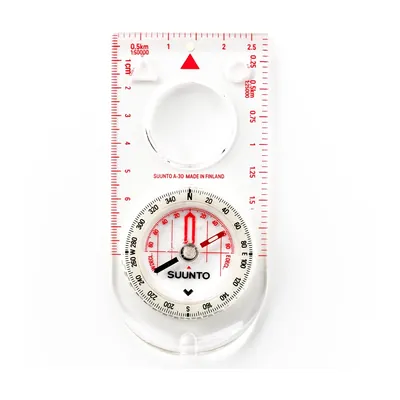
Suunto A-30 NH
A 1.1 oz baseplate compass with a magnifier and luminous markings, sold with metric or USGS map scales: for going back to the map when the blazes run out.
View on Amazon (opens in a new tab)
FAQ
Is there a free hiking map I can use without cell service?
Yes, two kinds, according to the publishers’ pages read in November 2026. The free National Park Service app lets you download parks before a visit and use them when there is no internet. USGS topoView and US Topo maps are free files you download and open in a PDF reader or GIS software.
Did onX buy FATMAP?
The pages read do not say so. FATMAP was retired on October 1, 2024, and onX presents Backcountry as an alternative. Its page adds that importing an existing file is different from recovering data from the retired service.
Do I need a subscription to import or export a GPX file?
It depends on the app. onX Backcountry supports GPX and KML imports (files under 4 MB through the web map). A free AllTrails account can import and download tracks. Komoot’s export needs the start region to be unlocked. For Gaia GPS and CalTopo, the pages read don’t say.
Has Komoot been sold?
Yes. Bending Spoons announced on March 20, 2025 that it had closed the acquisition of komoot. A change of owner can change offers and prices, so reread them on the day you buy.
Can I count on cell service for my map?
No. The National Park Service says not to rely on your cell phone, because there may be no coverage in your park. It advises a fully charged battery, an extra battery and a backup paper map. Download the maps at home, before you leave cell service.
Sources
- onX Backcountry, pricing page, accessed November 5, 2026. onxmaps.com https://www.onxmaps.com/backcountry/app/pricing ↩
- CalTopo, subscription plans, accessed November 5, 2026. caltopo.com https://caltopo.com/northern ↩
- Gaia GPS blog, “Unlock Your Next Adventure with Gaia GPS Premium & Outside+”, December 1, 2024, accessed November 5, 2026. blog.gaiagps.com https://blog.gaiagps.com/unlock-your-next-adventure-with-gaia-gps-premium-outside/ ↩
- TopoGrafix, “GPX: the GPS Exchange Format”, accessed October 28, 2026. topografix.com https://www.topografix.com/gpx.asp ↩
- App Store (US), National Park Service app listing, accessed November 5, 2026. apps.apple.com https://apps.apple.com/us/app/national-park-service/id1549226484 ↩
- National Park Service, Trip Planning Guide, accessed November 5, 2026. home.nps.gov https://home.nps.gov/subjects/healthandsafety/trip-planning-guide.htm ↩
- National Park Service, Arches National Park, “Safety”, accessed November 5, 2026. nps.gov https://www.nps.gov/arch/planyourvisit/safety.htm ↩
- USGS, topoView, accessed November 5, 2026. usgs.gov https://www.usgs.gov/tools/topoview ↩
- USGS, “How do I find, download, or order topographic maps?”, accessed November 5, 2026. usgs.gov https://www.usgs.gov/faqs/how-do-i-find-download-or-order-topographic-maps ↩
- USGS, “US Topo: Maps for America”, accessed November 5, 2026. usgs.gov https://www.usgs.gov/programs/national-geospatial-program/us-topo-maps-america ↩
- onX Backcountry, app page, accessed November 5, 2026. onxmaps.com https://www.onxmaps.com/backcountry/app ↩
- App Store (US), onX Backcountry listing, in-app purchases, accessed November 5, 2026. apps.apple.com https://apps.apple.com/us/app/onx-backcountry-3d-trail-maps/id1529165366 ↩
- onX Backcountry, “FATMAP is Shutting Down”, accessed November 5, 2026. onxmaps.com https://www.onxmaps.com/backcountry/blog/fatmap-alternative ↩
- App Store (US), Gaia GPS: Mobile Trail Maps listing, in-app purchases, accessed November 5, 2026. apps.apple.com https://apps.apple.com/us/app/gaia-gps-mobile-trail-maps/id1201979492 ↩
- Gaia GPS, Premium page, accessed November 5, 2026. gaiagps.com https://www.gaiagps.com/premium/ ↩
- CalTopo, FAQ, accessed November 5, 2026. training.caltopo.com https://training.caltopo.com/all_users/getting-started/faq ↩
- CalTopo, About page, accessed November 5, 2026. caltopo.com https://caltopo.com/about ↩
- App Store (US), komoot listing, in-app purchases, accessed November 5, 2026. apps.apple.com https://apps.apple.com/us/app/komoot-hike-bike-run/id447374873 ↩
- komoot, “Export and import Routes and Activities”, help center, accessed October 28, 2026. support.komoot.com https://support.komoot.com/hc/en-us/articles/10115477099674-Export-and-import-Routes-and-Activities ↩
- Silicon UK, “Bending Spoons acquires komoot”, republished press release of March 20, 2025, accessed November 5, 2026. silicon.co.uk https://www.silicon.co.uk/press-release/bending-spoons-acquires-komoot ↩
- AllTrails, “How to download maps to your phone for offline use”, help center, accessed October 28, 2026. support.alltrails.com https://support.alltrails.com/hc/en-us/articles/37213318235028-How-to-download-maps-to-your-phone-for-offline-use ↩
- App Store (US), AllTrails listing, in-app purchases, accessed November 5, 2026. apps.apple.com https://apps.apple.com/us/app/alltrails-hike-bike-run/id405075943 ↩
- AllTrails, “Uploading files to AllTrails”, help center, accessed October 28, 2026. support.alltrails.com https://support.alltrails.com/hc/en-us/articles/37228498475028-Uploading-files-to-AllTrails ↩
- AllTrails, “Downloading files from AllTrails”, help center, accessed October 28, 2026. support.alltrails.com https://support.alltrails.com/hc/en-us/articles/37230403315476-Downloading-files-from-AllTrails ↩
- National Park Service, “Hike Smart”, accessed November 5, 2026. nps.gov https://www.nps.gov/articles/hiking-safety.htm ↩
- National Park Service, “Ten Essentials”, accessed November 5, 2026. nps.gov https://www.nps.gov/articles/10essentials.htm ↩
- National Park Service, Great Smoky Mountains National Park, “Hiking Safety”, accessed November 5, 2026. nps.gov https://www.nps.gov/grsm/planyourvisit/hikingsafety.htm ↩

Vans, RVs, biking and calculators
Julien de Jurquet writes for Outfarer about camper vans, RVs, biking, and calculators. He reads manuals cover to cover and never lets a number slide without its unit, so your choices rest on math, not promises.

 Guillaume Hoarau

