 Français (France)
 English (UK)
 English (US)
 Deutsch (Deutschland)

Sunday evening, the route downloads in two taps: a neat red line on the screen, 14 km (9 miles), a perfect loop. The following Saturday, that red line sends you up a slope no path has ever crossed. It is less far-fetched than it sounds. In July 2021, Mountaineering Scotland, which represents hill walkers and climbers in Scotland, and the John Muir Trust, a Scottish charity that protects wild places, warned that a popular mapping app, asked for driving directions to Ben Nevis, could send walkers to a car park at the head of Glen Nevis and show a dotted line to the summit through very steep, rocky, pathless ground. Add low cloud and rain, said Mountaineering Scotland’s mountain safety adviser, and that line was potentially fatal; the app has since changed its directions to the visitor centre car park [1].
Planning your route, then, comes down to three questions, in this order: where does the line come from, what does the map say, and what will be left when your phone has neither signal nor battery. This guide expands on step 2 of our guide to planning a walk.
First, a reliable source for your route
The best line follows a path somebody looks after. National Trails in England and Wales and Scotland’s Great Trails are maintained and signposted with funding from public bodies, and OS Explorer maps show them with an acorn or a thistle [2]. On the way, waymarks confirm you are still on the right path: on public rights of way in England, Wales and Northern Ireland, yellow arrows for footpaths and blue for bridleways [3].
Routes shared by other walkers are useful too, on one condition: check them. Mountaineering Scotland advises checking any route downloaded from an app or website against other reliable sources, to make sure it is safe and suits your experience and ability [4]. After the Ben Nevis episode, the John Muir Trust advised anyone heading for a mountain or a hill to cross-check information on a map, or to consult a local guide [1].
On the map: the right scale
Few things beat a 1:25,000 map unfolded on the kitchen table, and it is not just nostalgia talking. At that scale, 1 cm on the map represents 250 m on the ground, or 4 cm to 1 km, and the grid squares are exactly 1 km across [6]. It is the scale of Ordnance Survey’s Explorer maps, which show many features including paths and buildings; the Landranger maps, at 1:50,000, show roads, larger paths and some individual features [6]. In Ireland, Tailte Éireann publishes its Discovery Series at 1:50,000 and a 1:25,000 series designed for hill walkers and mountaineers [7].
| Scale | 1 cm on the map | What it shows best |
|---|---|---|
| 1:25,000 (OS Explorer) | 250 m | Paths and buildings: following the route and finding where you are |
| 1:50,000 (OS Landranger) | 500 m | Roads, larger paths and some features: a wider view |
| 1:100,000 (OS Tour) | 1 km | Road, rail and sea links: planning a longer trip |
Based on Ordnance Survey. [6]
On the map, run your finger along the route and note what matters: the ascent, by counting the contour lines, the tricky sections, water, shelter and the paths that let you cut the day short. Ascent and distance give you the time, which our guide to walking time helps you work out, and the route’s grade tells you whether the ground is within your reach.
The GPX file: what’s inside
GPX, short for GPS Exchange Format, is the usual format for routes: a lightweight XML format for exchanging GPS data, waypoints, routes and tracks, between applications [8]. It can hold three different things, which are easily confused [9]:
- Waypoints: a point of interest or a named feature, such as a spring, a hut or a summit.
- A route: an ordered list of waypoints, a series of turn points leading to a destination.
- A track: an ordered list of points describing a path.
What matters to you: a track recorded on the move sticks to the path, bend after bend, whereas a route keeps only the turn points, and between two of them nothing tells you where the path actually runs. Ordnance Survey makes the same point: a track shows the exact path someone followed, and is often the best option for repeating a proven route on the ground [10]. A line drawn by hand at home is only as good as the map it was drawn on: hence the point of drawing it on a recent 1:25,000 map, and checking it.
Walking apps: what’s free, and what you pay for
A walking app does three things: it shows a map, lets you draw or import a route on it, and puts you on that map, even with no signal if the map has been downloaded. What sets them apart is the map underneath, and what’s free. In Great Britain, the reference is Ordnance Survey’s mapping, and in most apps you pay to carry it offline. Here are the ones you’re most likely to come across, with no claim to be complete. Our comparison of walking apps sets out their maps, offline use and prices.
| App | Base map | Offline | GPX files | Price |
|---|---|---|---|---|
| OS Maps (Ordnance Survey) | OS Explorer 1:25,000 and Landranger 1:50,000 with a subscription; Great Britain only | With a subscription | Import; download for subscribers | £35.99 a year or £7.49 a month |
| Outdooractive | OpenStreetMap; official topographic maps, including OS and Ordnance Survey Ireland, with Pro | With Pro | Import and export; GPX download free | Pro £26.99 a year |
| Komoot | Komoot’s own map, based on OpenStreetMap | One region free, then the World Pack or Premium | Import free; export once the start region is unlocked | World Pack £29.99 (one-off); Premium £59.99 a year |
| AllTrails | Not specified by the company | With AllTrails Plus or Peak | Import and export with a free account | Plus £35.99 a year |
OS Maps is the obvious choice in Great Britain: a subscription unlocks Ordnance Survey’s Explorer maps at 1:25,000 and Landranger maps at 1:50,000, covering the whole of Great Britain, all of which can be downloaded for offline use [11], and every route you create comes with a GPX file for premium members [12]. You can also use it free of charge in a desktop browser at explore.osmaps.com [13]. The subscription costs £35.99 a year or £7.49 a month on the UK App Store [14]. It doesn’t cover Ireland: there, Outdooractive’s Pro membership lists maps from Ordnance Survey Ireland and Ordnance Survey Northern Ireland among its official topographic maps [15], for £26.99 a year on the UK App Store [16], or €29.99 on its website [17]. Outdooractive also took over ViewRanger, once Britain’s leading outdoor app, in 2020 [18].
Komoot, bought by the Italian group Bending Spoons in March 2025 [19], uses its own map built on OpenStreetMap data: you can navigate one region offline for free, and Premium adds worldwide offline maps [20], at £59.99 a year on the UK App Store [21]; exporting a GPX file requires the region where the route starts to be unlocked [22]. AllTrails keeps offline maps for its Plus and Peak plans [23], from £35.99 a year [24], but any member can import and export route files [25, 26].
On your phone: offline maps and battery
You cannot always rely on a phone signal in the great outdoors, AdventureSmart UK reminds us: download all the maps you need before you set off, along with your route, and pack a waterproof paper map as well [27]. Fully charge your phone, carry a charged power bank in a dry bag, and keep some charge in reserve in case you need to make an emergency call; flight mode makes the battery last longer, and you can still use the phone to navigate [27]. Mountain Rescue England and Wales adds that many accidents happen towards the end of the day, when both you and your phone are low on energy [28].
The cold does not help. Apple puts the comfort zone of its phones at 0 to 35 °C ambient temperature, and warns that in very cold conditions battery life drops, temporarily, until the battery warms up again [29]. In winter or high on the hill, keep your phone in an inside pocket rather than in the lid of your rucksack, and take it out to check your position, not to follow the line all day.
On the way: map first
Mountaineering Scotland is clear about it: safe navigation means reading and interpreting a map, not just following an arrow on a screen, and mountain rescue teams respond to many call-outs caused by GPS or smartphone failure, poor route choice, or people unable to use the technology effectively [4]. France’s sports ministry, in its summer mountain safety campaign, says much the same: do not rely on your mobile alone, as there is not always signal in the mountains [30]. Map and compass come into their own when the mist comes down, notes the French Hiking Federation [31]; our guide to the compass shows you how to take a bearing.
On the way, check your position regularly: knowing where you are tells you whether you are keeping to time, and lets you decide early enough to change route, shorten the day or turn back. AdventureSmart suggests noting key features, such as path junctions and streams, and the time you pass them, to keep track of your progress; if you lose your way, it advises backtracking to your last known point rather than taking a shortcut across country [27]. For the worst case, our guide to calling for help without signal is one to read before you set off, not on the hill.
A damaged path? Report it
A waymark gone, a path blocked, a stile broken: in England and Wales, on a public right of way, GOV.UK asks you to contact the local council to report problems such as obstructions, poor maintenance or a misleading sign [3]. The council’s rights of way officer holds the definitive map, can clear the route, and contacts Ordnance Survey if its maps need updating [2]. Reports like yours are what keep everyone else’s maps and lines accurate.
A line well chosen, checked and downloaded, and a paper map for the day everything goes dark: with these three layers, the red line goes back to being what it should be, a guide rather than a master. For the rest of your rucksack, our day walk kit list covers the lot.
Kit related to this article
No affiliation: no commission, no sponsored products.
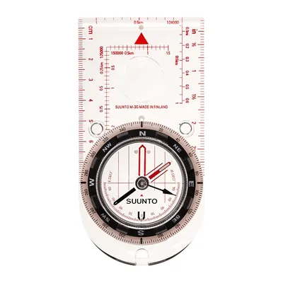
Suunto M-3 NH
A baseplate compass with adjustable declination: set the offset once and there is no more arithmetic on every bearing. Northern-hemisphere needle, magnifying lens.
View on Amazon (opens in a new tab)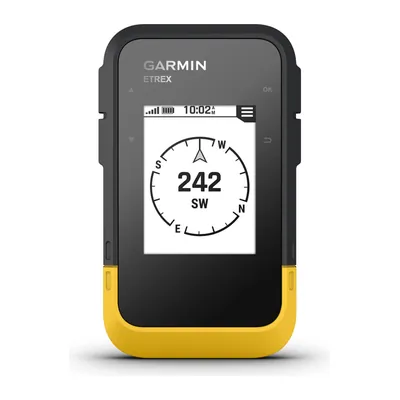
Garmin eTrex SE
A hiking GPS running on two AA batteries for up to 168 hours in standard mode, IPX7 waterproof, that shows geocaches once registered on Geocaching.com: your phone keeps its charge.
View on Amazon (opens in a new tab)
FAQs
Which map should I use to plan a walk?
A 1:25,000 map, where 1 cm represents 250 m: it is the scale of Ordnance Survey’s Explorer maps, which show many features including paths and buildings, and the most useful for following a route on foot. The 1:50,000 Landranger shows a wider area in less detail. In Ireland, Tailte Éireann publishes the 1:50,000 Discovery Series and a 1:25,000 series designed for hill walkers.
Can I follow a GPX route I found online?
Yes, once you have checked it. Mountaineering Scotland advises checking any route downloaded from an app or website against other reliable sources, to make sure it is safe and suits your ability. Lay it over a recent 1:25,000 map, check that it follows a path drawn on the map, and remember that a right of way on a map is not always a usable path on the ground.
Track or route: what’s the difference in a GPX file?
A track is an ordered list of points describing a path: it sticks to the path, bend after bend. A route is an ordered list of turn points leading to a destination: between two points, nothing tells you where the path runs. A GPX file can also hold single waypoints, such as a spring, a hut or a summit.
How do I stop my phone running flat on a walk?
Download the maps and the route before you leave, start with a full charge and carry a charged power bank in a dry bag. AdventureSmart UK suggests flight mode, which makes the battery last longer while still letting you navigate. In the cold, keep the phone in an inside pocket, as battery life drops in very cold conditions, and take it out to check your position rather than following the screen all day.
Do I still need a compass if I have GPS?
Yes, along with a paper map. Mountaineering Scotland says no system is 100% fail-safe and calls a separate backup, such as a map and compass, a must, along with the skills to use them. Mountain Rescue England and Wales points out that a paper map is the reliable option, needing neither batteries nor charge. Together they weigh very little, and neither ever runs flat.
Sources
- John Muir Trust, ‘Online routes could put walkers at risk’, joint warning with Mountaineering Scotland, 16 July 2021, updated 20 July 2021, accessed 28 October 2026. johnmuirtrust.org https://www.johnmuirtrust.org/whats-new/news/929-online-routes-could-put-walkers-at-risk ↩
- Ordnance Survey, ‘Public Rights of Way Explained: Footpaths, Bridleways and Access Land’, OS GetOutside, 15 October 2026, accessed 28 October 2026. osmaps.com https://osmaps.com/discover/guides/public-rights-of-way/ ↩
- GOV.UK, ‘Rights of way and accessing land: use public rights of way’, accessed 28 October 2026. gov.uk https://www.gov.uk/right-of-way-open-access-land/use-public-rights-of-way ↩
- Mountaineering Scotland, ‘Smartphones and GPS for navigation’, accessed 28 October 2026. mountaineering.scot https://www.mountaineering.scot/safety-and-skills/essential-skills/navigation/electronic-navigation-aids ↩
- French Hiking Federation (FFRandonnée), ‘Les gendarmes de montagne dénoncent les applications de randonnée trompeuses’ (in French), alert from the Luchon mountain gendarmerie unit (PGHM), 12 August 2025, accessed 28 October 2026. ffrandonnee.fr https://www.ffrandonnee.fr/s-informer/actualites/les-gendarmes-de-montagne-denoncent-les-applications-de-randonnee-trompeuses ↩
- Ordnance Survey, ‘A Beginner’s Guide to Understanding Map Scales’, OS GetOutside, 29 May 2022, accessed 28 October 2026. osmaps.com https://osmaps.com/discover/guides/understanding-map-scales/ ↩
- Tailte Éireann, ‘Tourist and Leisure Maps’, accessed 28 October 2026. tailte.ie https://tailte.ie/map-shop/tourist-leisure-maps/ ↩
- TopoGrafix, ‘GPX: the GPS Exchange Format’, accessed 28 October 2026. topografix.com https://www.topografix.com/gpx.asp ↩
- TopoGrafix, ‘GPX 1.1 Schema Documentation’, accessed 28 October 2026. topografix.com https://www.topografix.com/GPX/1/1/ ↩
- Ordnance Survey, ‘What is a GPX file?’, OS GetOutside, accessed 28 October 2026. osmaps.com https://osmaps.com/discover/guides/what-is-a-gpx-file/ ↩
- Google Play (UK), OS Maps app page, updated 19 October 2026,, accessed 28 October 2026. play.google.com https://play.google.com/store/apps/details?id=uk.co.ordnancesurvey.osmaps&hl=en_GB&gl=GB ↩
- Ordnance Survey, ‘GPX file FAQs: a complete guide for hikers’, OS Maps, updated 21 October 2026,, accessed 28 October 2026. osmaps.com https://osmaps.com/discover/guides/gpx-file-faqs-a-complete-guide-for-hikers/ ↩
- Ordnance Survey, ‘OS Maps terms’ (end user licence agreement),, accessed 28 October 2026. ordnancesurvey.co.uk https://www.ordnancesurvey.co.uk/legal/os-maps-terms ↩
- App Store (UK), OS Maps app page, in-app purchases,, accessed 28 October 2026. apps.apple.com https://apps.apple.com/gb/app/os-maps-walk-hike-run-bike/id978307846 ↩
- Outdooractive, ‘Map information’,, accessed 28 October 2026. outdooractive.com https://www.outdooractive.com/en/map-information.html ↩
- App Store (UK), Outdooractive app page, in-app purchases,, accessed 28 October 2026. apps.apple.com https://apps.apple.com/gb/app/outdooractive-hike-and-ride/id1364846172 ↩
- Outdooractive, ‘Membership plans’,, accessed 28 October 2026. outdooractive.com https://www.outdooractive.com/en/membership/plans.html ↩
- Outdooractive, company blog post on the ViewRanger and MountNpass acquisitions (in German), 15 June 2020,, accessed 28 October 2026. corporate.outdooractive.com https://corporate.outdooractive.com/oa-blog/die-jungsten-firmenubernahmen-schaffen-mehr-moglichkeiten-fur-sie-als-outdooractive-kunde/ ↩
- Bending Spoons, home page (list of acquisitions),, accessed 28 October 2026. bendingspoons.com https://bendingspoons.com/ ↩
- Komoot, ‘The hiking app with GPX support’,, accessed 28 October 2026. komoot.com https://www.komoot.com/hiking-app/hiking-app-with-gpx-support ↩
- App Store (UK), Komoot app page, in-app purchases,, accessed 28 October 2026. apps.apple.com https://apps.apple.com/gb/app/komoot-hike-bike-run/id447374873 ↩
- Komoot, ‘Export and import Routes and Activities’, help centre,, accessed 28 October 2026. support.komoot.com https://support.komoot.com/hc/en-us/articles/10115477099674-Export-and-import-Routes-and-Activities ↩
- AllTrails, ‘How to download maps to your phone for offline use’, help centre,, accessed 28 October 2026. support.alltrails.com https://support.alltrails.com/hc/en-us/articles/37213318235028-How-to-download-maps-to-your-phone-for-offline-use ↩
- App Store (UK), AllTrails app page, in-app purchases,, accessed 28 October 2026. apps.apple.com https://apps.apple.com/gb/app/alltrails-hike-run-walk/id405075943 ↩
- AllTrails, ‘Downloading files from AllTrails’, help centre,, accessed 28 October 2026. support.alltrails.com https://support.alltrails.com/hc/en-us/articles/37230403315476-Downloading-files-from-AllTrails ↩
- AllTrails, ‘Uploading files to AllTrails’, help centre,, accessed 28 October 2026. support.alltrails.com https://support.alltrails.com/hc/en-us/articles/37228498475028-Uploading-files-to-AllTrails ↩
- AdventureSmart UK, ‘Keep on Track’, accessed 28 October 2026. adventuresmart.co.uk https://www.adventuresmart.co.uk/keep-on-track/ ↩
- Ordnance Survey, ‘Advice from Mountain Rescue’, advice from Mountain Rescue England and Wales, OS GetOutside, 21 March 2023, accessed 28 October 2026. osmaps.com https://osmaps.com/discover/guides/mountain-safety/ ↩
- Apple (UK), ‘Batteries: Maximising Performance’, accessed 28 October 2026. apple.com https://www.apple.com/uk/batteries/maximizing-performance/ ↩
- French Ministry of Sports, ‘Prévention montagne été’, summer mountain safety campaign (in French), accessed 28 October 2026. sports.gouv.fr https://www.sports.gouv.fr/prevention-montagne-ete ↩
- French Hiking Federation (FFRandonnée), ‘Bien préparer sa randonnée’ (in French), 23 June 2022, accessed 28 October 2026. ffrandonnee.fr https://www.ffrandonnee.fr/randonner/conseils/bien-preparer-sa-randonnee ↩

Camping, wild camping, bushcraft and hiking
Guillaume Hoarau writes for Outfarer about camping, wild camping, bushcraft and hiking. A survival-skills enthusiast and a collector of old field manuals, he likes clear explanations, lists that earn their place and other people’s stories, which he tells well.


 Julien de Jurquet
