 Français (France)
 English (UK)
 English (US)
 Deutsch (Deutschland)

Contents
Picture the jetty at Saint-Gingolph at dawn: Lake Geneva flat behind you, your boots on the first red and white stripes, and ahead, a month of passes, high pastures, and hilltop villages all the way to the Mediterranean. The GR5 has traced this north-south crossing of the French Alps since 1950 [1], and on this stretch the long European trail is called the Grande Traversée des Alpes, the Great Alpine Crossing [2].
This guide follows the official stages of the Grande Traversée des Alpes association, the route’s manager, and the parks’ rules. For any hike of several days, see also our guide to planning a multi-day hike.
The Alpine GR5 at a glance
The figures change with the page you read, even on the manager’s website: 600 km and some forty stages on the home page, 620 km on the route page [1, 3]. The French Hiking Federation, the FFRandonnée, gives about 600 km, 98,400 feet (30,000 m) of elevation gain, and 36 stages [4]. Added up, the 36 stages detailed by the manager come to 349 miles (561 km) and about 103,000 feet (31,400 m) of gain, our calculation; the gap probably comes from variants, a start in Thonon rather than Saint-Gingolph, and a finish in Menton rather than Nice.
This is no stroll. The FFRandonnée says the route is better suited to hikers with some experience and reliable gear, on a mountain trail with big climbs of up to 4,270 feet (1,300 m) per stage [5]; the manager’s own list opens with 5,580 feet (1,701 m) of gain on day one, from Saint-Gingolph to the Chalets de Bise [6]. The manager puts the average stage at 3,280 feet (1,000 m) of gain and warns of dizzying sections, where sure footing matters in wet weather or fog [7]. Red and white GR stripes mark the trail, plus each park’s and département’s signs [7].
Four sections, 36 stages
Rather than a month in one go, the manager suggests four sections of seven to ten stages [8]. Here are their totals, stage figures added up.
| Section | From, to | Stages | Distance | Elevation gain |
|---|---|---|---|---|
| 1. Lake Geneva, Mont Blanc | Saint-Gingolph, Les Houches | 7 | 63 mi (101.5 km) | 23,300 ft (7,100 m) |
| 2. Mont Blanc, Maurienne | Les Houches, Modane | 10 | 98 mi (158 km) | 27,400 ft (8,340 m) |
| 3. Maurienne, Ubaye | Modane, Larche | 10 | 90 mi (145 km) | 26,900 ft (8,210 m) |
| 4. Ubaye, Mediterranean | Larche, Nice | 9 | 97 mi (156.5 km) | 25,400 ft (7,750 m) |
Our calculation, adding up the stages the manager publishes for each section; its own pages sometimes give other totals. Miles and feet: our conversion. [6, 9, 10, 11]
The first section crosses the Chablais and dips into Switzerland on stages 3 and 4, via the Chésery hut [6]. From the Col de Brévent, on its last stage, the GR5 shares its path with the Tour du Mont-Blanc; the manager says the two run together as far as the Col du Bonhomme [6], but the TMB’s own route description carries on over the Col de la Croix du Bonhomme before dropping to Les Chapieux [12], so in practice they part there. The second section then crosses the more technical Col de la Croix du Bonhomme and the Vanoise [9]. The third goes through Briançon and the Queyras, a regional nature park, and over the Col Girardin, at 8,850 feet (2,699 m), the highest pass on the route [10]. The last follows the Tinée valley and, from Saint-Dalmas-Valdeblore, drops to Nice in three stages; the variant on the GR52, through the Vallée des Merveilles, ends in Menton [11].
Huts, gîtes, and camping
French mountain huts, or refuges, are staffed in summer: you book a bunk in a dorm, and half board means dinner and breakfast; gîtes are hikers’ hostels in the villages. Most huts open from June 15 to September 15, sometimes longer in the Southern Alps, and some village stores close as early as the end of August [13]. The manager recommends booking or calling ahead, and points to several booking platforms: the Tour du Mont-Blanc’s for the huts the two routes share, and those of the Vanoise National Park huts, the Compagnie des refuges Clarée-Thabor, and the FFCAM, the French federation of Alpine clubs [14]. On the shared stretch, the official TMB website set October 15, 2026 as the opening date for summer 2027 bookings [15]. Our guide to staying in a mountain hut in France explains the etiquette.
| Service | Full price |
|---|---|
| Half board in a dorm | €60.50 |
| Bed only in a dorm | €23 |
| Camping only, by the hut | €6 |
| Camping with half board | €43.50 |
| Packed lunch | €13 |
Tourist tax on top: €0.85 per person. [16]
Club discounts are mostly a European affair. The FFCAM gives 50% off the night in its huts and chalets above 4,920 feet (1,500 m) to members of the clubs on its reciprocity list, except chalets you can reach by road; that list has no American club [17]. It adds that every association in the UIAA, the international mountaineering federation, can buy individual stickers for its members, so ask your club whether it belongs and offers them [17]. The discount only applies in the French Alpine Club’s own huts, not in the Vanoise park huts or private gîtes. Our comparison of Alpine club memberships sets out what each European club covers.
If you’re used to dispersed camping on national forest or BLM land, leave that habit at home. There’s no single rule for camping on the GR5: each park and reserve has its own, and almost everywhere the tent goes up in the evening and comes down in the morning. Our article on the rules in French national parks goes into detail; here’s what applies along the route.
| Area | Rule |
|---|---|
| Haute-Savoie nature reserves | Tolerated from 7 p.m. to 9 a.m. outside no-go zones, on camping areas you book; no fires |
| Core of the Vanoise National Park | Only on the booked area near certain staffed huts, from 7 p.m. to 8 a.m., €6 per person |
| Queyras Regional Nature Park | Tolerated more than an hour’s walk from villages and hamlets |
| Core of the Mercantour National Park | More than an hour’s walk from a road or the edge of the core, 7 p.m. to 9 a.m., one night per spot, in a tent you can’t stand up in; around the Merveilles and Fontanalbe rock engravings, on the GR52 variant, only on the signed areas near the huts |
From the FFRandonnée, the Arpont hut for the Vanoise National Park, and the Mercantour National Park’s 2018 order. [18, 19, 20, 21]
Trains and buses: getting to the GR5, and getting home
This is one of the GR5’s strengths: you can reach it, and leave it, without a car, by train and then often by bus. The manager lists the train stations from north to south: Lausanne, then a boat across Lake Geneva to Saint-Gingolph, Thonon-les-Bains, Les Houches, Landry, Modane, Briançon, Guillestre, Sospel, Menton, and Nice [22]. Buses also run to Saint-Gingolph from Thonon, to Les Contamines from Saint-Gervais, to Tignes from Bourg-Saint-Maurice, to Montgenèvre and Névache from Briançon, to Château-Queyras and Ceillac from Mont-Dauphin, to Saint-Étienne-de-Tinée from Nice, and from Gap to Barcelonnette, with a free shuttle on to Larche [22].
Flying in from the US, Geneva is the natural gateway to the northern end. The Chamonix tourist office puts Geneva airport 55 miles (88 km) from Chamonix, with a Léman Express rail link from the airport to Saint-Gervais-Le Fayet and daily buses [23]. For the start, Léman Express line L1 runs from Geneva through Annemasse to Thonon-les-Bains, on a timetable valid until December 12, 2026 [24]: check the 2027 times before you book. Our Tour du Mont-Blanc guide covers the Geneva to Chamonix options in more detail.
In the Alpes-Maritimes, the Mercantour National Park publishes the bus lines that suit hikers each summer: in 2026, Lignes d’Azur route 91 linked Nice and Auron, a shuttle continued to Saint-Étienne-de-Tinée, and a free shuttle ran from Larche to the Lauzanier valley [27].
When to go
The hiking season in the Alps runs mainly from June to October, but the staffed huts narrow the real window to mid-June through mid-September [13]. Early in the summer, old snow can linger in hollows and on north-facing slopes, calling for stiff boots or even mountaineering gear, and the weather changes fast, thunderstorms and snow included [13]. Cicerone adds that the French summer vacation, from mid-July to mid-August, brings the best weather but busy lodging [28]. Late in the summer, springs can become very scarce on limestone terrain [29], so carry enough between villages.
Safety, rescue, and livestock guardian dogs
In an emergency, dial 112, not 911; many mountain areas have no cell service, though [30], so see our guide to calling for help without cell service. In France, the rescue itself is free away from the ski areas, the French government told the Senate in 2025, while noting that only the costs borne by public authorities are free [31]. Stages 3 and 4 of the first section are in Switzerland [6], where even Swiss residents’ compulsory health insurance pays only half the cost of a rescue, up to 5,000 francs a year [32]: as a visitor, count on your own insurance. The big white dogs that guard the flocks, known as patous, only turn aggressive if you approach the flock: give it a wide berth, the manager advises [30], and see our guide to livestock guardian dogs.
Luggage, food, and budget
The manager doesn’t point to one luggage service for the whole Alpine GR5: some of the places to stay it lists, and some travel agencies, carry bags or hikers, as flagged on each listing [34]. In the Ubaye, a local operator drives hikers from Maljasset to Fouillouse, for those who’d rather skip a stage along the road in high season [34]. Some places to stay pack picnic lunches or open a self-catering kitchen [29], and not every hut has an outlet for charging your phone [7].
For the budget, take half board at the Arpont hut, €60.50 in 2026 [16], as a benchmark: six nights in huts come to €363, our calculation, before trains and picnic lunches. On the stretch shared with the Tour du Mont-Blanc, the official TMB website puts a night in a dorm with half board at about €65 to €95 [15]. Prices stay in euros here: check the exchange rate when you budget.
In English, the guidebook is Cicerone’s “The GR5 Trail,” by Paddy Dillon, in a fourth edition published on July 1, 2025: 28 stages from Lake Geneva to Nice, with the GR52 finish to Menton and 1:100,000 maps [28]. One slip to correct as you read: it calls the Queyras a national park, when it’s a regional nature park, created in 1977 as the first in France [10].
The smart move before you book the first hut: pick your section, note the stations or bus stops at each end, and check that year’s guidebook for the stages the website describes two different ways. Lake Geneva and the Mediterranean won’t move; the snowfields, the bus times, and the prices will.
Gallery: Lake Geneva to Nice in six photos
Six real photos of the trail and the places it passes through, from north to south, from Lake Geneva to the Mediterranean, published under free licenses on Wikimedia Commons by their photographers, who are credited under each image. Tap or click a photo to enlarge it.
Gear related to this article
No affiliation: no commission, no sponsored products.
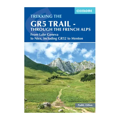
The GR5 Trail: Through the French Alps (Cicerone)
Paddy Dillon’s guide to the Alpine GR5 from Lake Geneva to Nice in 28 stages, with the GR55, GR5E and GR52 variants and 1:100,000 maps; fourth edition.
View on Amazon (opens in a new tab)
Worth watching
A recent film of 23 days on the GR5 from Lake Geneva to Briançon, covering the first half of the Alpine route section by section.
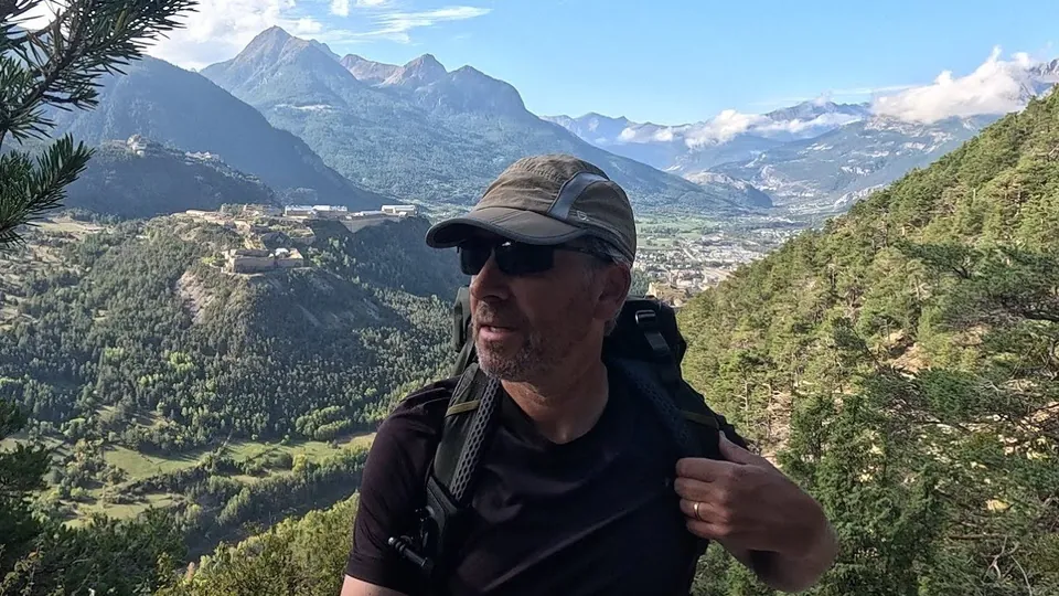
The video is hosted by YouTube (Google): nothing loads until you play it, and Google may then set cookies.
FAQ
How many days does the GR5 through the French Alps take?
About a month. The route’s manager mentions some forty stages on its home page and details 36; the FFRandonnée also counts 36, and Cicerone’s guide offers 28-, 31-, and 40-day schedules. The manager suggests four sections of seven to ten stages each, if you’d rather hike it a week or two at a time, with a station or a bus at each end.
How long is the GR5 from Lake Geneva to Nice?
Between 348 and 385 miles (560 to 620 km), depending on how you count. The route’s website gives 600 km on its home page and 620 km on its route page; the FFRandonnée says about 600 km. Added up, the 36 stages published by the manager come to 561 km. Variants, a start in Thonon, and a finish in Menton explain part of the gap.
When is the best time to hike the GR5 in the Alps?
From mid-June to mid-September, while the huts are staffed: the manager says most open from June 15 to September 15, sometimes longer in the Southern Alps. Early in the summer, old snow may call for stiff boots; late in the summer, springs dry up on limestone terrain and some village stores close from the end of August.
Can you camp anywhere on the GR5?
No: each area has its own rules. In the core of the Vanoise, only on the booked area near certain huts, from 7 p.m. to 8 a.m., for €6; in the core of the Mercantour, more than an hour’s walk from a road, from 7 p.m. to 9 a.m.; in the Haute-Savoie nature reserves, on camping areas you book, and fires are banned in those reserves.
Is mountain rescue free on the GR5?
In France, away from the ski areas, the rescue itself is free, as the French government restated in 2025. But two stages of the first section are in Switzerland, where rescue isn’t free. Call 112, not 911. Medicare usually doesn’t cover care abroad, so check that your travel insurance covers mountain rescue and helicopter evacuation.
Sources
- Grande Traversée des Alpes, the route’s official website, home page (in French), accessed November 14, 2026. grande-traversee-alpes.com https://www.grande-traversee-alpes.com/ ↩
- Grande Traversée des Alpes, “L’histoire,” January 17, 2024 (in French), accessed November 14, 2026. grande-traversee-alpes.com https://www.grande-traversee-alpes.com/portfolio-item/histoire-gr5-alpes/ ↩
- Grande Traversée des Alpes, “L’itinéraire intégral” (in French), accessed November 14, 2026. grande-traversee-alpes.com https://www.grande-traversee-alpes.com/itineraire-gr5-alpes/ ↩
- French Hiking Federation (FFRandonnée), “La Grande Traversée des Alpes (GTA) : GR 5, une aventure à vivre à pied dans les Alpes,” November 22, 2025 (in French), accessed November 14, 2026. ffrandonnee.fr https://www.ffrandonnee.fr/s-informer/actualites/la-grande-traversee-des-alpes-gta-gr-5-une-aventure-a-vivre-a-pied-dans-les-alpes ↩
- French Hiking Federation (FFRandonnée), “GR 5, le sentier de l’Europe” (in French), accessed November 14, 2026. ffrandonnee.fr https://www.ffrandonnee.fr/randonner/sentiers/gr-5-le-sentier-de-l-europe ↩
- Grande Traversée des Alpes, “GR5 du Léman au Mont-Blanc,” section 1 (in French), accessed November 14, 2026. grande-traversee-alpes.com https://www.grande-traversee-alpes.com/gr5-du-leman-au-mont-blanc/ ↩
- Grande Traversée des Alpes, “Le balisage et la difficulté de l’itinéraire,” January 12, 2024 (in French), accessed November 14, 2026. grande-traversee-alpes.com https://www.grande-traversee-alpes.com/portfolio-item/balisage-et-difficulte-de-litineraire/ ↩
- Grande Traversée des Alpes, “L’itinéraire par tronçons” (in French), accessed November 14, 2026. grande-traversee-alpes.com https://www.grande-traversee-alpes.com/litineraire-par-troncons/ ↩
- Grande Traversée des Alpes, “GR5 tronçon 2, du Mont-Blanc à la Maurienne” (in French), accessed November 14, 2026. grande-traversee-alpes.com https://www.grande-traversee-alpes.com/gr5-troncon-2-du-mont-blanc-maurienne/ ↩
- Grande Traversée des Alpes, “GR5 tronçon 3, de la Maurienne à l’Ubaye” (in French), accessed November 14, 2026. grande-traversee-alpes.com https://www.grande-traversee-alpes.com/gr5-troncon-3-de-la-maurienne-a-lubaye/ ↩
- Grande Traversée des Alpes, “GR5 tronçon 4, de l’Ubaye à la Méditerranée” (in French), accessed November 14, 2026. grande-traversee-alpes.com https://www.grande-traversee-alpes.com/gr5-troncon-4-ubaye-mediterranee/ ↩
- Autour du Mont-Blanc, Espace Mont-Blanc website, “Tour du Mont Blanc,” route description, accessed November 14, 2026. autourdumontblanc.com https://www.autourdumontblanc.com/en/routes/all-routes/tour-du-mont-blanc ↩
- Grande Traversée des Alpes, “Quand partir ?,” January 12, 2024 (in French), accessed November 14, 2026. grande-traversee-alpes.com https://www.grande-traversee-alpes.com/portfolio-item/periode-conseillee/ ↩
- Grande Traversée des Alpes, “Les hébergements,” January 11, 2024 (in French), accessed November 14, 2026. grande-traversee-alpes.com https://www.grande-traversee-alpes.com/portfolio-item/refuges-et-hebergements-2/ ↩
- Official Tour du Mont-Blanc website, “FAQ,” accessed November 14, 2026. montourdumontblanc.com https://www.montourdumontblanc.com/en/faq ↩
- Refuge de l’Arpont (Vanoise National Park), “Tarifs et réservation,” summer 2026 prices (in French), accessed November 14, 2026. refuge-arpont.vanoise.com https://refuge-arpont.vanoise.com/tarifs-et-reservation ↩
- French Federation of Alpine and Mountain Clubs (FFCAM), “Réduction dans les refuges des clubs alpins” (in French), accessed November 14, 2026. ffcam.fr https://www.ffcam.fr/reciprocite-refuges.html ↩
- French Hiking Federation (FFRandonnée), “Le bivouac en Haute-Savoie : pensez à faire vos réservations dans les réserves naturelles,” May 13, 2026 (in French), accessed November 14, 2026. ffrandonnee.fr https://www.ffrandonnee.fr/s-informer/actualites/le-bivouac-en-haute-savoie-pensez-a-faire-vos-reservations-dans-les-reserves-naturelles ↩
- Refuge de l’Arpont (Vanoise National Park), “Le bivouac” (in French), accessed November 14, 2026. refuge-arpont.vanoise.com https://refuge-arpont.vanoise.com/le-bivouac ↩
- French Hiking Federation (FFRandonnée), “Queyras : harmonisation de la réglementation des espaces naturels,” October 29, 2023 (in French), accessed November 14, 2026. ffrandonnee.fr https://www.ffrandonnee.fr/s-informer/actualites/queyras-harmonisation-de-la-reglementation-des-espaces-naturels ↩
- Mercantour National Park, order no. 2018-07 of June 1, 2018 regulating backcountry camping in the core of the park, text reproduced by AIDA (INERIS) (in French), accessed November 14, 2026. aida.ineris.fr https://aida.ineris.fr/reglementation/arrete-ndeg-2018-07-010618-reglementant-pratique-bivouac-coeur-parc-national ↩
- Grande Traversée des Alpes, “Les accès,” January 16, 2024 (in French), accessed November 14, 2026. grande-traversee-alpes.com https://www.grande-traversee-alpes.com/portfolio-item/les-transports/ ↩
- Chamonix-Mont-Blanc tourist office, “How to get here,” accessed November 14, 2026. en.chamonix.com https://en.chamonix.com/plan-my-stay/usual-information-services/how-to-get-here ↩
- Léman Express, line L1 timetable, Coppet, Geneva, Annemasse, Thonon-les-Bains, Évian-les-Bains, valid December 14, 2025 to December 12, 2026 (PDF, in French), accessed November 14, 2026. lemanexpress.com https://www.lemanexpress.com/wp-content/uploads/2025/11/2026_LEX_FH_L1_COP_EVI.pdf ↩
- European Union, Travel to Europe, “A Modern, More Efficient Border Management System for Europe,” EES leaflet (PDF), accessed November 14, 2026. travel-europe.europa.eu https://travel-europe.europa.eu/dam/jcr:578477d1-2e2d-4546-80c5-040570ae2bbc/Leaflet-A5_en.pdf ↩
- European Commission, Migration and Home Affairs, “European Travel Information and Authorisation System (ETIAS),” accessed November 14, 2026. home-affairs.ec.europa.eu https://home-affairs.ec.europa.eu/policies/schengen/smart-borders/european-travel-information-authorisation-system_en ↩
- Mercantour National Park, “Partir randonner sans voiture c’est possible ! (été 2026),” PDF updated July 1, 2026 (in French), accessed November 14, 2026. mercantour-parcnational.fr https://www.mercantour-parcnational.fr/sites/mercantour-parcnational.fr/files/2026-07/Offre%20mobilit%C3%A9s%20par%20vall%C3%A9es_2026.pdf ↩
- Cicerone, “The GR5 Trail: Through the French Alps,” Paddy Dillon, fourth edition, published July 1, 2025, ISBN 9781852848606, accessed November 14, 2026. cicerone.co.uk https://www.cicerone.co.uk/products/the-gr5-trail-through-the-french-alps ↩
- Grande Traversée des Alpes, “L’alimentation,” January 17, 2024 (in French), accessed November 14, 2026. grande-traversee-alpes.com https://www.grande-traversee-alpes.com/portfolio-item/nourriture-et-eau/ ↩
- Grande Traversée des Alpes, “La sécurité,” January 17, 2024 (in French), accessed November 14, 2026. grande-traversee-alpes.com https://www.grande-traversee-alpes.com/portfolio-item/securite-secours/ ↩
- French Senate, written question no. 03383 on charging for mountain rescue, and the answer of the Ministry for Regional Planning and Decentralization published in the Senate’s Official Journal on June 5, 2025, page 2983 (in French), accessed November 14, 2026. senat.fr https://www.senat.fr/questions/base/2025/qSEQ250203383.html ↩
- Federal Office of Public Health (FOPH, Switzerland), “Frais de transport et de sauvetage” (in French), accessed November 14, 2026. bag.admin.ch https://www.bag.admin.ch/fr/frais-de-transport-et-de-sauvetage ↩
- Medicare.gov, “Travel outside the U.S.,” accessed November 14, 2026. medicare.gov https://www.medicare.gov/coverage/travel-outside-the-u.s. ↩
- Grande Traversée des Alpes, “Le transport de bagages,” January 16, 2024 (in French), accessed November 14, 2026. grande-traversee-alpes.com https://www.grande-traversee-alpes.com/portfolio-item/guides-transport-de-bagages/ ↩

Camping, backpacking, bushcraft and hiking
Guillaume Hoarau writes for Outfarer about camping, backpacking, bushcraft, and hiking. A survival-skills buff and a collector of vintage field manuals, he loves clear explanations, lists that actually help and other people’s stories, which he tells well.


