 Français (France)
 English (UK)
 English (US)
 Deutsch (Deutschland)

Contents
Picture the beach at Hendaye: the Atlantic at your back, and the first red and white stripe heading off toward the Basque hills. At the other end, 55 stages away in one German guidebook’s breakdown, waits the beach at Banyuls and the Mediterranean [1]. In between, the GR10 crosses five French départements, roughly the French version of counties, from the Basque Country to the Catalan Pyrenees [2]. The French Hiking Federation, the FFRandonnée, points out that the two seas are about 280 miles (450 km) apart as the crow flies; the trail itself is far longer [3].
This guide draws on official sources: the FFRandonnée and its guidebooks, the rules of the Pyrenees National Park, and the regional bus and train timetables, plus what you’ll need flying in from the US. For multi-day hikes in general, see our guide to planning a multi-day hike.
The GR10 at a glance
| GR10 | |
|---|---|
| Start and finish | Hendaye (Pyrénées-Atlantiques) to Banyuls-sur-Mer (Pyrénées-Orientales) |
| Distance | 573 miles (922 km) in a 2024 news item, or about 684 miles (1,100 km) on the trail page |
| Time | 50 to 60 days, a good month and a half, or 65 to 70 days, depending on the page |
| Waymarks | Red and white stripes, like every GR (grande randonnée) trail |
| Départements | Pyrénées-Atlantiques, Hautes-Pyrénées, Haute-Garonne, Ariège, Pyrénées-Orientales |
| Best season | June to October, with late June the most favorable |
From the pages of the FFRandonnée and its MonGR website. Miles: our conversion. [3, 4, 2]
The GR10’s length depends on who’s measuring. The FFRandonnée’s trail page says about 684 miles (1,100 km), doable in a good month and a half; a news item from the same federation, in March 2024, gives 573 miles (922 km), 180,000 feet (55,000 m) of elevation gain, and 50 to 60 days [3, 4]. Cicerone’s English-language guidebook counts 593 miles (954 km); the Hautes-Pyrénées tourist board, in English, 572 miles (920 km) and over 180,000 feet of gain; France’s official tourism website, in German, 528 miles (850 km) [5, 6, 7]. The 55 stages in the Conrad Stein guidebook add up to 580 miles (933.6 km), our calculation [1]. The federation doesn’t explain the gap; how the stages are split and the detours to lodging probably account for part of it.
Four big sections, from ocean to sea
The FFRandonnée covers the GR10 in four French-language guidebooks, called topoguides: Western Pyrenees, Hendaye to Arrens, 174 miles (280 km) in 15 days; Central Pyrenees, Arrens to Bagnères-de-Luchon, 115 miles (185 km) in 13 days; the Ariège Pyrenees; and Eastern Pyrenees, Mérens-les-Vals to Banyuls, in 12 days [8, 9, 10]. We found no free official list of stages: the most complete stage figures we read are Conrad Stein’s, from 4.5 to 16.8 miles (7.3 to 27.1 km), 10.6 miles (17 km) on average, our calculation [1].
The passes aren’t the whole story. The GR10 often drops to the valley floor, where the food stores and the gîtes d’étape, hikers’ hostels, are, and that quickly piles on the climbing: many days top 3,280 feet (1,000 m) of ascent or descent, the Hautes-Pyrénées tourist board warns [6]. According to the Amis GRdistes, a volunteer association devoted to the trail, the high point is the Hourquette d’Ossoue, at 8,970 feet (2,734 m) [11].
Huts, gîtes, and unstaffed cabins
Pyrenees National Park has 19 huts, 14 of them in its core, the most protected part of the park; they’re staffed in summer, from early June to late September, and get packed in high season, so the park advises booking as early as you can [12]. Blankets or duvets are provided, but bring a sleeping bag liner; outside the staffed season, part of each hut stays open as a shelter [12]. The Amis GRdistes say booking is all but mandatory in the high huts, and call July 15 to August 15 a busy period [13]. Our guide to staying in a mountain hut explains dorms and half board.
| Option | Price per adult |
|---|---|
| Half board (bed, tourist tax, dinner, breakfast) | €47.90 |
| Full board (with packed lunch) | €59.90 |
| Dinner only | €22 |
| Breakfast only | €9 |
From the hut’s rates page, which shows no year and requires online booking; its home page announced a season from May 13 to September 26, 2026. [14, 15]
The Ayous hut, at 6,500 feet (1,980 m) between Etsaut and Gabas, makes a handy benchmark: €47.90 for half board on the rates page we read in November 2026 [14, 15]. Seven nights at that price come to €335.30, our calculation; prices stay in euros here, so check the exchange rate when you budget. One catch with printed guidebooks: in its August 5, 2026 update to the Western Pyrenees topoguide, the FFRandonnée says the Abérouat hut, at Lescun, has closed after going into liquidation [8].
Between Luchon, in the Haute-Garonne, and Mérens-les-Vals, in the Ariège, lodging thins out. Conrad Stein ends five of its stages at unstaffed huts between Luchon and Mérens-les-Vals [1]. One of them, the Clarans cabin, at 3,480 feet (1,060 m), is stocked by the Amis GRdistes: eight places at most, blankets, a gas stove, and food, paid for on trust [16]. On this section, a tent in your pack buys you some margin, and our guide to unstaffed huts and shelters explains the etiquette.
Camping: the national park and Néouvielle rules
If you’re used to dispersed camping on public land back home, the Pyrenees work differently. French rules separate camping, a fixed camp, which is banned in the core of Pyrenees National Park, from the bivouac, an overnight pitch: in a tent you can’t stand up in or a natural shelter, it’s allowed from 7 p.m. to 9 a.m., more than an hour’s walk from roads or the edge of the core, or on marked sites near certain huts [17, 18]. So the tent goes up after 7 p.m. and comes down before 9 a.m., the park spells out [18]. Fires are banned there, and so are wood-burning stoves: only gas stoves are allowed, unless the prefecture, the state’s local authority, restricts them [19].
The Néouvielle National Nature Reserve, which the GR10 crosses for about 5 miles (8 km), from the Col de Madamète to the Lac de l’Oule, according to the Amis GRdistes [20], is stricter: you may camp there only from 7 p.m. to 9 a.m., on two signed sites, at Lac d’Orédon and Aubert [18]. Near the Ayous hut, one area is closed to camping from July 1 to September 30, because of the livestock and the crowds [21]. Our guide to camping laws in France covers the rest of the country.
Flights, trains, and buses: in and out of each section
Flying in from the US, look at the airports the Conrad Stein guidebook lists near the trail, west to east: Biarritz, Pau, Tarbes-Lourdes, Toulouse, Carcassonne, and Perpignan, or, across the border in Spain, Bilbao, San Sebastián, Pamplona, Girona, and Barcelona [1]. On the ground, the GR10 works well with public transportation: several train stations sit along the route, and regional buses run up the valleys. Timetables change with the seasons: check them before you go, since some of the ones we read no longer apply.
| GR10 point | Service | Details |
|---|---|---|
| Hendaye (start) | Train | Station at the start of the trail |
| Etsaut, Aspe valley | Bus 550 | From Bedous station to Canfranc, via Etsaut (2026 timetable published through July 3) |
| Cauterets | liO bus 965 | From Lourdes station, about an hour, €2 |
| Luz-Saint-Sauveur, Gavarnie | liO bus 968 | From Lourdes, June 4 to August 31, 2027 |
| Bagnères-de-Luchon | Train | Montréjeau to Luchon line, reopened June 22, 2025, 35 minutes |
| Mérens-les-Vals | Train | Toulouse to Latour-de-Carol line |
| Mont-Louis, Bolquère | Yellow Train | Villefranche-de-Conflent to Latour-de-Carol |
| Banyuls-sur-Mer (finish) | Train | Perpignan to Cerbère line, 50 minutes end to end |
From the transportation operators and regional tourist boards; the travel time on route 965 is our calculation from the timetable. [1, 23, 24, 25, 26, 27, 28, 29]
In the Occitanie region, a liO bus ride costs €2, and a 10-ride pass €15 [30]. On the Yellow Train, the Train jaune, you signal the driver to get on or off at the small stations, and in summer you should be at the station about 30 minutes before departure, as seats are limited [28].
When to go: snow first, then thunderstorms
The FFRandonnée recommends June to October, and calls late June the best time, with long days and flowers everywhere; but the passes stay snowbound very late, and it advises checking with the PGHM, the gendarmerie’s mountain rescue unit, or with hut keepers [2]. According to the Amis GRdistes, the Hourquette d’Arre sometimes keeps its snow until mid-July or even late July, and the late-melting Hourquette d’Ossoue can be bypassed via the Col de Riou between Cauterets and Luz-Saint-Sauveur [11]. Cicerone isn’t consistent either: its page gives June to September in one place, and July to October, or June in a low-snow year, in another [5].
Summer brings its own risks: thunderstorms and intense heat waves aren’t uncommon, and the passes can be windswept or chilly, the Hautes-Pyrénées tourist board notes [6]. The Amis GRdistes advise setting off very early in the morning, since summer storms most often break in mid-afternoon [33].
Tricky passages and rescue
A few passages call for sure footing: the Holzarte footbridge, 230 feet (70 m) long and 590 feet (180 m) above the Olhadubi gorge, the Pas de l’Osque, the Chemin de la Mâture, and the Corniche des Alhas, between Gabas and Gourette, secured by a cable, according to the Amis GRdistes [34]. Cicerone’s guidebook suggests alternatives for exposed sections such as the Corniche des Alhas [5]. Lingering snowfields on the trail are, the association says, one of the most frequent causes of accidents [35].
The park’s huts have a way to alert rescuers [12]. Between huts, our guide to calling for help without cell service covers your options. For the long descents that come back day after day, see also how to go easy on your knees.
Cash, guidebooks, and budget
Bring cash. According to the Amis GRdistes, only four towns in the Western Pyrenees have an ATM, Hendaye, Sare, Saint-Étienne-de-Baïgorry, and Saint-Jean-Pied-de-Port, and you won’t find one directly on the GR10 in the Ariège [39]. In English, the guidebook is Cicerone’s “Trekking the GR10,” by Brian Johnson and Stuart Butler, published in 2023 and reprinted in April 2026: 55 stages described west to east, with 1:100,000 maps and a profile for each stage [5]. The FFRandonnée’s four topoguides, in French, cost €18.40 each, or €73.60 for the set, our calculation, and their store pages post updates such as lodging closures [8, 9, 40, 10].
The smart move, before you book the first hut: pick your section, find the station or bus stop at each end, and check the topoguide’s online update for lodging that has closed. The Pyrenees won’t move; the snowfields, the timetables, and the huts will.
Gallery: Hendaye to Banyuls in six photos
Six real photos of the trail and its landscapes, from west to east, from the Atlantic to the Mediterranean, published under free licenses on Wikimedia Commons by their photographers, who are credited under each image. Tap or click a photo to enlarge it.
Gear related to this article
No affiliation: no commission, no sponsored products.
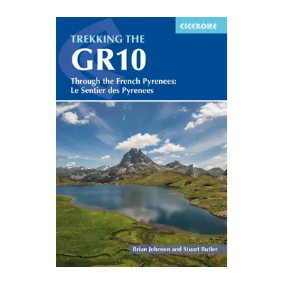
Trekking the GR10 (Cicerone)
Brian Johnson and Stuart Butler’s guide to the GR10 across the French Pyrenees, west to east in 55 stages, with 1:100,000 maps and elevation profiles.
View on Amazon (opens in a new tab)
Worth watching
A short, recent look at what the GR10 involves, from the Atlantic to the Mediterranean, and whether it suits your experience and the time you have.
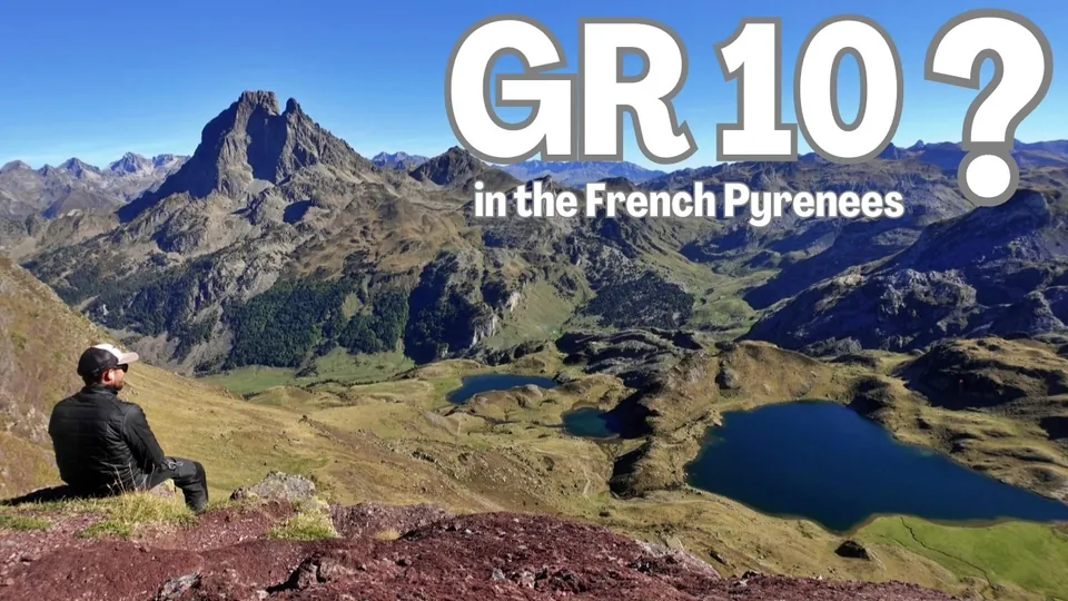
The video is hosted by YouTube (Google): nothing loads until you play it, and Google may then set cookies.
FAQ
How many days does it take to hike the whole GR10?
Between 50 and 60 days, according to an FFRandonnée news item; the federation’s trail page says a good month and a half, and its MonGR site 65 to 70 days. Cicerone says seven weeks, and the Conrad Stein guidebook splits the trail into 55 stages of 4.5 to 16.8 miles (7.3 to 27.1 km). MonGR also suggests sections of 4 to 8 days.
Can you camp along the GR10?
Yes, with rules. In the core of Pyrenees National Park, an overnight pitch is allowed from 7 p.m. to 9 a.m., more than an hour’s walk from roads or on marked sites; a fixed camp is banned. In the Néouvielle reserve, only the Orédon and Aubert sites are allowed. Fires are banned in the park, and only gas stoves are permitted.
When is the best time to hike the GR10?
From June to October, according to the FFRandonnée, which calls late June the most favorable time. But some passes stay snowbound late: the Hourquette d’Arre sometimes until late July, according to the Amis GRdistes. In summer, set off early in the morning, since thunderstorms most often break in mid-afternoon.
How do you get to the GR10 from the US?
Fly into an airport near the range: the Conrad Stein guidebook lists Biarritz, Pau, Tarbes-Lourdes, Toulouse, Carcassonne, and Perpignan. Then take the train to Hendaye, Luchon, Mérens-les-Vals, or Banyuls, and regional buses up the valleys: in Occitanie, a liO bus ride costs €2, for example from Lourdes to Cauterets or, in summer, to Gavarnie.
Can you hike the GR10 with a dog?
Not the whole way without detours: in the core of Pyrenees National Park, dogs are banned, even on a leash (except on a few roads and trails), and several towns require leashes on the summer pastures. The Amis GRdistes describe alternative routes for some sections, but not for all of them, so you’re better off leaving your dog at home.
Sources
- Conrad Stein Verlag, excerpt from “Pyrenäenweg GR 10,” OutdoorHandbuch vol. 216, 2nd edition, 2025, contents and introduction, PDF (in German), accessed November 14, 2026. conrad-stein-verlag.de https://www.conrad-stein-verlag.de/wp-content/uploads/2025/01/9783866868403_HP.pdf ↩
- MonGR (French Hiking Federation (FFRandonnée)), “GR® 10 : la traversée des Pyrénées de Hendaye à Banyuls” (in French), accessed November 14, 2026. mongr.fr https://www.mongr.fr/trouver-prochaine-randonnee/itineraire/gr-10-la-traversee-des-pyrenees-de-hendaye-a-banyuls ↩
- French Hiking Federation (FFRandonnée), “GR® 10, la grande traversée des Pyrénées,” July 24, 2024 (in French), accessed November 14, 2026. ffrandonnee.fr https://www.ffrandonnee.fr/randonner/sentiers/gr-10-la-grande-traversee-des-pyrenees ↩
- French Hiking Federation (FFRandonnée), “Les trois Grands Itinéraires de la Traversée des Pyrénées : GR® 10, GR® 11 et HRP,” March 7, 2024 (in French), accessed November 14, 2026. ffrandonnee.fr https://www.ffrandonnee.fr/s-informer/actualites/les-trois-grands-itineraires-de-la-traversee-des-pyrenees-gr-10-gr-11-et-hrp ↩
- Cicerone, “Trekking the GR10,” Brian Johnson and Stuart Butler, published July 28, 2023, reprinted April 1, 2026, ISBN 9781786311160, accessed November 14, 2026. cicerone.co.uk https://www.cicerone.co.uk/products/trekking-the-gr10 ↩
- Hautes-Pyrénées Tourisme, “The GR 10,” accessed November 14, 2026. en.tourisme-hautes-pyrenees.com https://en.tourisme-hautes-pyrenees.com/the-mountains-in-summer/hiking-in-the-hautes-pyrenees/the-legendary-gr-and-footpaths/the-gr-10/ ↩
- France.fr (Atout France), “Der Pyrenäen-Wanderweg GR 10,” updated April 8, 2025 (in German), accessed November 14, 2026. france.fr https://www.france.fr/de/artikel/der-pyrenaeen-wanderweg-gr-10/ ↩
- French Hiking Federation (FFRandonnée), online store, topoguide “Pyrénées Occidentales - GR®10” (ref. 1086), 14th edition, April 2025, and its update of August 5, 2026 (in French), accessed November 14, 2026. boutique.ffrandonnee.fr https://boutique.ffrandonnee.fr/topoguide/pyrenees-occidentales-gr10 ↩
- French Hiking Federation (FFRandonnée), online store, topoguide “Pyrénées Centrales - La Traversée des Pyrénées - GR®10” (ref. 1091), 11th edition, April 2026 (in French), accessed November 14, 2026. boutique.ffrandonnee.fr https://boutique.ffrandonnee.fr/topoguide/pyrenees-centrales-gr-10 ↩
- French Hiking Federation (FFRandonnée), online store, topoguide “Pyrénées Orientales : La Traversée des Pyrénées - GR®10” (ref. 1092), 8th edition, April 2026 (in French), accessed November 14, 2026. boutique.ffrandonnee.fr https://boutique.ffrandonnee.fr/topoguide/pyrenees-orientales-la-traversee-des-pyrenees-gr10 ↩
- Association des Amis GRdistes (GR10.org), “Surveillance Veille Enneigement sur le GR10” (in French), accessed November 14, 2026. gr10.org https://gr10.org/index.php/surveillance-veille-enneigement-sur-le-gr10/ ↩
- Pyrenees National Park, “Refuges” (in French), accessed November 14, 2026. pyrenees-parcnational.fr https://pyrenees-parcnational.fr/votre-visite/preparer-sa-visite/ou-dormir/refuges ↩
- Association des Amis GRdistes (GR10.org), “Réserver ou ne pas réserver son hébergement sur le GR10 ?” (in French), accessed November 14, 2026. gr10.org https://gr10.org/index.php/reserver-ou-ne-pas-reserver-son-hebergement-sur-le-gr10/ ↩
- Refuge d’Ayous, “Tarifs” (in French), accessed November 14, 2026. refuge-ayous.fr https://www.refuge-ayous.fr/tarifs ↩
- Refuge d’Ayous, home page, 2026 opening dates (in French), accessed November 14, 2026. refuge-ayous.fr https://www.refuge-ayous.fr/ ↩
- Association des Amis GRdistes (GR10.org), “La cabane ravitaillée de Clarans sur le GR10” (in French), accessed November 14, 2026. gr10.org https://gr10.org/index.php/la-cabane-ravitaillee-de-clarans-sur-le-gr10/ ↩
- Pyrenees National Park, director’s order regulating camping and backcountry camping in the core of the park, Tarbes, August 29, 2013, PDF (in French), accessed November 14, 2026. pyrenees-parcnational.fr https://www.pyrenees-parcnational.fr/sites/pyrenees-parcnational.fr/files/available_docs/arrete_camping_bivouac_dans_le_coeur_du_parc_national_des_pyrenees.pdf ↩
- Pyrenees National Park, “Campement et bivouac” (in French), accessed November 14, 2026. pyrenees-parcnational.fr https://pyrenees-parcnational.fr/votre-visite/sinformer/reglementation/campement-et-bivouac ↩
- Pyrenees National Park, “Bivouac” (in French), accessed November 14, 2026. pyrenees-parcnational.fr https://pyrenees-parcnational.fr/votre-visite/preparer-sa-visite/ou-dormir/bivouac ↩
- Association des Amis GRdistes (GR10.org), “Les réserves naturelles traversées par le GR10” (in French), accessed November 14, 2026. gr10.org https://gr10.org/index.php/les-reserves-naturelles-traversees-par-le-gr10/ ↩
- Refuge d’Ayous, “Bivouac autour du refuge d’Ayous” (in French), accessed November 14, 2026. refuge-ayous.fr https://www.refuge-ayous.fr/bivouac-autour-du-refuge-dayous ↩
- Pyrenees National Park, “Animaux domestiques” (in French), accessed November 14, 2026. pyrenees-parcnational.fr https://pyrenees-parcnational.fr/votre-visite/sinformer/reglementation/animaux-domestiques ↩
- Nouvelle-Aquitaine Region, timetable for bus route 550 Bedous to Canfranc, valid June 6 to July 3, 2026, published by the Pyrénées Béarnaises tourist office, PDF (in French), accessed November 14, 2026. pyrenees-bearnaises.com https://www.pyrenees-bearnaises.com/app/uploads/pyreneesbearnaises/2025/12/Bus-Fiche-Horaire-paysage-14dec-03juillet-2026-550.pdf ↩
- liO (Occitanie Region), timetable for route 965 Lourdes to Cauterets, September 1, 2026 to August 31, 2027, PDF (in French), accessed November 14, 2026. storage.googleapis.com https://storage.googleapis.com/is-wp-90-prod/uploads-prod/2026/08/OC-0826-FHliO-65-965-web_v2.pdf ↩
- liO (Occitanie Region), “Horaires et plans,” route 968 Lourdes to Gavarnie (in French), accessed November 14, 2026. lio-occitanie.fr https://www.lio-occitanie.fr/horaires-et-plans/ ↩
- Banque des Territoires, “Occitanie : réouverture de la petite ligne ferroviaire Montréjeau-Luchon,” June 23, 2025 (in French), accessed November 14, 2026. banquedesterritoires.fr https://www.banquedesterritoires.fr/occitanie-reouverture-de-la-petite-ligne-ferroviaire-montrejeau-luchon-avec-un-financement-100 ↩
- Tourisme Occitanie (Occitanie regional tourist board), “Ligne des Pyrénées Toulouse - Latour-de-Carol” (in French), accessed November 14, 2026. tourisme-occitanie.com https://www.tourisme-occitanie.com/rail-tour/train/ligne-des-pyrenees-toulouse-latour-de-carol/ ↩
- Tourisme Occitanie (Occitanie regional tourist board), “Ligne du Train jaune” (in French), accessed November 14, 2026. tourisme-occitanie.com https://www.tourisme-occitanie.com/rail-tour/train/ligne-train-jaune/ ↩
- Tourisme Occitanie (Occitanie regional tourist board), “Ligne de la Côte Vermeille Perpignan - Cerbère” (in French), accessed November 14, 2026. tourisme-occitanie.com https://www.tourisme-occitanie.com/rail-tour/train/ligne-de-la-cote-vermeille-perpignan-cerbere/ ↩
- liO (Occitanie Region), “Titres et tarifs liO car” (in French), accessed November 14, 2026. lio-occitanie.fr https://www.lio-occitanie.fr/titres-et-tarifs/titres-et-tarifs-lio-car/ ↩
- European Union, Travel to Europe, “A Modern, More Efficient Border Management System for Europe,” EES leaflet, PDF, accessed November 14, 2026. travel-europe.europa.eu https://travel-europe.europa.eu/dam/jcr:578477d1-2e2d-4546-80c5-040570ae2bbc/Leaflet-A5_en.pdf ↩
- European Commission, Migration and Home Affairs, “European Travel Information and Authorisation System (ETIAS),” accessed November 14, 2026. home-affairs.ec.europa.eu https://home-affairs.ec.europa.eu/policies/schengen/smart-borders/european-travel-information-authorisation-system_en ↩
- Association des Amis GRdistes (GR10.org), “Les orages pyrénéens” (in French), accessed November 14, 2026. gr10.org https://gr10.org/index.php/les-orages-pyreneens/ ↩
- Association des Amis GRdistes (GR10.org), “Les passages délicats et vertigineux sur le GR10” (in French), accessed November 14, 2026. gr10.org https://gr10.org/index.php/les-passages-delicats-et-vertigineux-sur-le-gr10/ ↩
- Association des Amis GRdistes (GR10.org), “Le danger des névés de printemps et d’été sur le GR10” (in French), accessed November 14, 2026. gr10.org https://gr10.org/index.php/le-danger-des-neves-de-printemps-et-dete-sur-le-gr10/ ↩
- Prefecture of the Hautes-Pyrénées, “Opérations Prévention Montagne Pyrénées durant la saison estivale 2023,” press release, July 11, 2023, PDF (in French), accessed November 14, 2026. hautes-pyrenees.gouv.fr https://www.hautes-pyrenees.gouv.fr/contenu/telechargement/15226/107019/file/025%20-%20Op%C3%A9rations%20Pr%C3%A9vention%20Montagne%20Pyr%C3%A9n%C3%A9es%20durant%20la%20saison%20estivale%202023.pdf ↩
- French Senate, written question no. 03383 on charging for mountain rescue, and the answer of the Ministry for Regional Planning and Decentralization published in the Senate’s Official Journal on June 5, 2025, page 2983 (in French), accessed November 14, 2026. senat.fr https://www.senat.fr/questions/base/2025/qSEQ250203383.html ↩
- Medicare.gov, “Travel Outside the U.S.,” accessed November 14, 2026. medicare.gov https://www.medicare.gov/coverage/travel-outside-the-u.s. ↩
- Association des Amis GRdistes (GR10.org), “Répartition des distributeurs de billets sur le GR10” (in French), accessed November 14, 2026. gr10.org https://gr10.org/index.php/repartition-des-distributeurs-de-billets-sur-le-gr10/ ↩
- French Hiking Federation (FFRandonnée), online store, topoguide “Pyrénées Ariégeoises - GR®10” (ref. 1090), 15th edition, June 2025 (in French), accessed November 14, 2026. boutique.ffrandonnee.fr https://boutique.ffrandonnee.fr/topoguide/pyrenees-ariegeoises-gr10 ↩
Corrections
- Corrected : Pyrenees National Park: the park allows leashed dogs on a few roads and trails in its core; the article said they were banned throughout the core.

Camping, backpacking, bushcraft and hiking
Guillaume Hoarau writes for Outfarer about camping, backpacking, bushcraft, and hiking. A survival-skills buff and a collector of vintage field manuals, he loves clear explanations, lists that actually help and other people’s stories, which he tells well.


 Nolwenn Bastide