 Français (France)
 English (UK)
 English (US)
 Deutsch (Deutschland)

Contents
Hard to believe, but one of England’s best-known long-distance hikes only got its official seal in the spring of 2026. Alfred Wainwright first described the Coast to Coast in 1973 [1], a walk across northern England from the Irish Sea to the North Sea, and more than 6,000 people complete the whole thing every year [2]. The government agreed in 2022 to make it a National Trail, part of England’s family of official long-distance trails, and on March 26, 2026, after a three-year upgrade program and a £5.5 million investment, it officially opened as the newest of them [1, 2].
This guide gathers what you need for 2027: the stages, where to sleep, the camping rules, bag transfers, getting there from the US without a car, and what changed with the new status. For the general rules on pitching a tent in Britain, see our guide to wild camping in the UK.
The Coast to Coast at a glance
| Coast to Coast Path | |
|---|---|
| Start and finish | St Bees (Cumbria) to Robin Hood’s Bay (North Yorkshire) |
| Distance | 190 miles (306 km), according to National Trails |
| Time | 12 to 15 days for most people |
| Direction | Usually west to east, signed in both directions |
| National parks | Lake District, Yorkshire Dales, North York Moors |
| Waymarks | The National Trail acorn, on stiles, gates, and signposts |
From the trail page and FAQ of National Trails, the official website of England’s National Trails. [1, 3]
Nobody quite agrees on the distance. National Trails, the UK government, and Ordnance Survey, Britain’s national mapping agency, all say 190 miles [3, 2, 4]. The Lake District National Park says 192 miles, the 2026 Cicerone guidebook 182 miles (293 km) in 13 stages, and the 2022 Natural England report that laid the groundwork for the trail 197 miles [5, 6, 7]. Variants, detours into overnight villages, and changes to the line between 2022 and 2026 probably explain the gap.
The stages, from the Irish Sea to the North Sea
National Trails describes the route in 12 sections, with no figures in the text [8]. Cicerone’s guidebook, in its 5th edition from 2026, lays out 13 stages with distances, elevation gain, and times; it’s the most complete breakdown we found, and its distances add up to 182 miles (293.3 km), our calculation [6].
| Stage | Distance | Elevation gain | Time |
|---|---|---|---|
| 1. St Bees to Ennerdale Bridge | 14.9 mi (24 km) | 2,670 ft (815 m) | 7 hr |
| 2. Ennerdale Bridge to Rosthwaite | 14.9 mi (24 km) | 2,070 ft (630 m) | 6 hr |
| 3. Rosthwaite to Patterdale | 14.6 mi (23.5 km) | 3,810 ft (1,160 m) | 7 hr |
| 4. Patterdale to Shap | 15.2 mi (24.5 km) | 3,630 ft (1,105 m) | 7 hr |
| 5. Shap to Kirkby Stephen | 19.3 mi (31 km) | 2,150 ft (655 m) | 8 hr |
| 6. Kirkby Stephen to Keld | 11.2 mi (18 km) | 2,070 ft (630 m) | 6 hr |
| 7. Keld to Reeth, high-level route | 10.9 mi (17.5 km) | 2,070 ft (630 m) | 6 hr |
| 8. Reeth to Richmond | 10.4 mi (16.7 km) | 1,230 ft (375 m) | 4 hr 45 min |
| 9. Richmond to Danby Wiske | 14.1 mi (22.7 km) | not published | 7 hr |
| 10. Danby Wiske to Ingleby Cross | 8.82 mi (14.2 km) | 330 ft (100 m) | 5 hr |
| 11. Ingleby Cross to Blakey Ridge | 19.9 mi (32 km) | 3,850 ft (1,175 m) | 8 hr 15 min |
| 12. Blakey Ridge to Grosmont | 13 mi (21 km) | 620 ft (190 m) | 6 hr |
| 13. Grosmont to Robin Hood’s Bay | 15 mi (24.2 km) | 2,280 ft (695 m) | 7 hr |
Main route: south shore of Ennerdale Water and high-level route between Keld and Reeth. Cicerone’s page repeats the distance where the gain should be for stage 9. Miles and feet: our conversion from the metric figures. [6]
Other schedules are out there. Sherpa Van, a bag transfer company, follows Wainwright’s 12 stages, where Richmond to Ingleby Cross, 23 miles with no shops along the way, is the longest [9]. Brigantes, a walking vacation company, sells a 14-day plan with an extra night in Grasmere between Rosthwaite and Patterdale [10]. Wainwright himself suggested cutting the days to 10 or 12 miles, to leave time “to stand and stare” [11].
The Lake District is the toughest part: stages 1 to 4 string together steep crossings of the fells, as the hills are called here, and exposed high ground, with more than 3,280 feet (1,000 m) of gain on stages 3 and 4 [6]. Farther east, Cicerone flags the peat bog and occasional route uncertainty on the high ground south of Nine Standards Rigg in poor visibility [6].
Lodging: book early, start midweek
You’ll mostly sleep in B&Bs, guesthouses, pubs, small hotels, and hostels, which are present but not abundant, Cicerone says; some close altogether in the quieter months, and not all serve breakfast as standard [6]. National Trails warns that beds book up quickly in peak season, recommends booking well in advance, and suggests offsetting your days, starting on a Monday or Tuesday, for example [3]. There’s no hut-style reservation system here: you book each night yourself, or pay a company to do it, such as Sherpa Van, which charges £50 per person for one to seven nights [9].
A few stages take some planning. YHA Ennerdale, the valley’s youth hostel, sits 3 miles up a forest track, and no buses run there [12]. Between Orton and Kirkby Stephen, Sherpa Van mentions isolated farmhouse lodging on the route, and some more in hamlets a mile or so off it; at Clay Bank Top there’s none, so you walk a couple of miles downhill to Great Broughton or Chop Gate [9]. National Trails also lists YHA hostels on the route at Grinton Lodge, Osmotherley, and Boggle Hole [13].
Camping: only with the landowner’s permission
If you’re used to dispersed camping on national forest or BLM land, this is the big adjustment. In England, National Trail users normally have no right to wild camp along the way; National Trails recommends asking the landowner, and points to campsites along the trail [3]. Even on open access land, the privately owned mountains, moors, heaths, and downs where you may walk off the paths, camping is on the list of things you usually can’t do [14]. On that land, dogs must stay on a leash no longer than 6.6 feet (2 m) from March 1 to July 31, to protect ground-nesting birds [14].
The Lake District National Park says wild camping there is technically not permitted without the landowner’s permission, and that it can’t allow camping on private land; it adds that a night out is normally tolerated above the highest fell wall, well away from villages and lake shores, for one night only, in groups of one or two tents, and that landowners can still ask you to move on [15]. We found no equivalent guidance from the Yorkshire Dales or North York Moors parks: elsewhere, it’s a campsite or the landowner’s OK. Our guide to dispersed camping in the US shows how different the rules are back home.
Sending your bags ahead
Several companies will move your bags between overnight stops, help plan your trip, or arrange a full package [3], which means you can hike the whole way with a daypack. Three of them publish their prices.
| Company | Published price | Limit | Good to know |
|---|---|---|---|
| Sherpa Van | £17.50 per bag per stage, minimum £35 per booking (2027 prices) | 44 lb (20 kg) per bag | Doesn’t deliver to YHA Ennerdale, Black Sail, or YHA Helvellyn |
| Coast to Coast Packhorse | £17.50 per stage (year not stated) | 44 lb (20 kg) per bag | West to east only |
| Brigantes | £35 for a single bag, £18 per bag from two bags (undated) | 44 lb (20 kg) per bag | Bags only or full packages |
Prices checked on November 14, 2026 on the companies’ websites, in pounds sterling. [9, 17, 10]
Run the numbers at Sherpa Van’s 2027 rate: 13 stages at £17.50 come to £227.50 for one bag, our calculation [9]. For isolated places the vans can’t reach, such as YHA Ennerdale or Black Sail, the companies keep your bag overnight [9, 17]. To compare with other famous trails, see our guide to self-guided hiking with bag transfers.
What the new status changed, and what’s still temporary
The upgrade focused on waymarking, surfacing, and the tricky stretches. The government counts 3.1 miles (5 km) of new flagstone path over Nine Standards Rigg and White Mossy Hill; the Yorkshire Dales park describes 1.9 miles (3 km) of stone flags laid over the Birkdale peat bog, more than 40 new fingerposts, and five new bridges [2, 18]. The two figures probably don’t cover the same stretch.
Two things were still temporary when National Trails last updated its FAQ, on July 13, 2026: the start is diverted at St Bees because of cliff falls on St Bees Head, and a signed alternative loops north to cross the A19 highway on the Black Swan Bridge, until a permanent solution is in place near Ingleby Arncliffe [3, 6]. Paper maps aren’t all up to date either: the route on your map may differ slightly from the one waymarked on the ground, National Trails warns [3].
Fog, moors, and mountain rescue
Cell coverage is patchy: National Trails says not to rely on your phone to navigate, and recommends a map or guidebook, and a compass [3]. Opinions differ on the waymarks: Cicerone’s 2026 planning guide praises “excellent waymarking,” while Packhorse, a bag transfer company, says the route isn’t well signposted on the hilltops and that you’ll need your compass in poor weather [6, 19]; between Keld and Reeth, Sherpa Van advises the low-level route along the River Swale when the cloud is low [9]. If you’re rusty, brush up on map and compass skills before you go.
That wildfire, declared a major incident on August 12, 2025, was the biggest in the history of the North York Moors National Park; the public rights of way across Fylingdales Moor, the Coast to Coast included, reopened on December 5, 2025 [22]. The heat set off more than 20 explosive devices, which is why the park asks you to keep to the path [22]. Our guide to calling for help without cell service covers the rest.
When to go
The trail can be walked year-round, but it’s best enjoyed from spring through fall, National Trails says [3]. Cicerone recommends May, June, September, and October, which tend to bring the most settled weather, and suggests avoiding July and August if you can, when lodging comes under real pressure; winter is possible but demanding, with shorter days and some lodging closed on the remote sections [6]. Pack rain gear even in summer [19]. Sherpa Van and Packhorse run their 2027 season from March 22 to October 17 [9, 25]. In the Lake District, the park’s Weatherline service posts a daily report on conditions at the top of Helvellyn from December to April [26].
Getting to St Bees, and home from Robin Hood’s Bay
Cicerone says international travelers usually find Manchester Airport the most convenient gateway [6], and the airport has its own train station, linked to all terminals by a covered walkway [27]. National Trails points to trains to St Bees from Carlisle or Lancaster, and at the finish, a bus to Whitby station [3]. St Bees station, run by the rail operator Northern, has no staff on hand to help passengers [28]. Robin Hood’s Bay has no station: you head to Whitby, on the Esk Valley line, or to Scarborough, by bus [6]. Check times on the National Rail and Traveline journey planners, as the trail’s website recommends [3].
Without a car, the bag companies also run shuttles: £55 per person from Kirkby Stephen to St Bees, or from Robin Hood’s Bay back to Kirkby Stephen, with Packhorse, a drive of about two and a half hours; Sherpa Van charges the same from Richmond to St Bees, and from Robin Hood’s Bay to Richmond [17, 19, 9]. Kirkby Stephen is on the Settle to Carlisle railway line, but its station is about 2 miles (3 km) from town [19].
Budget, cash, and guidebooks
We found no dated B&B or hostel prices for 2027, so budget at least for the bags, £227.50 at Sherpa Van’s rate, the shuttles, and the ETA. Prices stay in pounds here: check the exchange rate when you plan. Bring cash: Packhorse mentions honesty boxes along the route and smaller places with no card machine, and lists ATMs in Grasmere, Kirkby Stephen, and Richmond, while Cicerone counts only two towns with full banking facilities, Kirkby Stephen and Richmond [19, 6]. For two weeks of gear, see our guide to pack weight on multi-day hikes.
For a guidebook, Cicerone’s “Walking the Coast to Coast Path” by Terry Marsh, 5th edition, 2026, follows the 13 stages above; the Trailblazer guide is out of print, with a new edition announced for March 2027 [6, 31]. For maps, the Cicerone guidebook comes with a 1:25,000 OS map booklet of the full route, split into the same 13 stages and also sold on its own; Ordnance Survey’s own Explorer set takes ten 1:25,000 sheets, and Harvey prints the whole trail at 1:40,000 on one waterproof map [6, 32, 33]. To get the most out of them, see our guide to reading a topographic map.
And then there’s the pebble: a tradition rather than a requirement, Packhorse notes, but who could resist? You pick it up at St Bees, carry it for two weeks across three national parks, and hand it back to the North Sea. Book that first night, and the rest will follow.
Gallery: the Coast to Coast in six landscapes
Six real photos of the trail, from west to east, from the Irish Sea to the North Sea, published under free licenses on Wikimedia Commons by their photographers, who are credited under each image. Tap or click a photo to enlarge it.
Gear related to this article
No affiliation: no commission, no sponsored products.
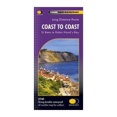
Harvey Coast to Coast map (XT40)
The whole Coast to Coast from St Bees to Robin Hood’s Bay on one waterproof strip map at 1:40,000, printed on both sides; 2021 edition.
View on Amazon (opens in a new tab)
Worth watching
A detailed guide to planning the Coast to Coast: trail details, where to resupply along the way and lessons learned on the walk across England.
The video is hosted by YouTube (Google): nothing loads until you play it, and Google may then set cookies.
FAQ
How many days does the Coast to Coast take?
Most people take 12 to 15 days, according to National Trails, the trail’s official website. Cicerone’s guidebook lays out 13 stages of 8.82 to 19.9 miles (14.2 to 32 km), plus 15- and 19-day itineraries. With one or two rest days, the walk fits into a two-week vacation, the Wainwright Society points out.
Can you wild camp on the Coast to Coast?
Not by right. In England, National Trail users normally have no right to wild camp: you need the landowner’s permission, or a campsite. In the Lake District, the park says a night out is normally tolerated above the highest fell wall, well away from villages and lakes, in groups of one or two tents. Campsites are spread along the route.
When should you book lodging on the Coast to Coast?
Well in advance, especially in summer: National Trails warns that beds book up quickly in peak season and suggests starting on a Monday or Tuesday. Cicerone recommends May, June, September, and October, and avoiding July and August if you can. Sherpa Van and Packhorse run their 2027 bag transfer season from March 22 to October 17.
Is the Coast to Coast well marked?
Better than it used to be: since it opened as a National Trail on March 26, 2026, it’s marked with an acorn in both directions. Cicerone praises the waymarking, though Packhorse says the hilltops are poorly signposted, and cell coverage is patchy. National Trails recommends carrying a map or guidebook, and a compass, so be ready to navigate in fog.
How do you get to the Coast to Coast from the US?
Cicerone suggests flying into Manchester Airport, which has its own train station. Trains reach St Bees from Carlisle or Lancaster; at the end, a bus links Robin Hood’s Bay to Whitby or Scarborough. Without a car, shuttles cost £55 per person. Before you fly, apply for a UK ETA, required for US citizens since February 25, 2026.
Sources
- National Trails, “Coast to Coast Path National Trail,” trail page, updated July 7, 2026, accessed November 14, 2026. nationaltrail.co.uk https://www.nationaltrail.co.uk/en_GB/trails/coast-to-coast/ ↩
- UK government (gov.uk), “‘Wainwright Way’ Becomes England’s Newest National Trail,” press release, March 26, 2026, accessed November 14, 2026. gov.uk https://www.gov.uk/government/news/wainwright-way-becomes-englands-newest-national-trail ↩
- National Trails, “Coast to Coast Map and Information,” FAQ, updated July 13, 2026, accessed November 14, 2026. nationaltrail.co.uk https://www.nationaltrail.co.uk/en_GB/trails/coast-to-coast/trail-information/ ↩
- Ordnance Survey, “Coast to Coast Walk Map & FAQ’s,” OS Maps Discover, accessed November 14, 2026. osmaps.com https://osmaps.com/discover/guides/coast-to-coast-walk-map-faqs/ ↩
- Lake District National Park Authority, “Coast to Coast National Trail Upgrades: Before and After,” April 9, 2026, accessed November 14, 2026. lakedistrict.gov.uk https://lakedistrict.gov.uk/?p=26362 ↩
- Cicerone, “Coast to Coast Path: A Complete Planning Guide,” updated August 2026 (Terry Marsh’s guidebook, 5th edition), accessed November 14, 2026. cicerone.co.uk https://www.cicerone.co.uk/coast-to-coast-path-a-complete-planning-guide ↩
- Natural England, “National Trail Proposal for the Coast to Coast Path” (NE777), edition 1, approved July 25, 2022, PDF, accessed November 14, 2026. nationaltrails.s3.eu-west-2.amazonaws.com https://nationaltrails.s3.eu-west-2.amazonaws.com/uploads/NE777-Edition-1-Approved-National-Trail-Proposal-for-the-Coast-to-Coast-Path.pdf ↩
- National Trails, “Route Description: Coast to Coast Path,” accessed November 14, 2026. nationaltrail.co.uk https://www.nationaltrail.co.uk/en_GB/trails/coast-to-coast/route-description-coast-to-coast-path/ ↩
- Sherpa Van, “Coast to Coast Route Planner,” page with 2027 prices, accessed November 14, 2026. sherpavan.com https://www.sherpavan.com/coast-to-coast/ ↩
- Brigantes English Walks, “Coast to Coast,” accessed November 14, 2026. brigantesenglishwalks.com https://www.brigantesenglishwalks.com/c2c/ ↩
- Wainwright Society, “AW’s Coast to Coast,” accessed November 14, 2026. wainwright.org.uk https://www.wainwright.org.uk/coast-to-coast/ ↩
- YHA (England & Wales), YHA Ennerdale access statement, April 2024, PDF, accessed November 14, 2026. yha.org.uk https://www.yha.org.uk/sites/default/files/media/document/8a7dc653__yha-ennerdale-access-statement-2024.pdf ↩
- National Trails, “Accommodation on the Coast to Coast,” accessed November 14, 2026. nationaltrail.co.uk https://www.nationaltrail.co.uk/en_GB/trails/coast-to-coast/accommodation-on-the-coast-to-coast/ ↩
- UK government (gov.uk), “Rights of Way and Accessing Land: Use Your Right to Roam,” accessed November 14, 2026. gov.uk https://www.gov.uk/right-of-way-open-access-land/use-your-right-to-roam ↩
- Lake District National Park Authority, “Wild Camping,” accessed November 14, 2026. lakedistrict.gov.uk https://lakedistrict.gov.uk/explore/where-to-stay/wild-camping/ ↩
- Natural England and Natural Resources Wales, “The Countryside Code: Advice for Countryside Visitors,” updated May 26, 2023, applies to England and Wales, accessed November 14, 2026. gov.uk https://www.gov.uk/government/publications/the-countryside-code/the-countryside-code-advice-for-countryside-visitors ↩
- Coast to Coast Packhorse, “Services,” updated October 12, 2026, accessed November 14, 2026. c2cpackhorse.co.uk https://c2cpackhorse.co.uk/services/ ↩
- Yorkshire Dales National Park Authority, “Coast to Coast Upgrade Completed,” November 12, 2025, accessed November 14, 2026. yorkshiredales.org.uk https://www.yorkshiredales.org.uk/coast-to-coast-upgrade-completed/ ↩
- Coast to Coast Packhorse, “Frequently Asked Questions,” accessed November 14, 2026. c2cpackhorse.co.uk https://c2cpackhorse.co.uk/frequently-asked-questions/ ↩
- Mountain Rescue England and Wales, “In Case of Emergency,” accessed November 14, 2026. mountain.rescue.org.uk https://www.mountain.rescue.org.uk/how-to-call-out-mr/ ↩
- Ordnance Survey, “Stay Safe in the Outdoors,” advice from Mountain Rescue England and Wales, accessed November 14, 2026. osmaps.com https://osmaps.com/discover/guides/mountain-safety/ ↩
- North York Moors National Park Authority, “Wildfire,” updated July 21, 2026, accessed November 14, 2026. northyorkmoors.org.uk https://www.northyorkmoors.org.uk/climate-change/wildfire ↩
- NHS, “How to Access NHS Services in England if You Are Visiting From Abroad,” last reviewed April 25, 2023, accessed November 14, 2026. nhs.uk https://www.nhs.uk/nhs-services/visiting-or-moving-to-england/how-to-access-nhs-services-in-england-if-you-are-visiting-from-abroad/ ↩
- Medicare.gov, “Travel Outside the U.S.,” accessed November 14, 2026. medicare.gov https://www.medicare.gov/coverage/travel-outside-the-u.s. ↩
- Coast to Coast Packhorse, home page, 2027 season, accessed November 14, 2026. c2cpackhorse.co.uk https://c2cpackhorse.co.uk/ ↩
- Lake District National Park Authority, “Weatherline,” accessed November 14, 2026. lakedistrict.gov.uk https://lakedistrict.gov.uk/explore/plan-your-visit/lake-district-weather/weatherline/ ↩
- National Rail, “Trains From Barrow-in-Furness to Manchester Airport,” page on Manchester Airport station, accessed November 14, 2026. nationalrail.co.uk https://www.nationalrail.co.uk/destinations/trains-from-barrow-in-furness-to-manchester-airport/ ↩
- National Rail, “St Bees Station,” accessed November 14, 2026. nationalrail.co.uk https://www.nationalrail.co.uk/stations/st-bees/ ↩
- UK government (gov.uk), Home Office, “UK Enforces Digital Permission to Travel,” press release, February 24, 2026, accessed November 14, 2026. gov.uk https://www.gov.uk/government/news/uk-enforces-digital-permission-to-travel ↩
- UK government (gov.uk), “Get an Electronic Travel Authorisation (ETA) to Visit the UK,” accessed November 14, 2026. gov.uk https://www.gov.uk/eta ↩
- Trailblazer, “Coast to Coast Path: St Bees to Robin Hood’s Bay,” 10th edition, accessed November 14, 2026. trailblazer-guides.com https://trailblazer-guides.com/book/coast-to-coast-path ↩
- Ordnance Survey Shop, “OS Explorer Wainwright’s Coast-to-Coast Walk Map Set,” accessed November 14, 2026. shop.osmaps.com https://shop.osmaps.com/os-explorer-wainwrights-coast-to-coast-walk-map-set/ ↩
- Harvey Maps, “Coast to Coast,” 1:40,000 map, accessed November 14, 2026. harveymaps.co.uk https://www.harveymaps.co.uk/acatalog/Coast-to-Coast-YHWRCTC.html ↩

Trail running, snow, water, nature and destinations
Nolwenn covers trail running, snow, water, nature and destinations for Outfarer. Curious about everything, from meteor showers to night-train schedules, she has a knack for digging up the one detail that changes everything, and nailing it in a single sentence.


 Arnaud Couderc