 Français (France)
 English (UK)
 English (US)
 Deutsch (Deutschland)

Contents
In the spring of 1964, when the GR54 was officially approved, some of its passes, like the Col de l’Aup Martin, hadn’t been crossed for several decades: the first hikers felt like real pioneers, says Écrins National Park [1]. The reputation stuck. The French Hiking Federation, the FFRandonnée, calls the Tour de l’Oisans et des Écrins one of the toughest GR trails in Europe, because of its late snow, its steep slopes, and its slippery schist [2].
GR stands for grande randonnée, France’s network of long-distance trails. This guide follows the 13 stages the park publishes from Le Bourg-d’Oisans, its camping rules, and the pages of the huts and transportation operators. The GR54 is a loop: you can start at Le Bourg-d’Oisans, L’Argentière, La Grave, or any other village along the way, the park notes [3]. For multi-day hikes in general, see our guide to planning a multi-day hike.
The GR54 at a Glance
How far is it? It depends on the page, sometimes from the same publisher. The park’s English pages say 114 miles (184 km); its French tour page says 118 miles (190 km) in its text and 121 miles (194.4 km) in its data. The FFRandonnée sticks to about 109 miles (176 km), as does the text of its MonGR website, whose online route nonetheless measures 194.81 km [1, 3, 4, 2, 5]. The elevation gain and the number of days are just as inconsistent.
| Source | Distance | Elevation gain | Time |
|---|---|---|---|
| FFRandonnée | About 109 mi (176 km) | Over 39,000 ft (12,000 m) | About twelve days |
| MonGR, the FFRandonnée’s GR website | 109 mi (176 km) in the text, 121 mi (194.81 km) for the online route | About 42,000 ft (over 12,800 m) | Not given |
| FFRandonnée topoguide, 18th edition (2025) | Not given online | Not given online | 10 days |
| National park, overview page | 114 mi (184 km) | About 42,000 ft (over 12,800 m) | 10 to 15 days |
| National park, tour page (2026) | 121 mi (194.4 km) | 39,245 ft (11,962 m) | 13 days |
| National park, leaflet (2020) | 121 mi (195 km) | 39,685 ft (12,096 m) | 13 days |
| Sum of the park’s 13 stages | 124 mi (198.8 km) | 39,892 ft (12,159 m) | 77 hours of hiking |
The last row is our calculation, from the stages the park publishes; miles and feet: our conversions. [2, 5, 6, 7, 3, 8]
Part of the gap probably comes from variants and detours. The park publishes four starting points, Le Bourg-d’Oisans, L’Argentière-la-Bessée, La Chapelle-en-Valgaudemar, and La Grave, for 12 to 15 days, and its second stage leaves the GR54 to end at the Mouterres hut, 15 minutes away on the GR50 [1, 4]. The detail that changes everything is the time on your feet. The park’s 13 stages add up to 77 hours of hiking, nearly 6 hours a day, and seven of them climb more than 3,280 feet (1,000 m), our calculation [3]. The park rates the loop “Hard,” like eight of its stages, and the other five “Medium” [3].
The park counts the GR54 in the “trilogy of major hiking trails in the French Alps,” with the trails around Mont Blanc and the Vanoise, and calls it “without doubt the most untamed of all, and the most difficult”; MonGR says much the same in French [1, 5]. In the park’s words, it’s “accessible to experienced hiking fans” [1].
The 13 Stages, Pass After Pass
From Le Bourg-d’Oisans back to Le Bourg-d’Oisans, the trail crosses the Oisans and the Emparis plateau, goes through La Grave and over the Col d’Arsine, drops to Le Monêtier-les-Bains and the Vallouise, then strings together the Champsaur, Valgaudemar, and Valjouffrey valleys before heading back past the Muzelle and Lauvitel lakes [3]. On French maps, col means pass and lac means lake.
| Stage | From, to | Distance | Elevation gain | Time | Passes |
|---|---|---|---|---|---|
| 1 | Le Bourg-d’Oisans to Clavans-le-Bas | 13.4 mi (21.5 km) | 4,767 ft (1,453 m) | 6 hr 30 min | Col de Sarenne, 6,562 ft (2,000 m) |
| 2 | Clavans-le-Bas to Les Mouterres | 6.0 mi (9.6 km) | 3,455 ft (1,053 m) | 4 hr 30 min | Ferrand valley, Emparis plateau |
| 3 | Les Mouterres to the Alpe de Villar-d’Arène | 14.4 mi (23.1 km) | 3,517 ft (1,072 m) | 8 hr 30 min | Col de Souchet, 7,759 ft (2,365 m); La Grave |
| 4 | Alpe de Villar-d’Arène to Le Monêtier-les-Bains | 8.0 mi (12.9 km) | 965 ft (294 m) | 4 hr 30 min | Col d’Arsine, 7,703 ft (2,348 m) |
| 5 | Le Monêtier-les-Bains to Vallouise | 13.5 mi (21.7 km) | 3,264 ft (995 m) | 7 hr | Col de l’Eychauda, 7,956 ft (2,425 m) |
| 6 | Vallouise to the Pré de la Chaumette | 15.1 mi (24.3 km) | 5,318 ft (1,621 m) | 9 hr | Col de l’Aup Martin, 9,058 ft (2,761 m); Pas de la Cavale, 8,973 ft (2,735 m) |
| 7 | Pré de la Chaumette to Lac de Vallonpierre | 6.8 mi (10.9 km) | 3,812 ft (1,162 m) | 6 hr | Cols de la Vallette, 8,753 ft (2,668 m), de Gouiran, 8,520 ft (2,597 m), and de Vallonpierre, 8,553 ft (2,607 m) |
| 8 | Lac de Vallonpierre to La Chapelle-en-Valgaudemar | 8.6 mi (13.9 km) | 236 ft (72 m) | 3 hr 30 min | Descent along the Séveraisse |
| 9 | La Chapelle-en-Valgaudemar to Les Souffles | 6.2 mi (10 km) | 3,199 ft (975 m) | 4 hr 30 min | Climb to the Souffles hut, 6,480 ft (1,975 m) |
| 10 | Les Souffles to Le Désert-en-Valjouffrey | 6.8 mi (11 km) | 2,096 ft (639 m) | 5 hr 30 min | Col de la Vaurze, 8,169 ft (2,490 m) |
| 11 | Le Désert-en-Valjouffrey to Valsenestre | 7.1 mi (11.5 km) | 3,363 ft (1,025 m) | 5 hr | Col de Côte Belle, 7,513 ft (2,290 m) |
| 12 | Valsenestre to Lac de la Muzelle | 5.6 mi (9 km) | 4,242 ft (1,293 m) | 5 hr 30 min | Col de la Muzelle, 8,573 ft (2,613 m) |
| 13 | Lac de la Muzelle to Le Bourg-d’Oisans | 12.1 mi (19.4 km) | 1,657 ft (505 m) | 7 hr | Col du Vallon, 8,304 ft (2,531 m); Lac du Lauvitel |
From the park’s tour page and stage pages, read November 16, 2026; miles and feet: our conversions. [3, 4]
The sixth stage is the big day of the tour, the park says: 15.1 miles (24.3 km) and 5,318 feet (1,621 m) of gain, over the Col de l’Aup Martin, the high point of the loop, then the steep descent to the Pré de la Chaumette [9]. The fourth, by contrast, is short: 4 hr 30 min below the Agneaux peak, with a recommended detour at the Col d’Arsine to the glacier lake, hidden just a few strides away [4]. Nothing says you have to do it all at once. If you want to “take it a little easier,” you can cut the trail into sections for a week or a weekend, the park suggests [1], and the FFRandonnée’s topoguide, its guidebook, suggests shorter treks of 2 to 5 days [6].
The Passages That Call for Sure Footing
The park doesn’t hide it: the “54” links challenging stages, “spiced up with tricky, technical passages,” and some of them, near the high mountains, cross tricky terrain [1]. Its stage pages name them. Right out of Le Bourg-d’Oisans, handrails help you over the delicate passages up to the hamlet of La Ville, on slabs that get slick in the rain [10]. Below the Col de l’Aup Martin, at 9,058 feet (2,761 m), the trail markers climb through big boulder fields, then the trail disappears, and the last 328 feet (100 m) are done with your uphill hand on the ground [9]. The next day, the Cols de la Vallette, de Gouiran, and de Vallonpierre cross schist slopes that can become extremely slippery, especially in the rain [11].
The Col de la Vaurze, at 8,169 feet (2,490 m), is reached by way of rungs and handrails, and its steep descent holds lingering snow late on this north face [12]. At the Col de la Muzelle, at 8,573 feet (2,613 m), no fewer than 50 switchbacks cut into the schist lead up the last slope; in spring, its snowfields may call for crampons and an ice ax [13]. Between these passages, the FFRandonnée points to easier stretches, such as the Vallouise valley or the Emparis plateau [2]. Our guide to mountain hiking difficulty ratings helps you size up this terrain, but the official pages we read give the GR54 no rating, only the park’s own scale, which calls it “Hard.”
When to Go: The Snow Has the Final Say
Every source agrees on summer, if not quite on when it starts and ends. The park recommends late June to mid-September, the FFRandonnée considers the trail passable from late June to late September, and the park’s 2020 leaflet said June 15 to September 15 [3, 2, 8]. MonGR warns that the highest passes are often snowbound until mid-July, and that most huts are no longer staffed from mid-September [5].
In early summer, check the weather and the snow on the passes, the park advises [3]; its French page adds that trail conditions vary every year, and that early in some seasons, you need an ice ax and crampons to cross some of the high passes [4]. The Maisons du Parc, the park’s visitor centers, can tell you about late-lying snow [8]. If the three passes between the Champsaur and the Valgaudemar are snowbound or impassable, the park suggests another way: rejoin the GR54 at Villar-Loubière in three days on the Tour du Vieux Chaillol, a regional trail [11]. An ice ax and crampons add up in your pack; our guide to pack weight on multi-day hikes helps you run the numbers.
Huts and Gîtes: Book Early, Bring Cash
The FFRandonnée advises planning your stages and booking huts in advance, after checking when they’re open [2]. You can also sleep in campgrounds, hotels, or gîtes, the hikers’ hostels in the villages, the park notes, and some stages require you to carry your own food [3]. Here are four huts run by the French Federation of Alpine and Mountain Clubs (FFCAM) where the park’s stages end.
| Hut | End of stage | Elevation | Staffed | Beds |
|---|---|---|---|---|
| Alpe de Villar-d’Arène | 3 | 6,795 ft (2,071 m) | June 11 to September 20, 2026 | 94 |
| Pré de la Chaumette | 6 | 5,915 ft (1,803 m) | Mid-June to late September | 60 |
| Vallonpierre | 7 | 7,421 ft (2,262 m) | Early June to late September | 39 |
| Les Souffles | 9 | 6,460 ft (1,969 m) | Mid-June to mid-September | 30 |
Elevations, staffed periods, and beds from each hut’s page, read November 16, 2026. [15, 16, 17, 18]
At a staffed hut, half board means a bunk, dinner, and breakfast. Vallonpierre lists 2026 half board at €60.50 full price, and €47.75 for members of the FFCAM and of foreign alpine clubs; a bunk alone costs €25.50 [19]. At the Pré de la Chaumette, a night costs €21 in 2025-2026, or €10.50 for a member [20]. Good news if you camp nearby: the hut also serves dinner, €25, and breakfast, €10, and makes bag lunches, €13, best reserved 48 hours ahead [21]. At both huts, bring your own sleeping bag liner [16, 17]. And bring cash: Vallonpierre doesn’t take cards, only checks, holiday vouchers, and cash [19].
As a benchmark, take Vallonpierre’s half board: the loop’s 12 nights would cost €726 at that price, our calculation, before tourist tax, bag lunches, and travel; prices stay in euros, so check the exchange rate. After the Aup Martin, the park’s leaflet, which doesn’t claim to be complete, lists only the Pré de la Chaumette hut, with 60 places in 2020 [8]. Our guide to staying in a mountain hut covers booking and etiquette.
Camping in the Core of the National Park
Used to dispersed camping on public land back home? The Écrins work differently. Part of the GR54, most of it according to the park’s 2020 leaflet, runs through the core of Écrins National Park, its most protected zone, where a fixed camp is banned but backcountry camping, the French bivouac, is allowed under conditions [1, 8, 22]. Since an order of June 16, 2026, replacing the 2014 one, all of these conditions apply [23]:
- set up after 7 p.m. and take down before 9 a.m., unless bad weather threatens your safety;
- a small tent you can’t stand up in;
- one night only in the same spot;
- more than an hour’s walk from the edge of the core, and from the parking areas and roads inside it;
- a gas stove is fine, but no fire or any other kind of burner;
- dishwater and washing water go more than 164 feet (50 m) from lakes, streams, and wetlands.
Two spots matter on the GR54. At the Pré de la Chaumette, less than an hour from the edge of the core, camping is still allowed [23, 22], and the hut asks you to check in at reception to find out where its camping area is [21]. At the Muzelle and Lauvitel lakes, which the last two stages pass, it’s banned within 1,640 feet (500 m) of the shores, outside the sites marked on the ground [23]. The park justifies the tighter rules by the doubling in the number of tents observed between 2021 and 2025 at several reference sites [23].
Outside the core, other rules apply: the park mentions those of the Emparis plateau and bans in some towns, without details on its page [3]. Ask at the town hall (mairie) or the tourist office. As for dogs, they’re banned in the core, even leashed or carried; the park allows them on a leash only on a few parking areas, a road, a track, and one trail that it lists, such as the Route de l’Enver at La Grave [24]. Our article on the rules of France’s national parks compares the other parks, and our guide to camping laws in France covers the rest of the country.
Getting There: Flights, Trains, and Buses
No train station sits on the GR54 itself, MonGR points out [5]. Flying in from the US? The park lists three airports: Grenoble, Lyon Saint-Exupéry, and Geneva, in Switzerland [3]. From Lyon airport, Flixbus and BlaBlaCar Bus coaches run to Grenoble every day, about 56 miles (90 km), in 55 minutes to 1 hr 5 min depending on the stop, the airport says [25]. From Grenoble’s train station, daily buses run to Le Bourg-d’Oisans, according to the park [3]. Starting from Paris instead? A night train with mandatory reservations runs to Briançon: it’s one of five night lines organized by the French government [26].
| GR54 point | Service | Details |
|---|---|---|
| Le Bourg-d’Oisans, La Grave, Villar-d’Arène, Le Monêtier-les-Bains | Zou! LER 55 | Briançon to Grenoble over the Col du Lautaret, daily; Grenoble to Le Bourg-d’Oisans in 1 hr 5 min in fall 2026 |
| Vallouise | Zou! 543 shuttle | From L’Argentière-la-Bessée, served by the LER 69 Marseille-Gap-Briançon route |
| La Chapelle-en-Valgaudemar | Car Région T90-91 bus, then shuttle | Gap-Corps-La Mure-Grenoble route to Saint-Firmin, then a local shuttle to La Chapelle |
| Le Monêtier-les-Bains | Zou! 551 | From Briançon |
From Écrins National Park and the route 55 timetable; travel time: our calculation. [27, 28]
Route 55 is the workhorse: it serves Le Bourg-d’Oisans, La Grave, Villar-d’Arène, the Col du Lautaret, and Le Monêtier-les-Bains, so several points on the loop [28]. Its fall 2026 timetable shows two departures a day from Briançon, and advises booking 36 hours ahead at busy times [28]. Check the summer schedule on the Zou! website before you go; some shuttles also have to be reserved in advance, the park adds [27].
Rescue, Guidebook, and Final Checks
The FFRandonnée’s topoguide, reference 508, is in its 18th edition, from June 2025: 160 pages in French, 1:25,000 maps, €18.40, or €17.48 for a member; on November 16, 2026, its page offered to notify you when it was available [6]. The park’s 2020 leaflet listed seven IGN 1:25,000 maps, from 3335 ET to 3536 OT; IGN is France’s national mapping agency [8]. Keep cash for the huts that don’t take cards, and a few meals in your pack for the stages with nowhere to buy food [19, 3].
All that’s left is picking your start: Le Bourg-d’Oisans for the classic loop, La Grave to begin face to face with the Meije, or a week-long section to sample the schist passes. The GR54 is more than sixty years old, and its passes haven’t gotten any smaller: they’ll be waiting as soon as the snow lets them go.
Gallery: The Tour of the Oisans and Écrins in Five Photos
Five real photos of the GR54’s landscapes, in the order of the loop, published under free licenses on Wikimedia Commons by their photographers, who are credited under each image. Tap or click a photo to enlarge it.
Gear related to this article
No affiliation: no commission, no sponsored products.
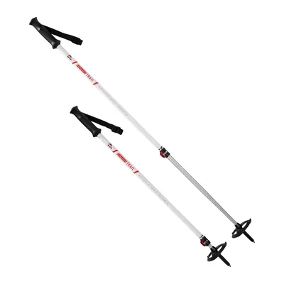
MSR DynaLock Trail Poles
Aluminum poles adjustable from 39.5 to 55 in, with a DynaLock lever lock that tightens without tools, plus snow and summer baskets: shorter uphill, longer downhill.
View on Amazon (opens in a new tab)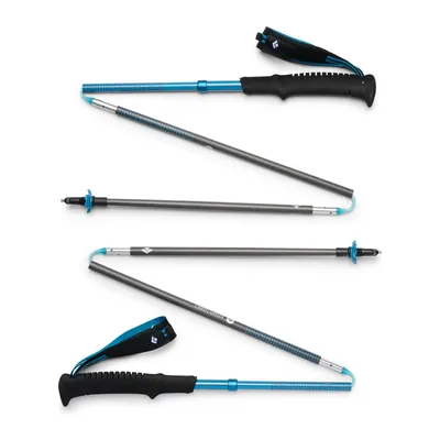
Black Diamond Distance Carbon Z (47 in)
Fixed-length folding Z-poles with 100% carbon fiber shafts, sold in lengths from 41 to 51 in (this listing: 47 in), about 9 to 10.4 oz per pair depending on length, two-year warranty.
View on Amazon (opens in a new tab)
FAQ
How many days does it take to hike the GR54?
Between 10 and 15 days, depending on the source. Écrins National Park splits the loop from Le Bourg-d’Oisans into 13 stages, which add up to 77 hours of hiking by our calculation; the FFRandonnée says about twelve days and its guidebook 10. The park also offers starts from La Grave, L’Argentière-la-Bessée, and La Chapelle-en-Valgaudemar, and week-long sections.
How long is the GR54?
From 109 to about 124 miles (176 to 198.8 km), depending on how you count. The FFRandonnée gives about 109 miles; Écrins National Park says 114 miles (184 km) on its English pages and 121 miles (194.4 km) in its tour data, with 39,245 feet of gain. Its 13 stages add up to 124 miles and 39,892 feet, our calculation. Variants and detours to huts probably explain part of the gap.
When is the best time to hike the GR54?
From late June to mid-September, says Écrins National Park. The highest passes are often snowbound until mid-July, MonGR warns, and early in some seasons you need an ice ax and crampons, according to the park. After mid-September, most huts are no longer staffed: in 2026, the Souffles hut was staffed from mid-June to mid-September.
Can you camp along the GR54?
Yes, within the rules of the core of Écrins National Park: tent up after 7 p.m. and down before 9 a.m., one night in the same spot, more than an hour’s walk from the edge of the core and from roads, and no fires. The Pré de la Chaumette is an exception. At the Muzelle and Lauvitel lakes, camping is banned within 1,640 feet (500 m) of the shores, outside the marked sites.
How do you get to the GR54 from the US?
Fly into Lyon, Geneva, or Grenoble, the airports the park lists. From Lyon airport, coaches reach Grenoble in about an hour, and buses run daily from Grenoble to Le Bourg-d’Oisans. Zou! route 55 links Grenoble and Briançon through several villages on the loop, and from Paris, a night train with mandatory reservations runs to Briançon.
Sources
- Écrins National Park, “The GR® 54,” overview page, Destination Parc national des Écrins website, accessed November 16, 2026. destination.ecrins-parcnational.fr https://destination.ecrins-parcnational.fr/en/information/4-The-GR%C2%AE-54 ↩
- French Hiking Federation (FFRandonnée), “GR® 54, tour de l’Oisans et des Ecrins,” June 10, 2026 (in French), accessed November 16, 2026. ffrandonnee.fr https://www.ffrandonnee.fr/randonner/sentiers/gr-54-tour-de-l-oisans-et-des-ecrins ↩
- Écrins National Park, “Tour of Oisans and Ecrins,” tour page from Le Bourg-d’Oisans, with its 13 stages, accessed November 16, 2026. destination.ecrins-parcnational.fr https://destination.ecrins-parcnational.fr/en/trek/937571-Tour-of-Oisans-and-Ecrins ↩
- Écrins National Park, “GR®54 - Tour de l’Oisans et des Ecrins,” tour page from Le Bourg-d’Oisans and its 13 stage pages, updated October 29, 2026 (in French), accessed November 16, 2026. destination.ecrins-parcnational.fr https://destination.ecrins-parcnational.fr/trek/937571-GR%C2%AE54---Tour-de-l-Oisans-et-des-Ecrins ↩
- MonGR (FFRandonnée), “GR® 54 : Tour de l’Oisans et des Ecrins” (in French), accessed November 16, 2026. mongr.fr https://www.mongr.fr/trouver-prochaine-randonnee/itineraire/gr-54-tour-de-l-oisans-et-des-ecrins ↩
- French Hiking Federation (FFRandonnée), online store, topoguide “Tour de l’Oisans et des Ecrins - GR® 54” (ref. 508), 18th edition, June 2025 (in French), accessed November 16, 2026. boutique.ffrandonnee.fr https://boutique.ffrandonnee.fr/topoguide/tour-de-loisans-et-des-ecrins-gr54 ↩
- Écrins National Park, “Le GR® 54,” overview page (in French), accessed November 16, 2026. destination.ecrins-parcnational.fr https://destination.ecrins-parcnational.fr/information/4-Le-GR%C2%AE-54 ↩
- Écrins National Park, leaflet “GR®54, Tour de l’Oisans et des Écrins,” 2020, PDF (in French), accessed November 16, 2026. ecrins-parcnational.fr https://www.ecrins-parcnational.fr/sites/ecrins-parcnational.com/files/fiche_doc/16337/4voletgr5440x42-bat05.pdf ↩
- Écrins National Park, “De Vallouise au Pré de la Chaumette par le col de l’Aup Martin (étape du GR 54)” (in French), accessed November 16, 2026. destination.ecrins-parcnational.fr https://destination.ecrins-parcnational.fr/trek/939569-De-Vallouise-au-Pre-de-la-Chaumette-par-le-col-de-l-Aup-Martin-(etape-du-GR-54)?parentId=937571 ↩
- Écrins National Park, “Du Bourg d’Oisans à Clavans le Bas (étape du GR 54)” (in French), accessed November 16, 2026. destination.ecrins-parcnational.fr https://destination.ecrins-parcnational.fr/trek/939529-Du-Bourg-d-Oisans-a-Clavans-le-Bas-(etape-du-GR-54)?parentId=937571 ↩
- Écrins National Park, “Du Pré de la Chaumette au lac de Vallonpierre (étape du GR 54)” (in French), accessed November 16, 2026. destination.ecrins-parcnational.fr https://destination.ecrins-parcnational.fr/trek/939571-Du-Pre-de-la-Chaumette-au-lac-de-Vallonpierre-(etape-du-GR-54)?parentId=937571 ↩
- Écrins National Park, “Des Souffles au Désert en Valjouffrey (étape du GR 54)” (in French), accessed November 16, 2026. destination.ecrins-parcnational.fr https://destination.ecrins-parcnational.fr/trek/939589-Des-Souffles-au-Desert-en-Valjouffrey-(etape-du-GR-54)?parentId=937571 ↩
- Écrins National Park, “De Valsenestre au lac de la Muzelle (étape du GR 54)” (in French), accessed November 16, 2026. destination.ecrins-parcnational.fr https://destination.ecrins-parcnational.fr/trek/939599-De-Valsenestre-au-lac-de-la-Muzelle--(etape-du-GR-54)?parentId=937571 ↩
- Écrins National Park, “Du lac de la Muzelle au Bourg d’Oisans par le col du Vallon (étape du GR 54),” updated October 29, 2026 (in French), accessed November 16, 2026. destination.ecrins-parcnational.fr https://destination.ecrins-parcnational.fr/trek/939601-Du-lac-de-la-Muzelle-au-Bourg-d-Oisans-par-le-col-du-Vallon-(etape-du-GR-54)?parentId=937571 ↩
- Refuge de l’Alpe de Villar-d’Arène (FFCAM), home page, 2026 season (in French), accessed November 16, 2026. refugealpedevillardarene.ffcam.fr https://refugealpedevillardarene.ffcam.fr/ ↩
- Refuge du Pré de la Chaumette (FFCAM), home page (in French), accessed November 16, 2026. refugepredelachaumette.ffcam.fr https://refugepredelachaumette.ffcam.fr/ ↩
- Refuge de Vallonpierre (FFCAM), home page (in French), accessed November 16, 2026. refugevallonpierre.ffcam.fr https://refugevallonpierre.ffcam.fr/ ↩
- Refuge des Souffles (FFCAM), home page (in French), accessed November 16, 2026. refugedessouffles.ffcam.fr https://refugedessouffles.ffcam.fr/ ↩
- Refuge de Vallonpierre (FFCAM), “Tarifs,” 2026 half board and 2025-2026 nights (in French), accessed November 16, 2026. refugevallonpierre.ffcam.fr https://refugevallonpierre.ffcam.fr/tarifs.html ↩
- Refuge du Pré de la Chaumette (FFCAM), “Tarifs,” 2025-2026 nights (in French), accessed November 16, 2026. refugepredelachaumette.ffcam.fr https://refugepredelachaumette.ffcam.fr/tarifs.html ↩
- Refuge du Pré de la Chaumette (FFCAM), “Bivouac” (in French), accessed November 16, 2026. refugepredelachaumette.ffcam.fr https://refugepredelachaumette.ffcam.fr/bivouac.html ↩
- Écrins National Park, “Bivouac,” regulations page (in French), accessed November 16, 2026. ecrins-parcnational.fr https://www.ecrins-parcnational.fr/qui-sommes-nous/reglementation/bivouac ↩
- Écrins National Park, order no. 148/2026 of June 16, 2026 regulating backcountry camping in the core of the park, consolidated with corrective order no. 185/2026 of July 6, 2026, PDF (in French), accessed November 16, 2026. ecrins-parcnational.fr https://www.ecrins-parcnational.fr/sites/ecrins-parcnational.com/files/fiche_doc/27327/2606148arretebivouacvf-rectificatif.pdf ↩
- Écrins National Park, “Animaux domestiques,” regulations page (in French), accessed November 16, 2026. ecrins-parcnational.fr https://www.ecrins-parcnational.fr/qui-sommes-nous/reglementation/animaux-domestiques ↩
- Lyon Aéroports, “Bus Lyon Aéroport - Grenoble : navette autocar” (in French), accessed November 16, 2026. lyonaeroports.com https://www.lyonaeroports.com/bus-lyon-aeroport-grenoble-navette-autocar ↩
- French Ministry for Regional Planning and Ecological Transition, “L’État, autorité organisatrice des trains d’équilibre du territoire,” updated June 26, 2026 (in French), accessed November 16, 2026. ecologie.gouv.fr https://www.ecologie.gouv.fr/politiques-publiques/letat-autorite-organisatrice-trains-dequilibre-du-territoire ↩
- Écrins National Park, “Venir et se déplacer dans les Écrins” (in French), accessed November 16, 2026. ecrins-parcnational.fr https://www.ecrins-parcnational.fr/votre-visite/preparer-sa-visite/venir-et-se-deplacer-dans-les-ecrins ↩
- Région Sud, Zou! network, timetable for route LER 55 Briançon-Grenoble via Serre Chevalier, valid September 1 to December 17, 2026, PDF (in French), accessed November 16, 2026. zou.maregionsud.fr https://zou.maregionsud.fr/public/media/file/2026-08/zouler_ligne55_briancon_grenoble_via_serre_chevalier_sept_2026.pdf ↩
- French Senate, written question no. 03383 on charging for mountain rescue, and the answer of the Ministry for Regional Planning and Decentralization published in the Senate’s Official Journal on June 5, 2025 (in French), accessed November 16, 2026. senat.fr https://www.senat.fr/questions/base/2025/qSEQ250203383.html ↩

Trail running, snow, water, nature and destinations
Nolwenn covers trail running, snow, water, nature and destinations for Outfarer. Curious about everything, from meteor showers to night-train schedules, she has a knack for digging up the one detail that changes everything, and nailing it in a single sentence.

 Guillaume Hoarau

