 Français (France)
 English (UK)
 English (US)
 Deutsch (Deutschland)

Contents
What does the Bortle scale actually measure?
The Bortle scale describes the quality of a night sky in nine classes. Its creator, the American observer John E. Bortle, published it in the February 2001 issue of Sky & Telescope, drawing on nearly fifty years of observing [1]. He wanted a more complete method than simply spotting the faintest star visible to the naked eye.
His scale relies on several clues that complement one another: how many stars you can see, the structure of the Milky Way, the zodiacal light and the gegenschein, two very faint natural glows, and the way clouds look. Over a city, clouds reflect the glow of streetlights and other lighting. Under a very dark sky, they show up instead as dark holes in the star field [1].
The the magnitude of the faintest star you can make out without an instrument; the higher the number, the fainter the star, often shortened to NELM, is one of those clues. But it varies with the observer’s eyesight, how well their eyes have adapted to the dark and the state of the atmosphere [1] [2]. Bortle also notes that modest light pollution hurts diffuse objects, comets, nebulae and galaxies, far more than it hurts stars [1].
The nine classes, from dark sky to downtown
Class 1 is the darkest sky on the scale, class 9 the sky over a city center. The limiting magnitudes in the table are the benchmarks Bortle published: they don’t guarantee anything to a given observer on a given night [1].
| Class | Naked-eye limiting magnitude | What the sky looks like |
|---|---|---|
| 1 | 7.6 to 8.0 | Exceptionally dark sky. The Milky Way casts diffuse shadows on the ground; the zodiacal light, the gegenschein and the galaxy M33 are visible to the naked eye. |
| 2 | 7.1 to 7.5 | Truly dark sky. The summer Milky Way is highly structured, and M33 is fairly easy to see with direct vision. |
| 3 | 6.6 to 7.0 | Rural sky. The Milky Way still looks complex, some light pollution shows on the horizon, and M33 is easy to see with averted vision. |
| 4 | 6.1 to 6.5 | Rural/suburban transition. Light domes appear over towns; the Milky Way is still impressive but has lost nearly all its detail. |
| 5 | 5.6 to 6.0 | Suburban sky. The Milky Way is very faint or invisible near the horizon and looks washed out overhead; clouds are brighter than the sky. |
| 6 | About 5.5 | Bright suburban sky. The Milky Way is only faintly visible toward the zenith; up to 35° above the horizon, the sky is grayish white. M33 can no longer be seen without binoculars. |
| 7 | About 5.0, with effort | Suburban/urban transition. The whole sky background is grayish, the Milky Way invisible or nearly so, clouds brightly lit. |
| 8 | 4.5 at best | City sky. The sky is whitish gray or orange; some stars in familiar constellations are hard to see, or missing altogether. |
| 9 | 4.0 or less | Inner-city sky. The whole sky is lit, even overhead; the Moon, the planets and a few bright clusters are the only rewarding targets. |
M33, the Triangulum Galaxy, works as a benchmark because it’s diffuse: it quickly vanishes against a bright background. How visible it is also depends on the season and how high it sits in the sky. In class 4, Bortle describes it as visible with averted vision only when it’s more than 50° above the horizon [1].
In class 4, the Milky Way is still visible, but its detail is fading; beyond that, it pales until it disappears. Classes 1 to 3 offer increasingly favorable conditions for faint structures. Even so, no universal threshold guarantees any particular observation.
Why doesn’t a light pollution map give you the Bortle class?
Global maps rely on satellite images that detect light given off on the ground at night. The Earth Observation Group’s VIIRS data, for example, are filtered to remove, among other things, pixels lit by the Sun or the Moon and cloudy pixels [3].
These data don’t photograph the sky the way someone standing outside sees it: they measure the artificial light sent upward. An atmospheric model then estimates how much of that light gets scattered back and brightens the sky. The world atlas, consulted on October 31, 2026, uses satellite data from 2025, and its author states that it isn’t based on direct measurements [4].
This is where the two approaches part ways. A zenith brightness map describes the sky directly overhead. Bortle judges the whole dome of the sky, from the zenith down to the horizon, using clues seen with the naked eye. So a map can show a dark zenith while a strong glow from a city is still visible in one direction.
The atlas’s author showed this using National Park Service data gathered over 397 nights: he compares the measured sky brightness with the Bortle class that the agency’s teams noted on site, and the two don’t line up in any fixed way [5].
Bortle, SQM and limiting magnitude: three different yardsticks
The Sky Quality Meter, a small device that measures the brightness of the sky in magnitudes per square arcsecond is pointed at the zenith. The higher the reading, the darker the sky, because the magnitude scale runs backward. Its field of view is wide: about 42° across, measured where its sensitivity drops to half its maximum. The National Park Service notes that it no longer reliably measures a sky darker than 21.5 magnitudes per square arcsecond [2].
| Yardstick | What it describes | Its limits |
|---|---|---|
| Bortle class | The quality of the whole sky, judged by eye from several objects and clues | A judgment call, which depends on the observer’s experience |
| SQM | The brightness of one patch of sky, around the zenith, in magnitudes per square arcsecond | Doesn’t see light domes on the horizon; unreliable beyond 21.5 |
| Limiting magnitude | The faintest star visible to the naked eye | Varies a lot with eyesight and dark adaptation |
To describe a site in detail, the National Park Service photographs the entire celestial hemisphere with calibrated cameras, in high-resolution mosaics. That way it measures brightness and glare across the whole sky, then separates the natural part from the human-caused part [6]. It’s a good reminder that a single reading at the zenith doesn’t describe the whole sky.
How do you use a map to choose a place to observe from?
A map cuts down the number of sites worth looking into; it doesn’t replace checking out the place itself.
- Start with a map whose method is published: the date of the data, the sensor, what the value shown actually is. An annual atlas picks out dark areas, not the conditions on the night ahead [3] [4].
- Look for areas well away from big cities, at a regional scale. Don’t just pick the darkest pixel: access, nearby towns and the glow around them matter too.
- Look at the horizon, one direction at a time. A site that’s dark at the zenith can have a light dome on the side facing a city: is that exactly where the thing you want to observe will be [5]?
- Check the place itself: somewhere you’re allowed to be, with a clear horizon and no direct lighting. A line of trees or a building blocks part of the sky without getting rid of the light pollution.
- Check conditions on the night: an annual map says nothing about the Moon, clouds, haze or temporary lighting, all of which make a big difference to what you see [3].
How do you check the quality of the sky on site?
Get away from streetlights, headlights and lit buildings, and skip moonlit nights if you want to judge faint stars. The National Park Service only takes its reference measurements on moonless nights, under a sky that’s at least 95% clear. That’s its measurement protocol, not a rule for every outing [6].
Then give your eyes time to adjust to the dark. According to the British Astronomical Association, that takes 15 to 20 minutes or more, and a bright white light undoes the effort; a dim red flashlight is a better choice for reading a chart [7].

For a simple estimate, the citizen science program Globe at Night suggests comparing a constellation chosen for your date and location with charts showing more or fewer stars. The Association française d’astronomie, France’s national astronomy association, describes the method: wait for full darkness, about an hour and a half after sunset, avoid the Moon and direct lights, let your eyes adjust, then pick the chart that looks most like the sky you see [8]. In summer, when nights are short, full darkness comes much later.
This observation doesn’t automatically make a place a class 3 or class 4 site: it tests the map’s estimate against reality. For the comparison to be useful, write down the date, the time, the Moon, the state of the sky, the direction of any glows and the objects you actually saw, then try again on another night. Binoculars help you judge diffuse objects such as M33.
In the United States, a certified dark sky place makes a sensible shortlist, not a guarantee. The National Park Service, which has worked with the organization DarkSky for nearly two decades, says dozens of its park units hold Dark Sky Place certification; in 2007, Natural Bridges National Monument became the world’s first certified International Dark Sky Park [9]. The right site combines a dark enough sky, a clear horizon in the right direction and cooperative weather. A map points the way; only the sky, once you’re there, tells you what it’s willing to show.
Gear related to this article
No affiliation: no commission, no sponsored products.
 David Chandler Company
The Night Sky 40°-50° Planisphere (Small)
A pocket-size plastic planisphere for 40° to 50° north latitude, with a 5-inch map: dial in the date and time to see which constellations are up and where the radiant sits.
View on Amazon (opens in a new tab)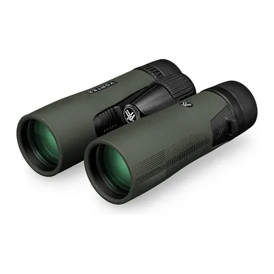
Vortex Diamondback HD 10x42
10x42 binoculars: 4.2 mm exit pupil, a 330 ft field of view at 1,000 yd, and 15 mm of eye relief, the minimum advised for eyeglass wearers. 21.3 oz, waterproof and fogproof.
View on Amazon (opens in a new tab)
Worth watching
An astrophotographer compares light pollution maps with the Bortle scale, then measures the sky with a Sky Quality Meter: the same pitfalls as above, put to the test.
The video is hosted by YouTube (Google): nothing loads until you play it, and Google may then set cookies.
FAQ
What Bortle class do you need to see the Milky Way?
The Milky Way is still visible in class 4, but it has lost nearly all its detail there. In class 3, it keeps a complex structure, and classes 1 and 2 offer the best conditions for its dark lanes. In class 5, it looks washed out overhead and disappears near the horizon. The season, the transparency of the air and how high it sits in the sky matter too.
Can you convert an SQM reading into a Bortle class?
Not reliably. The SQM mainly measures brightness around the zenith, while Bortle judges the whole sky and the objects you can see. A glow from a city on the horizon can spoil your observing without affecting the zenith reading. The author of the world light pollution atlas has shown, using National Park Service measurements, that the two don’t line up in any fixed way.
How do you find out the Bortle class near you?
Start with a light pollution atlas that gives the date and method behind its data, and pick out several possible areas. On site, on a moonless night and after 15 to 20 minutes of dark adaptation, compare the stars you can see and the look of the Milky Way with Bortle’s criteria. The result is still an estimate by eye, not a permanent measurement of the place.
Do the Moon and clouds change the Bortle class?
They change the observing conditions, not the site’s permanent light pollution. The Moon naturally brightens the sky and hides faint objects. Clouds and haze can scatter artificial light and strengthen the glow over cities. To compare two places, choose moonless nights with clear, transparent air, and write down the conditions every time.
Can you stargaze from a city, in class 7 or 8?
Yes. The brightest stars, the planets and the Moon can still be observed from an urban sky. Faint stars, the Milky Way and diffuse objects, on the other hand, become very hard to see. It all depends on your target: an evening devoted to the planets doesn’t call for the same sky as a session spent hunting for galaxies or nebulae.
Sources
- John E. Bortle, “Gauging Light Pollution: The Bortle Dark-Sky Scale,” Sky & Telescope, February 2001, online since July 18, 2006, accessed October 31, 2026. skyandtelescope.org https://skyandtelescope.org/astronomy-resources/light-pollution-and-astronomy-the-bortle-dark-sky-scale/ ↩
- National Park Service, “Metrics Guide to Night Skies Report,” accessed October 31, 2026. nps.gov https://www.nps.gov/subjects/nightskies/NSQmetrics.html ↩
- Earth Observation Group, Colorado School of Mines, “VIIRS Nighttime Light,” accessed October 31, 2026. eogdata.mines.edu https://eogdata.mines.edu/products/vnl/ ↩
- D. J. Lorenz, “Light Pollution Atlas,” method and 2025 satellite data, accessed October 31, 2026. djlorenz.github.io https://djlorenz.github.io/astronomy/lp/index.html ↩
- D. J. Lorenz, “Zenith Brightness (aka Light Pollution Maps) vs Bortle Scale,” accessed October 31, 2026. djlorenz.github.io https://djlorenz.github.io/astronomy/lp/bortle.html ↩
- National Park Service, “NPS Methods,” updated July 3, 2018, accessed October 31, 2026. nps.gov https://www.nps.gov/subjects/nightskies/methods.htm ↩
- British Astronomical Association, “Hints and tips for visual observing,” accessed October 31, 2026. britastro.org https://britastro.org/section_information_/hints-and-tips-for-visual-observing ↩
- Association française d’astronomie, “Mesurer la qualité du ciel avec Globe at Night” (in French), accessed October 31, 2026. afastronomie.fr https://www.afastronomie.fr/methode-globe-at-night ↩
- National Park Service, “Partnerships to Protect Night Skies,” updated June 13, 2024, accessed October 31, 2026. nps.gov https://www.nps.gov/subjects/nightskies/partnerships.htm ↩

The one who started Outfarer
Outfarer started with Erik, who launched it with a few passionate friends. A nature lover first and foremost, he writes about the topics closest to his heart and reviews a good chunk of the magazine, including every survival and bushcraft article before it’s published.

 Nolwenn Bastide

