 Français (France)
 English (UK)
 English (US)
 Deutsch (Deutschland)

The GR20 is said to be one of the toughest trails in Europe, and the Corsica Regional Nature Park, which runs its refuges, does not dispute it: the route includes steep, narrow and slippery sections, and in places descents on fixed cables or chains [1]. It also has stricter rules than most: every night must be booked, even under your own tent, and wild camping is banned [1]. Here are the stages, the bookings and the rules, as the park publishes them for the 2026 season.
Sixteen stages, two halves
The park divides the GR20 into sixteen stages, from Calenzana in the north to Conca in the south [1, 2]. The first nine, as far as Vizzavona, make up the northern GR: very technical and hard on the joints according to the park, they add up to 57 hr 5 min of walking based on its times. The seven stages of the southern GR, with more forest, add up to 37 hr 50 min [1]. At Vizzavona, halfway along, many hikers stop and take the train to Ajaccio or Bastia [1]. South to north, the times change: 92 hr 35 min in all, against 94 hr 55 min north to south [1].
The park gives walking times, not distances or height gain. For those figures, it asks you to carry the guidebook “À travers la montagne corse”, reference 067, which is part of its required gear list [1]. And it advises against doubling up stages because of how hard the route is: a booked night that is not changed at least 48 hours ahead cannot be moved to the next refuge [1].
| Stage | From, to | Time | Good to know |
|---|---|---|---|
| 1 | Calenzana, Ortu di u Piobbu | 6 hr 30 min | Last water at the Ortiventi fountain; no dormitory at the refuge |
| 2 | Ortu di u Piobbu, Carrozzu | 7 hr | No water until Carrozzu; high point at 6,627 feet (2,020 m) |
| 3 | Carrozzu, Ascu Stagnu | 6 hr 10 min | No water; Lake Muvrella unfit to drink |
| 4 | Ascu Stagnu, Tighjettu | 8 hr | New route since the Cirque de la Solitude closed; nearly 3,900 feet (1,200 m) of climbing |
| 5 | Tighjettu, Ciottulu di i Mori | 4 hr | Short stage; refuge at 6,532 feet (1,991 m) |
| 6 | Ciottulu di i Mori, Manganu | 8 hr | Long but “rolling”; can be split at Castel di Verghju |
| 7 | Manganu, Petra Piana | 6 hr 30 min | Technical and rocky |
| 8 | Petra Piana, L’Onda | 4 hr 50 min | Ridge variant, blazed in yellow, in settled weather only |
| 9 | L’Onda, Vizzavona | 6 hr 5 min | End of the northern GR; train station |
| 10 | Vizzavona, E Capanelle | 5 hr 15 min | No particular technical difficulty |
| 11 | E Capanelle, Prati | 6 hr 10 min | Laricio pine forest; water at the Marmanu footbridge |
| 12 | Prati, Usciolu | 5 hr 45 min | Water shortage in July and August |
| 13 | Usciolu, Cuscionu | 4 hr 25 min | Ridge of statues; private accommodation at Cuscionu |
| 14 | Cuscionu, Asinao | 4 hr 15 min | Monte Alcudina summit possible for 30 min more; no dormitory at the refuge |
| 15 | Asinao, Paliri | 7 hr | Alpine variant through the Bavella needles, more technical |
| 16 | Paliri, Conca | 5 hr | Hot stage; shuttle on request to Porto-Vecchio |
North-to-south times and information published by the Corsica Regional Nature Park, accessed on October 23, 2026.
Booking refuges and bivouac sites
At the park’s refuges, every night must be booked: in the dormitory, on a Shared sleeping platform without sheets or blankets: you need your own sleeping bag., or in the bivouac area [1]. Even with your own tent, you must book one bivouac site per person, two if you share a tent [1]. Bookings are made on the park’s reservation site, pnr-resa.corsica, paying by card when you order; the confirmation email serves as your receipt and must be shown to the warden on arrival [3].
In 2026, a night in the dormitory costs €20 per person, a bivouac site €12, and a rented two-person tent, site included, €27 for one person or €39 for two [3]. Booked places are held until 7 pm; after that, you sleep wherever there is room [3]. You can book up to 48 hours before the night, change your dates up to 2 days ahead, and cancel for a refund up to 2 months before your walk starts; for medical reasons there is no refund, but a credit for the following year, with proof and if you ask 10 days before setting off [3].
At the refuges: what you find, what you pay
The park runs a network of 13 refuges, staffed in 2026 from May 16 to October 4 [3]. Comfort is basic, but each has around thirty beds on average, a bivouac area, an emergency first-aid kit, an outdoor kitchen with gas and utensils, showers, composting toilets, running water, a small store, a meal service, and free phone charging, except at Ortu di u Piobbu and Asinao, where it is paid [1]. The common room and the indoor kitchen are for hikers sleeping in the dormitory; those in the bivouac area use the outdoor facilities [3].
Meals cannot be booked online: you order them on site from the warden, by 6 pm at the latest for dinner, served around 7 pm [1]. The park gives rough prices: about €10 for breakfast, €10 for a bag lunch and €20 for dinner, so €50 a day on average for all meals, payable in cash or by check [1]. Carry enough cash for the whole crossing.
Bivouacking, fires, dogs: the park’s rules
The park publishes its rules for the GR20 [1, 3]:
- Wild camping is banned, under the municipal bylaws: only near the refuges or in designated areas [1]. Camping and bivouacking are banned all along the route outside these areas [3].
- No fires or smoking from June 15 to September 30 in forests, moorland, scrubland and mountains [1].
- No swimming in the mountain lakes [1].
- Dogs on leashes, and strongly discouraged because of the technical sections; they are banned inside refuges and rented tents [1].
- No trekking poles at Lake Ninu or on the Cuscionu plateau, and do not trample the High wet meadows typical of Corsica, dotted with small pools: a very fragile habitat. [1].
- Drones need permission; do not feed or disturb wildlife [1].
Fire risk also affects the route itself. From mid-June to mid-September, depending on the weather, some massifs can be closed to the public at any time of day when the risk is severe; the fire risk map is updated at 6 pm for the following day [1]. And at the start, the park is clear: no departures on the GR20 are allowed from Calenzana after 11 am [1].
Water, weather and safety
Water is the first concern on the northern GR. Between Ortu di u Piobbu and Carrozzu, there is not a drop after the spring at the start; the third stage has no water at all, and the water of Lake Muvrella is unfit to drink [1]. In the south, the Prati to Usciolu stage is short of water in July and August [1]. The park’s required gear includes a filter bottle and purification tablets, and it advises filling up at every spring [1]. Our guide to finding and treating water when camping explains the methods.
A few points on the route let you shorten or leave the GR: Vizzavona and its station, at the end of the ninth stage; the private accommodation at Castel di Verghju, halfway through the sixth; and at the finish, a shuttle on request links Conca with Santa Lucia di Porti Vechju and Porto-Vecchio [1]. Our article on calling for help without signal explains how to raise the alarm when your phone has no service.
The required gear list
The park publishes a required gear list for the GR20 [1]: a sleeping bag, a waterproof jacket, a warm layer, pants and shorts, a first-aid kit, a survival blanket, a towel, mountain boots, a cap, a headlamp, a filter bottle with purification tablets, and the route guidebook. Beyond that, the rule is simple: you will carry everything for sixteen days. Our guides to sleeping bag temperature ratings and the three-layer system will help you choose, and our article on mountain huts completes this one.
Gallery: the GR20 in six landscapes
Six real photos of the trail and its mountains, from north to south, published under free licenses on Wikimedia Commons by their photographers, who are credited under each image. Tap or click a photo to enlarge it.
Gear related to this article
No affiliation: no commission, no sponsored products.
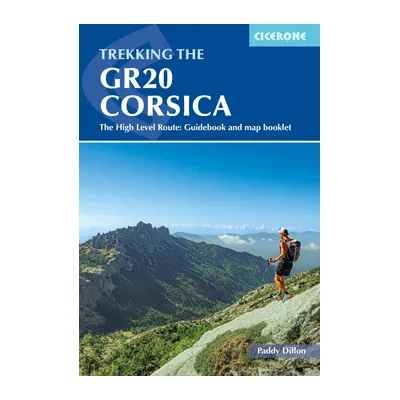
Trekking the GR20 Corsica (Cicerone)
Paddy Dillon’s guide to all 16 stages from Calenzana to Conca, with an IGN map booklet and GPX files; fifth edition, reprinted in July 2025.
View on Amazon (opens in a new tab)
FAQ
How many days does the GR20 take?
The Corsica Regional Nature Park divides the GR20 into sixteen stages, from Calenzana to Conca, so sixteen days of walking, plus any rest days you add. Its times add up to about 95 hours from north to south. The park advises against doubling up stages, because of how demanding the route is.
Do you need to book GR20 refuges?
Yes. At the park’s refuges, every night must be booked in advance on pnr-resa.corsica, in the dormitory or the bivouac area, even if you bring your own tent: you then book one site per person. You show the confirmation email to the warden, and places are held until 7 pm.
How much does a night on the GR20 cost?
In 2026, €20 per person in the dormitory, €12 for a bivouac site, and €27 for one person or €39 for two with a rented tent. Meals are paid separately, on site, in cash or by check: the park reckons on about €50 a day for breakfast, a bag lunch and dinner.
Can you wild camp on the GR20?
No. Wild camping is banned under the municipal bylaws: you can only sleep in a tent near the refuges or in designated areas, and those sites must be booked. Camping and bivouacking are banned all along the route outside these areas, according to the park’s terms of sale.
When is the best time to walk the GR20?
In 2026, the refuges were staffed from May 16 to October 4. Summer brings other constraints: no fires or smoking from June 15 to September 30, massifs sometimes closed when fire risk is severe, and a water shortage in July and August on the Prati to Usciolu stage. Check that year’s staffed dates before booking.
Sources
- Corsica Regional Nature Park, “GR®20 : Frà li monti®,” information, prices, rules and stages for the 2026 season (in French), accessed October 23, 2026. pnr.corsica https://www.pnr.corsica/fr/randonnees-decouverte/gr-20-fra-li-monti ↩
- Corsica Regional Nature Park, overnight booking site, presentation of the GR®20 stages, 2026 version 6.2, accessed October 23, 2026. pnr-resa.corsica https://pnr-resa.corsica/ ↩
- Corsica Regional Nature Park joint authority, “Conditions générales de vente à distance de nuitées en refuge,” in force for 2026 (in French), accessed October 23, 2026. pnr-resa.corsica https://pnr-resa.corsica/CGV.pdf ↩

Camping, backpacking, bushcraft and hiking
Guillaume Hoarau writes for Outfarer about camping, backpacking, bushcraft, and hiking. A survival-skills buff and a collector of vintage field manuals, he loves clear explanations, lists that actually help and other people’s stories, which he tells well.


 Nolwenn Bastide