 Français (France)
 English (UK)
 English (US)
 Deutsch (Deutschland)

Contents
The GR34 at a glance: more than 1,240 miles of coast
A path as wide as a pair of shoulders, a heath of gorse and heather, the sea a few dozen metres below, and a white and red mark painted on a rock: that is the GR34 for hundreds of miles. Between headlands, it also crosses dunes, beaches, harbours and the muddy upper reaches of estuaries.
The GR34 is the long-distance path, or GR (sentier de grande randonnée), of the Brittany coast. It sets off from the bay of Mont-Saint-Michel, in the Manche, and reaches its end at Saint-Nazaire, in Loire-Atlantique, after following every stretch of Brittany’s coastline [1]. The French Hiking Federation (FFRandonnée), which approved the route, speaks of ‘more than 2,000 kilometres’; its Brittany committee reckons on 100 days’ walking at 12 miles (20 km) a day [2]. That makes it about twice the length of England’s South West Coast Path, 630 miles (1,014 km) from Minehead to Poole Harbour [3]. The path crosses six départements, the rough French equivalent of counties: the Manche, Ille-et-Vilaine, Côtes-d’Armor, Finistère, Morbihan and Loire-Atlantique, in three regions [4].
Why ‘more than 2,000’ rather than a figure to the nearest kilometre? Because the route moves: a cliff collapses, a diversion goes in, an estuary is skirted a different way, and each organisation measures a different route on a different date. A visitor survey presented to coastal site managers in 2019 came to 1,260 miles (2,028 km) [4], just after the addition of the final section, 90 miles (145 km) from the Vilaine to the Saint-Nazaire bridge, opened on 15 September 2018 [5].
| Département | Length |
|---|---|
| Manche | 5 miles (8 km) |
| Ille-et-Vilaine | 72 miles (116 km) |
| Côtes-d’Armor | 272 miles (438 km) |
| Finistère | 565 miles (910 km) |
| Morbihan | 256 miles (412 km) |
| Loire-Atlantique | 89 miles (144 km) |
| Total | 1,260 miles (2,028 km) |
GR34 visitor survey, December 2019 [4]; miles converted and rounded, so they may not add up exactly. The tourist offices now give 262 miles (421 km) for Côtes-d’Armor [6] and 582 miles (937 km) for Finistère [7]: the route changes every year.
Like every GR, it is waymarked in white and red; the GR de Pays, the regional paths that join it around Cap Sizun or the Crozon peninsula, are waymarked in yellow and red [8]. What each mark means is explained in our guide to trail waymarks.
Where the customs officers’ path comes from
The date the FFRandonnée settles on is 1791: during the Revolution, France’s new customs administration had the coast patrolled on foot to stop smuggling [9]. Customs officers also kept watch over wrecks washed ashore, which the State considered its own [10]. Foot patrols were in fact older still: under the Ancien Régime, the brigades of the Ferme générale, the private company that collected customs duties and other taxes for the king, were already paying lookouts to walk what would become the customs officers’ path [11].
The path fell out of use in the early 20th century [9]. In 1968, volunteers from the Comité national des sentiers de grande randonnée, the forerunner of the FFRandonnée, painted the first white and red marks on the Brittany coast, between Beg-Léguer and Pors Mabo, near Lannion [9]. The work was led by Émile Orain, then regional president of the youth hostels association, and its tools were the shovel, the billhook and the sickle [10].
The big turning point came with the law of 31 December 1976, which created a right of way for pedestrians along the coast and gave the path its legal footing [10]. Sections were then added one by one. Since 2017 the GR34 has started from Mont-Saint-Michel [10], and for its 50th birthday, in 2018, it gained its final section, to Saint-Nazaire [5].
The path has also become something of a celebrity. In a vote run by the FFRandonnée in November 2017, its Bay of Morlaix stretch, from Locquirec to Saint-Pol-de-Léon, won it the title of France’s favourite GR for 2018, with nearly 24% of the votes [13]. A regional study publicised by the federation in 2019 estimated that more than 9 million people used it every year, two thirds of them out for a short walk [14].
Which section to choose: seven classics, with the figures
Nobody has to start at Mont-Saint-Michel. The FFRandonnée’s topo-guides, its official guidebooks, divide the GR34 into big chunks of 176 to 331 miles (284 to 533 km) [15], and the tourist offices suggest walks of a few days, with their stages and ascent. Here are seven of the best documented, from north-east to south.
| Section | Distance | Suggested time | Ascent |
|---|---|---|---|
| Cancale to Saint-Malo (Côte d’Émeraude, the Emerald Coast) [16] | 21 miles (34 km) | 2 days | Nearly 1,000 m on the Cancale to La Guimorais stage alone [17] |
| Saint-Cast-le-Guildo to Pléneuf-Val-André (Cap Fréhel and Cap d’Erquy) [18] | 43 miles (70 km) | 4 days | 1,650 m |
| Saint-Brieuc to Paimpol (Goëlo coast) [19] | 43 miles (70 km) | 4 days | 2,400 m |
| Lannion to Perros-Guirec (Côte de Granit Rose, the Pink Granite Coast) [20] | 37 miles (60 km) | 4 days | 975 m |
| Round the Crozon peninsula [21] | About 80 miles (130 km) | 4 days at a brisk pace | Not published |
| Round Cap Sizun, from Douarnenez [15] | 75 miles (120 km), with the GR de Pays du Cap Sizun | 6 days | Not published |
| Round the Gulf of Morbihan [22] | 112 miles (180 km) | 16 stages of 5 to 12 miles (8 to 20 km) | Not published |
From the walking itineraries of the tourist offices and the FFRandonnée, accessed 23 October 2026. Ascent is the total of all the climbs.
The Côte d’Émeraude. Between Cancale and Saint-Malo, the Pointe du Grouin and a string of coves follow one another over 21 miles (34 km), in two stages [16]. The FFRandonnée reports nearly 1,000 m of total ascent on the first alone, from Cancale to La Guimorais [17], which may come as a surprise to anyone who pictured a gentle stroll along the beach. At Saint-Malo, you cross the Rance on foot over the barrage, or take the sea bus to Dinard.
Cap Fréhel and Cap d’Erquy. Together they have been a Grand Site de France since 2019, a State label for famous, much-visited protected landscapes [23]. The walk suggested by the Côtes-d’Armor tourist board links them in four stages of 8 to 12 miles (13 to 19 km), with 1,650 m of ascent, from Saint-Cast-le-Guildo to Pléneuf-Val-André [18].
The Goëlo coast. From Saint-Brieuc to Paimpol, this is the toughest of the three Côtes-d’Armor walks mentioned here: 2,400 m of ascent over 43 miles (70 km), including 545 m in the 7.5 miles (12 km) between Plouha and Lanloup [19]. The path drops into every cove and climbs straight back up onto the cliff.
The Côte de Granit Rose. It is gentler going: 975 m of ascent over 37 miles (60 km) from Lannion to Perros-Guirec, only 100 m of it between Pleumeur-Bodou and Trégastel [20]. At Ploumanac’h, at the Gouffre de Plougrescant and on the Île Renote, in Trégastel, walking poles must be fitted with rubber tips, to spare fragile paths [6].
The Crozon peninsula. The full circuit is about 80 miles (130 km), and in 2016 the FFRandonnée summed it up in one line: it ‘never stops climbing and dropping, from the clifftops to the bottom of the coves’ [21]. The four days it mentioned mean well over 18 miles (30 km) a day; at 12 miles (20 km) a day, I would rather allow six or seven.
Cap Sizun and the Pointe du Raz. The Pointe du Raz en Cap Sizun has been a Grand Site de France since 2004 [23]. The circuit of the cape is a loop from Douarnenez: 75 miles (120 km) in six days with the GR de Pays du Cap Sizun [15].
The Gulf of Morbihan. The full circuit is 112 miles (180 km) in 16 stages of 5 to 12 miles (8 to 20 km), or ‘a good fortnight’ [22]. Small ferries let you cut part of it out (see below).
Planning your route: the five topo-guides
The FFRandonnée describes the GR34 in a series of five topo-guides, each with its stages and the GR de Pays that branch off it [1] [15]. The way they divide it up gives a good idea of the scale of the path.
| Ref. | Title | Section | Distance | Time |
|---|---|---|---|---|
| 345 | Côte d’Émeraude, les chemins du Mont-Saint-Michel | Mont-Saint-Michel to Saint-Brieuc | 176 miles (284 km) | 15 days |
| 346 | Côte de Granit Rose | Saint-Brieuc to Morlaix | 214 miles (345 km) | 15 to 18 days |
| 347 | Les Abers, l’Iroise et Crozon | Morlaix to Douarnenez | 331 miles (533 km) | 22 to 26 days |
| 348 | La Cornouaille par la pointe du Raz | Douarnenez to Lorient | 243 miles (391 km) | 18 to 20 days |
| 561 | Le littoral et les îles du Morbihan | Lorient to the Vilaine | 317 miles (510 km) | 22 days |
Titles from the FFRandonnée [1], distances and times from its Brittany committee [15], accessed 23 October 2026. The final section, from the Vilaine to Saint-Nazaire, is not part of this series.
A word of advice from a long-time reader of old manuals: take the paper topo-guide even if you walk with an app. It will not show the latest diversions, true, but its battery never runs flat, and its maps show you the rivers you will have to walk round long before you reach the bank.
How fit do you need to be? Terrain, pace and footwear
The GR34 never climbs high, but it climbs often. The FFRandonnée’s Brittany committee warns that you can clock up 1,000 m of The total of all the climbs on a route, in metres. in a day, because ‘the climbs can be repeated over short distances’ [2]. The stretch between Mont-Saint-Michel and the Pointe du Raz has most of the relief [24]; the south, with its dunes and its gulf, has less.
To estimate a stage, the federation reckons on 4 km/h (2.5 mph) on the flat and 300 to 350 m of ascent an hour, breaks not included [25]. On the coast, the times published by the tourist offices work out at around 4 km/h: 9 miles (14.4 km) in 4 hours from Dinard to Saint-Malo [26], 18 miles (29 km) in 7½ hours from La Richardais to Lancieux [27]. The full method is in our guide to estimating walking time.
On rucksacks and footwear, two pieces of advice keep coming up on the pages of the federation and of Côtes-d’Armor: a rucksack weighing no more than 20% of the walker’s own weight [6], and proper footwear, because ‘sandals and flip-flops have no place’ on the GR34 [17]. The path can run over roots, granite steps and soft sand within the same hour.
Tides, estuaries and ferries: what cuts the path
The sea redraws the GR34 twice a day. On the Côte d’Émeraude, several stretches run along the beach at low tide, with an alternative through the streets at high tide: in Dinard, on the Prieuré and Saint-Énogat beaches, and in Saint-Servan, on the Rosais beach [26] [27]. Elsewhere, the tide closes the way altogether: at Trégunc, the causeway of the Minaouët tide mill is off limits from an hour before to two hours after high water when the coefficient, France’s measure of the size of a tide, is above 90 [28].
Official tide times and coefficients are published by the SHOM, the French Navy’s hydrographic service [29]; our guide to tides and the French coefficient explains how to read them. A small reminder that saves evenings: tide times shift from one day to the next, and they are not the same in one bay as in the next.
The other trap is the estuaries. Without a boat, the path goes round each river inland, sometimes a long way: at Lorient, the boat bus saves 3.7 miles (6 km) of walking between Locmiquélic and Port-Louis [30]. Ferries and small passenger boats shorten the way, but most of them only run from April to September.
| Crossing | When | Adult fare | Without the boat |
|---|---|---|---|
| Dinard to Saint-Malo, sea bus [31] | Daily from 28 March to 1 November, then 7 to 15 November | €6.30 | On foot over the Rance barrage, all year round [26] |
| Aber Wrac’h, Bac An Treizh [32] | July and August, depending on the tides | A few euros | Round the aber (estuary), inland |
| Bénodet to Sainte-Marine [33] | 4 April to 27 September | €2 | Round the Odet, upstream |
| Loctudy to Île-Tudy [34] | 4 April to 27 September | €2 | Round the Pont-l’Abbé river |
| Lorient harbour, boat buses [35] | All year round | €1.50 | 3.7 miles (6 km) extra between Locmiquélic and Port-Louis [30] |
| Étel to Le Magouër [36] | April to September | €2 | Detour via the Pont Lorois bridge |
| Locmariaquer to Port-Navalo [37] | 4 April to 30 September | €7 to €12 | The whole way round the Gulf of Morbihan |
Single fares, with 2026 prices and dates as published by the operators and tourist offices, accessed 23 October 2026; check again each spring.
Where to sleep: campsites, gîtes and the wild camping question
The GR34 is not a mountain hut route: you sleep in gîtes, hotels, B&Bs or on campsites. Gîtes d’étape (walkers’ hostels), hotels, campsites, chambres d’hôtes (B&Bs) and youth hostels can be found within 1.2 miles (2 km) of the path, and the Brittany committee advises booking ahead [2]. Most campsites open from April to September [2].
And the tent? France’s planning code, the Code de l’urbanisme, bans isolated camping, unless an exemption is granted, on the seashore and in sites inscrits and sites classés, France’s two levels of protected landscape [40], of which there are many on this coast. Mayors can also ban it by an order posted at the town hall and at the access points [40]: Pornichet’s beach order, for instance, bans bivouacking by name [41]. According to the local tourist office, wild camping is banned in every municipality of Lorient Bretagne Sud [42]. The Parc naturel régional d’Armorique points out that wild camping is banned on all sites inscrits or classés, and on the Iroise islands [43]; at Cap d’Erquy and Cap Fréhel, caravans and motorhomes are banned at night in the site classé [44].
A feature published by the FFRandonnée sums up the situation: wild camping is ‘broadly banned all along the coast’, and you are better off using the many campsites [45]. The rules in detail are in our guide to wild camping in France.
Getting there and back without a car
From Britain, you can sail almost straight onto the path. Brittany Ferries links Portsmouth and Saint-Malo all year round, about 11½ hours overnight to Saint-Malo and about 8½ hours by day on the way back, and Plymouth and Roscoff in season, about 5½ hours by day to Roscoff, with no crossings from December to February in the 2026-2027 timetables [46]. Both ports are on the GR34: Saint-Malo at the end of the Côte d’Émeraude section above, Roscoff on the north coast of Finistère, number 6 on the map.
Once in France, the train serves both ends of most sections, and Paris is only a few hours by TGV, France’s high-speed train, from the stations nearest the path.
| Station | Journey time |
|---|---|
| Rennes [47] | 1 hour 30 minutes |
| Vannes [48] | 2 hours 30 minutes |
| Auray [48] | 2 hours 50 minutes |
| Lorient [48] | 3 hours |
| Quimper [49] | 3 hours 30 minutes |
Fastest direct trains; check when you book.
Along the coast, Côtes-d’Armor has three regional (TER) railway stations on the route, Saint-Brieuc, Paimpol and Lannion, and many buses on the BreizhGo regional network run alongside the path, some only in summer [6]. Morbihan has three TGV stations, at Vannes, Lorient and Auray [48]. From Auray, the Tire-Bouchon train reaches Quiberon in about 43 minutes: in 2026 it ran at weekends in June and early September, and daily from 29 June to 31 August [50].
To get back to where you started, the walking itineraries often name the right bus: BreizhGo route 201 links Paimpol and Saint-Brieuc every day, all year round [19], and route 31 runs from Lamballe station to Saint-Cast-le-Guildo [18].
When to go: spring, summer or September
The Brittany committee recommends ‘spring, summer and early autumn’, because some sections become wet or muddy in autumn and winter [2]. Tourisme Bretagne, the regional tourist board, sees ideal conditions from mid-April to late June, and quieter paths in September [24].
| Weather station | Rainfall per year | Rainy days per year | Average July maximum |
|---|---|---|---|
| Dinard [51] | 752 mm | 128 | 22.1 °C |
| Ploumanac’h [52] | 855 mm | 143 | 20.1 °C |
| Lorient, Lann-Bihoué [53] | 943 mm | 130 | 22.5 °C |
| Brest, Guipavas [54] | 1,230 mm | 160 | 20.8 °C |
Météo-France 1991-2020 averages; days with at least 1 mm of rain, rounded to the nearest whole number.
So it does not rain equally everywhere: Brest gets over 60% more rain than Dinard. Out of season, bear in mind the closed campsites and boats, and food shopping too: in the low season, Sundays and public holidays can hold surprises [6].
Safety: cliffs, closures and emergency numbers
The GR34’s main danger is nothing exotic: it is the cliff edge. In 2025, the FFRandonnée recalled a walker’s fatal fall, from a height of more than 15 m, off the cliffs at Cancale [17]. The Côtes-d’Armor committee’s advice fits on one line: stay ‘without fail on the waymarked paths’ and do not cross into closed areas [55].
The path retreats with the coastline. Rockfalls cut it, and the local councils then close sections by order, with a waymarked diversion. On 23 October 2026, for example, the GR34 had been closed between the Cap Fréhel car park and Fort La Latte since the heath fire, and between Port Martin and Les Rosaires, in Plérin [55]; in Plougonvelin, a 2026 order closes it at Keryunan, above a cavity 4 to 5 m deep [56]. In Finistère, the Pointe de Rosmellec closes from 15 November to 15 March to leave the birds to overwinter in peace, with alternative routes to follow on the GR34 [28].
These alerts are published by the FFRandonnée’s département committees [55] [28]. Wind matters too: in gales, the Finistère prefecture, the State’s local office, advises keeping away from exposed coastal areas, as it did on 23 October 2026, during Storm Austen [57]. A tree across the path or a faded waymark can be reported on Suricate, the national system for flagging problems on paths [58].
Fires, dogs, bikes: what the path allows
- Fires: banned at all times on Morbihan’s beaches [61]; in Finistère, banned from 1 April to 30 September on heathland, in woods and within 200 m of them [62]. At Cap Fréhel, the Grand Site’s managers put it simply: do not light fires in the countryside [44].
- Dogs: the rules change from one municipality to the next, and many beaches are closed to them in summer, as at Pornichet from 15 June to 15 September [41]. At Cap d’Erquy and Cap Fréhel, the managers advise walking without your dog, and keeping it on a lead in any case [44]. Our advice on walking with your dog.
- Bikes: the coastal right of way is for pedestrians only [12]; cyclists have their own routes.
- The heath: stay on the path, because ‘shortcuts encourage erosion’ [44], and erosion is exactly what makes the path retreat.
Gallery: the GR34 in six landscapes
Six real photos of the path and its landscapes, from north-east to south, published under free licences on Wikimedia Commons by their authors, who are credited under each image. Tap or click a photo to enlarge it.
Kit related to this article
No affiliation: no commission, no sponsored products.
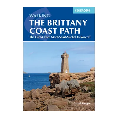
Walking the Brittany Coast Path (Cicerone)
Carroll Dorgan’s guide to the GR34 from Mont-Saint-Michel to Roscoff: 624 km in 28 stages, with maps, GPX files and accommodation listings (2022).
View on Amazon (opens in a new tab)
Worth watching
A hiker’s chaptered overview of the GR34 in English: direction, when to go, difficulty, road sections, side trips and the guidebooks to use, from the French Hiking Federation’s topo-guides to Cicerone.
The video is hosted by YouTube (Google): nothing loads until you play it, and Google may then set cookies.
FAQs
How long does it take to walk the whole GR34?
The FFRandonnée’s Brittany committee reckons on 100 days’ walking for the path’s 1,240 miles or so (2,000 km), at 12 miles (20 km) a day with no rest days. Its topo-guides split the GR34 into sections of 15 to 26 days. The walks suggested by the tourist offices last from two days to a fortnight: enough to cover it section by section, over the years.
How do you get to the GR34 from the UK?
By sea is the most direct way. Brittany Ferries sails between Portsmouth and Saint-Malo all year round, about 11½ hours overnight on the way out, and between Plymouth and Roscoff in season, about 5½ hours by day, with no crossings from December to February in the 2026-2027 timetables. Saint-Malo and Roscoff are both on the GR34.
Can you wild camp on the GR34?
Rarely within the rules. France’s planning code bans isolated camping, unless an exemption is granted, on the seashore and in protected sites, of which there are many on this coast, and the local tourist office says it is banned in every municipality of Lorient Bretagne Sud. Accommodation, campsites included, can be found within 1.2 miles (2 km) of the path: that is the solution recommended in a feature published by the FFRandonnée.
What is the most beautiful stretch of the GR34?
There is no official ranking, but there was a vote: in November 2017, the Bay of Morlaix stretch, from Locquirec to Saint-Pol-de-Léon, won the GR34 the title of France’s favourite GR for 2018. For cliffs, head for Cap Fréhel and Cap d’Erquy, Crozon or Cap Sizun; for granite, the Côte de Granit Rose; for gentler walking, the Gulf of Morbihan.
Is the GR34 difficult?
It is not a mountain path, but it is demanding: up to 1,000 m of ascent in a day, in short, repeated climbs and descents, especially between Mont-Saint-Michel and the Pointe du Raz. The Côte de Granit Rose is easier, with 975 m of ascent over 37 miles (60 km). The real danger remains the cliff edge.
When is the best time to walk the GR34?
The FFRandonnée recommends spring, summer and early autumn; in autumn and winter, some sections become wet or muddy. Tourisme Bretagne speaks of ideal conditions from mid-April to late June, and quieter paths in September. From October to March, many campsites and boats are closed.
Sources
- FFRandonnée (French Hiking Federation), ‘GR 34, le sentier des douaniers’ (in French), route page published 9 June 2026, accessed 23 October 2026. ffrandonnee.fr https://www.ffrandonnee.fr/randonner/sentiers/gr-34-le-sentier-des-douaniers ↩
- FFRandonnée Brittany committee, ‘GR34’ (in French), practical information, accessed 23 October 2026. bretagne.ffrandonnee.fr https://bretagne.ffrandonnee.fr/gr34/ ↩
- National Trails, ‘South West Coast Path’, accessed 23 October 2026. nationaltrail.co.uk https://www.nationaltrail.co.uk/en_GB/trails/south-west-coast-path/ ↩
- GR34 visitor survey (Enquête de fréquentation du GR34), presented at the Rencontres régionales des gestionnaires du littoral, a regional meeting of coastal site managers, 11 December 2019 (in French), accessed 23 October 2026. rivagesdefrance.org https://rivagesdefrance.org/wp-content/uploads/2023/07/20191211_RencontresReg_GestionnairesLittoral_.pdf ↩
- FFRandonnée, ‘Loire-Atlantique : inauguration du dernier tronçon du sentier littoral GR 34’ (in French), 5 September 2018, accessed 23 October 2026. ffrandonnee.fr https://www.ffrandonnee.fr/s-informer/actualites/loire-atlantique-inauguration-du-dernier-troncon-du-sentier-littoral-gr-34 ↩
- Côtes d’Armor Destination (Côtes-d’Armor tourist board), ‘GR34, sentier des douaniers : infos pratiques’ (in French), accessed 23 October 2026. cotesdarmor.com https://www.cotesdarmor.com/balades-et-randonnees/a-pied/gr34-sentier-des-douaniers/infos-pratiques/ ↩
- Finistère Tourisme (Finistère tourist board), ‘Le GR 34’ (in French), accessed 23 October 2026. toutcommenceenfinistere.com https://www.toutcommenceenfinistere.com/grand-itineraire/le-gr-34/ ↩
- FFRandonnée, ‘Le balisage des itinéraires de randonnée’ (in French), 7 October 2024, accessed 23 October 2026. ffrandonnee.fr https://www.ffrandonnee.fr/randonner/sentiers/le-balisage-des-itineraires-de-randonnee ↩
- FFRandonnée Brittany committee, ‘Les 50 ans du GR 34’ (in French), accessed 23 October 2026. bretagne.ffrandonnee.fr https://bretagne.ffrandonnee.fr/les-50-ans-du-gr-34/ ↩
- MonGR (FFRandonnée), ‘Secrets de rando : le GR 34, sentier des douaniers’ (in French), 26 July 2018, accessed 23 October 2026. mongr.fr https://www.mongr.fr/sinspirer/reportage-thematique/secrets-de-rando-le-gr-34-sentier-des-douaniers ↩
- Association pour l’histoire de l’administration des douanes (French customs history society), ‘1719-2019 : 300 ans de missions douanières garde-côtes’ (in French), accessed 23 October 2026. histoire-de-la-douane.org https://histoire-de-la-douane.org/1719-2019-300-ans-de-missions-douanieres-garde-cotes/ ↩
- Code de l’urbanisme (French planning code), articles L121-31 to L121-37 and R121-9 to R121-32 (pedestrian right of way along the coast), current version, Légifrance (in French), accessed 23 October 2026. legifrance.gouv.fr https://www.legifrance.gouv.fr/codes/section_lc/LEGITEXT000006074075/LEGISCTA000031210498/ ↩
- MonGR (FFRandonnée), ‘Le GR 34 élu GR préféré des Français’ (in French), accessed 23 October 2026. mongr.fr https://www.mongr.fr/sinspirer/mon-gr-prefere/le-gr-34-elu-gr-prefere-des-francais ↩
- FFRandonnée, ‘Quelle est la fréquentation du GR 34 en Bretagne ?’ (in French), 5 May 2019, accessed 23 October 2026. ffrandonnee.fr https://www.ffrandonnee.fr/s-informer/actualites/quelle-est-la-frequentation-du-gr-34-en-bretagne ↩
- FFRandonnée Brittany committee, ‘Les topo-guides du GR34’ (in French), accessed 23 October 2026. bretagne.ffrandonnee.fr https://bretagne.ffrandonnee.fr/les-topo-guides-du-gr34/ ↩
- FFRandonnée, ‘Une itinérance de trois jours sur la Côte d’Émeraude en Ille-et-Vilaine’ (in French), 22 March 2019, accessed 23 October 2026. ffrandonnee.fr https://www.ffrandonnee.fr/s-informer/actualites/une-itinerance-de-trois-jours-sur-la-cote-d-emeraude-en-ille-et-vilaine ↩
- FFRandonnée, ‘Le sentier côtier breton GR 34 : gare aux pièges’ (in French), 13 August 2025, accessed 23 October 2026. ffrandonnee.fr https://www.ffrandonnee.fr/s-informer/actualites/le-sentier-cotier-breton-gr-34-gare-aux-pieges ↩
- Côtes d’Armor Destination, ‘GR 34 : de Saint-Cast-le-Guildo à Pléneuf-Val-André’ (in French), accessed 23 October 2026. cotesdarmor.com https://www.cotesdarmor.com/balades-et-randonnees/a-pied/itinerance/gr-34-saint-cast-le-guildo-pleneuf-val-andre/ ↩
- Côtes d’Armor Destination, ‘GR 34 : de Saint-Brieuc à Paimpol’ (in French), accessed 23 October 2026. cotesdarmor.com https://www.cotesdarmor.com/balades-et-randonnees/a-pied/itinerance/gr-34-saint-brieuc-paimpol/ ↩
- Côtes d’Armor Destination, ‘GR 34 : de Lannion à Perros-Guirec’ (in French), accessed 23 October 2026. cotesdarmor.com https://www.cotesdarmor.com/balades-et-randonnees/a-pied/itinerance/gr-34-lannion-perros-guirec/ ↩
- FFRandonnée, ‘Finistère : la presqu’île de Crozon par le GR 34’ (in French), 31 January 2016, accessed 23 October 2026. ffrandonnee.fr https://www.ffrandonnee.fr/s-informer/actualites/finistere-la-presqu-ile-de-crozon-par-le-gr-34 ↩
- Morbihan Tourisme (Morbihan tourist board), ‘À la découverte du GR34’ (in French), accessed 23 October 2026. morbihan.com https://morbihan.com/decouvrir/sauvage-mythique/sur-les-chemins-du-morbihan-balades-et-randos/a-la-decouverte-du-gr34/ ↩
- Réseau des Grands Sites de France, ‘Le label’ (in French), 21 May 2026, accessed 23 October 2026. grandsitedefrance.com https://www.grandsitedefrance.com/label ↩
- Tourisme Bretagne (Brittany tourist board), ‘GR 34, le sentier des douaniers’ and its FAQ (in French), accessed 23 October 2026. tourismebretagne.com https://www.tourismebretagne.com/selon-mes-envies/randonnee-pedestre/gr-34-le-sentier-des-douaniers/ ↩
- FFRandonnée, ‘Les itinéraires de randonnée’ (in French), section on calculating walking times, accessed 23 October 2026. ffrandonnee.fr https://www.ffrandonnee.fr/randonner/ou-pratiquer/les-itineraires-de-randonnee ↩
- Dinard Côte d’Émeraude Tourisme, ‘Dinard, Saint-Malo par le GR34’ (in French), accessed 23 October 2026. dinardemeraudetourisme.com https://www.dinardemeraudetourisme.com/fiche/dinard-saint-malo-par-le-gr34-5V52OVP0/ ↩
- Dinard Côte d’Émeraude Tourisme, ‘GR34 de La Richardais à Lancieux’ (in French), accessed 23 October 2026. dinardemeraudetourisme.com https://www.dinardemeraudetourisme.com/fiche/gr34-de-la-richardais-a-lancieux-5V52P0PF/ ↩
- FFRandonnée Finistère committee, ‘Actualités des sentiers’ (in French), updated 22 October 2026, accessed 23 October 2026. finistere.ffrandonnee.fr https://finistere.ffrandonnee.fr/html/7958/actualites-des-sentiers ↩
- SHOM (French Navy hydrographic service), ‘Horaires de marées’ (in French), accessed 23 October 2026. maree.shom.fr https://maree.shom.fr/ ↩
- Tourisme Bretagne, ‘De Guidel à Port-Louis via la presqu’île de Gâvres’ (in French), accessed 23 October 2026. tourismebretagne.com https://www.tourismebretagne.com/selon-mes-envies/randonnee-pedestre/itineraires-sur-le-gr-34/de-guidel-a-port-louis-via-la-presquile-de-gavres/ ↩
- Compagnie Corsaire, ‘Bus de mer : traversée Saint-Malo, Dinard’ (in French), 2026 season, accessed 23 October 2026. compagniecorsaire.com https://compagniecorsaire.com/destination/bus-de-mer-traversee-saint-malo-dinard/ ↩
- Pays des Abers tourist office, ‘Le GR34 : randonner au cœur des paysages bretons’ (in French), accessed 23 October 2026. abers-tourisme.com https://www.abers-tourisme.com/a-voir-a-faire/aventures-et-escapades/le-gr34-randonner-au-coeur-des-paysages-bretons/ ↩
- Vedettes de l’Odet, ‘P’tit Bac Bénodet, Sainte-Marine’ (in French), 2026 season, accessed 23 October 2026. vedettes-odet.com https://www.vedettes-odet.com/croisieres/ptit-bac-benodet-sainte-marine/ ↩
- Vedettes de l’Odet, ‘P’tit Bac Île-Tudy, Loctudy’ (in French), 2026 season, accessed 23 October 2026. vedettes-odet.com https://www.vedettes-odet.com/croisieres/ptit-bac-ile-tudy-loctudy/ ↩
- Izilo, the Lorient Agglomération transport network, ‘Titres et abonnements’ (in French), accessed 23 October 2026. izilo.bzh https://www.izilo.bzh/titres-et-tarifs/titres-abonnements ↩
- Le Passeur des rias, Étel to Le Magouër crossing (in French), 2026 season, accessed 23 October 2026. lepasseurdesrias.fr https://lepasseurdesrias.fr/ ↩
- Morbihan Tourisme, ‘Le Passeur des îles’ (in French), 2026 season, accessed 23 October 2026. morbihan.com https://morbihan.com/a-voir-a-faire/activites-et-loisirs/le-passeur-des-iles-arzon-fr-4407716/ ↩
- Izilo, ‘Travaux à l’embarcadère de Gâvres’ (in French), accessed 23 October 2026. izilo.bzh https://www.izilo.bzh/actualites/reseau/travaux-embarcadere-de-gavres ↩
- Tourisme Bretagne, ‘Randonner en Bretagne : où dormir ?’ (in French), accessed 23 October 2026. tourismebretagne.com https://www.tourismebretagne.com/selon-mes-envies/randonnee-pedestre/randonner-en-bretagne-ou-dormir/ ↩
- Code de l’urbanisme (French planning code), articles R111-32 to R111-35 (camping), current version, Légifrance (in French), accessed 23 October 2026. legifrance.gouv.fr https://www.legifrance.gouv.fr/codes/section_lc/LEGITEXT000006074075/LEGISCTA000031719402/ ↩
- Ville de Pornichet (Pornichet town council), order ARR2026-211 on the general policing of beaches (in French), May 2026, accessed 23 October 2026. ville-pornichet.fr https://www.ville-pornichet.fr/wp-content/uploads/2026/05/ARR2026-211-POLICE-GENERALE-DES-PLAGES.pdf ↩
- Lorient Bretagne Sud Tourisme (Lorient tourist office), ‘Camping’ (Île de Groix) (in French), accessed 23 October 2026. lorientbretagnesudtourisme.fr https://www.lorientbretagnesudtourisme.fr/fr/immanquables/ile-de-groix/dormir/camping/ ↩
- Parc naturel régional d’Armorique (Armorique regional nature park), ‘Bivouaquer dans le Parc’ (in French), accessed 23 October 2026. pnr-armorique.fr https://www.pnr-armorique.fr/destination-parc/bivouaquer-dans-le-parc/ ↩
- Grand Site Cap d’Erquy-Cap Fréhel, ‘Je respecte le Grand Site’ (in French), accessed 23 October 2026. grandsite-capserquyfrehel.com https://grandsite-capserquyfrehel.com/visiter/je-respecte-le-grand-site/ ↩
- FFRandonnée, ‘Dossier GR 34, sentier des douaniers : le tour de la Bretagne à pied’ (in French), 19 July 2022, accessed 23 October 2026. ffrandonnee.fr https://www.ffrandonnee.fr/s-informer/actualites/dossier-gr-34-sentier-des-douaniers-le-tour-de-la-bretagne-a-pied ↩
- Brittany Ferries, timetable dataset (GTFS) published on data.gouv.fr, accessed 23 October 2026. data.gouv.fr https://www.data.gouv.fr/api/1/datasets/horaires-des-traversees-brittany-ferries/ ↩
- Tourisme Bretagne, ‘Venir en Bretagne en train’ (in French), accessed 23 October 2026. tourismebretagne.com https://www.tourismebretagne.com/comment-venir-en-bretagne/venir-en-bretagne/en-train/ ↩
- Morbihan Tourisme, ‘Comment venir’ (in French), accessed 23 October 2026. morbihan.com https://morbihan.com/pratique/comment-venir/ ↩
- Ville de Quimper (Quimper city council), ‘Le train’ (in French), accessed 23 October 2026. quimper.bzh https://www.quimper.bzh/403-train.htm ↩
- TER BreizhGo, 2026 timetable of the Tire-Bouchon train, Auray to Quiberon, published by the Baie de Quiberon tourist office (in French), accessed 23 October 2026. baiedequiberon.bzh https://www.baiedequiberon.bzh/sites/default/files/2026-05/Horaires%20tire%20bouchon%202026.pdf ↩
- Météo-France, climate data sheet for Dinard, 1991-2020 averages (in French), accessed 23 October 2026. donneespubliques.meteofrance.fr https://donneespubliques.meteofrance.fr/FichesClim/FICHECLIM_35228001.pdf ↩
- Météo-France, climate data sheet for Ploumanac’h, 1991-2020 averages (in French), accessed 23 October 2026. donneespubliques.meteofrance.fr https://donneespubliques.meteofrance.fr/FichesClim/FICHECLIM_22168001.pdf ↩
- Météo-France, climate data sheet for Lorient, Lann-Bihoué, 1991-2020 averages (in French), accessed 23 October 2026. donneespubliques.meteofrance.fr https://donneespubliques.meteofrance.fr/FichesClim/FICHECLIM_56185001.pdf ↩
- Météo-France, climate data sheet for Brest, Guipavas, 1991-2020 averages (in French), accessed 23 October 2026. donneespubliques.meteofrance.fr https://donneespubliques.meteofrance.fr/FichesClim/FICHECLIM_29075001.pdf ↩
- FFRandonnée Côtes-d’Armor committee, ‘Alertes sentiers’ (in French), accessed 23 October 2026. cotes-d-armor.ffrandonnee.fr https://cotes-d-armor.ffrandonnee.fr/alertes-sentiers-randonnee/ ↩
- Commune de Plougonvelin, mayor’s order no. 108-2026 closing the GR34 at Keryunan (in French), 2026, accessed 23 October 2026. cms.ffrandonnee.fr https://cms.ffrandonnee.fr/data/CD29/files/108-2026-fermeture-gr34-keryunan-pour-risque-d-effondrement.pdf ↩
- Préfecture du Finistère (Finistère prefecture), news feed, Storm Austen (in French), 23 October 2026, accessed 23 October 2026. finistere.gouv.fr https://www.finistere.gouv.fr/Actualite/Fil-d-actu-dans-le-Finistere ↩
- FFRandonnée, ‘Suricate : signaler un problème sur les sentiers’ (in French), accessed 23 October 2026. ffrandonnee.fr https://www.ffrandonnee.fr/randonner/sentiers/suricate-signaler-un-probleme-sur-les-sentiers ↩
- Service-Public.fr (French government), ‘Quels sont les numéros en cas d’urgence (Samu, pompiers...) et les numéros d’écoute ?’ (in French), checked 25 August 2026, accessed 23 October 2026. service-public.gouv.fr https://www.service-public.gouv.fr/particuliers/vosdroits/F33954 ↩
- mer.gouv.fr (French government website on maritime affairs), ‘Comment alerter les secours en mer ?’ (in French), accessed 23 October 2026. mer.gouv.fr https://www.mer.gouv.fr/comment-alerter-les-secours-en-mer ↩
- Préfecture du Morbihan (Morbihan prefecture), order of 3 June 2025 regulating the use of fire (in French), accessed 23 October 2026. morbihan.gouv.fr https://www.morbihan.gouv.fr/contenu/telechargement/76823/595944/file/20250603_AP_Feu_Morbihan.pdf ↩
- Préfecture du Finistère, ‘Réglementation de l’emploi du feu de plein air dans le département du Finistère’ (in French), order of 15 July 2025, accessed 23 October 2026. finistere.gouv.fr https://www.finistere.gouv.fr/Actions-de-l-Etat/Risques-naturels-et-technologiques/Feux-de-forets/Reglementation-de-l-emploi-du-feu-de-plein-air-dans-le-departement-du-Finistere ↩

Camping, wild camping, bushcraft and hiking
Guillaume Hoarau writes for Outfarer about camping, wild camping, bushcraft and hiking. A survival-skills enthusiast and a collector of old field manuals, he likes clear explanations, lists that earn their place and other people’s stories, which he tells well.


 Nolwenn Bastide
