 Français (France)
 English (UK)
 English (US)
 Deutsch (Deutschland)

Contents
From the Velay to the Cévennes valleys
The GR 70 crosses the Velay, the Gévaudan, Mont Lozère and the Cévennes. That succession is its appeal: the landscape changes while the thread stays the same. The French Hiking Federation (FFRandonnée) describes volcanic reliefs and farming plateaus in the Velay, valleys and forests in the Gévaudan, then the granite chaos of Mont Lozère and the Cévennes valleys. [1]
The route you walk today is not the route Stevenson walked. In 1878 he linked Le Monastier-sur-Gazeille to Saint-Jean-du-Gard in twelve days [1]. Waymarked by the FFRandonnée in 1993 between those two towns, the GR 70 was later extended to Le Puy-en-Velay and Alès, to make the historic route easier to reach [2]. This matters when you compare trips: two offers called ‘Stevenson Trail’ may not start and finish in the same places.
For a full crossing, take the ends of today’s GR. For a shorter trip, state your start and finish clearly before asking for a quote or booking nights. Do not compare only the number of days: compare the route actually included.
| Landmark | What it means when you prepare the trip |
|---|---|
| Le Puy-en-Velay | Start of the full GR 70; a railway station makes access easier. [1] [2] |
| Le Monastier-sur-Gazeille | Start of the historic core as the association presents it. [2] |
| Saint-Jean-du-Gard | End of that historic core, but not of the full GR. [2] |
| Alès | End of the full GR 70; a railway station makes the return easier. [1] [2] |
How many days to allow on the GR 70
The association usually gives 12 to 14 days between Le Puy-en-Velay and Alès. The FFRandonnée describes a usual split into 14 stages. These are not competing prescriptions: the split depends on where you sleep and on the days you want to walk. [1] [3]
Walking time and travel time are also two different things. Your calendar should show the arrival, a possible first night, the days on foot and the return. A number of walking days does not tell you, on its own, how much leave to take.
For one week, the association suggests splitting at Chasseradès or Le Bleymard. It also publishes ideas for shorter stays. These formats help you choose an area; they do not replace checking the stages and the transport. [3]
| Time available | Proposal published by the association | What it tells you |
|---|---|---|
| About two weeks | Le Puy-en-Velay to Alès, 272 km | Full crossing. [3] |
| About one week | Le Puy-en-Velay to Chasseradès or Le Bleymard | Northern part, to fit to the nights and the way out. [3] |
| About one week | Chasseradès or Le Bleymard to Alès | Southern part, with the first access to organise. [3] |
| A few days | One sector, for example Le Puy to Langogne | Partial trip; do not infer the difficulty from the number of days alone. [3] |
Do not turn these suggestions into a target to hit at all costs. The brochure describes a mid-mountain trail, often stony and sometimes muddy, with a succession of climbs and descents. A distance that is fine on familiar ground is therefore not enough to validate a stage of the GR 70. [2] To fit the distances to your own pace, see How to estimate walking time on a hike.
Indicative stages, not a compulsory programme
Here is an example of a split published by a transport operator working on the trail. Its interest is that it shows the gaps between days. It is neither an official guidebook, nor a buying recommendation, nor a guarantee of service or of available lodging. [4]
| Start | Finish | Published indicative distance |
|---|---|---|
| Le Puy-en-Velay | Le Monastier-sur-Gazeille | 19 km |
| Le Monastier-sur-Gazeille | Le Bouchet-Saint-Nicolas | 24 km |
| Le Bouchet-Saint-Nicolas | Pradelles | 21 km |
| Pradelles | Le Cheylard-l’Évêque | 22 km |
| Le Cheylard-l’Évêque | La Bastide-Puylaurent | 27 km |
| La Bastide-Puylaurent | Chasseradès | 13 km |
| Chasseradès | Le Bleymard | 17 km |
| Le Bleymard | Le Pont-de-Montvert | 19 km |
| Le Pont-de-Montvert | Florac | 29 km |
| Florac | Cassagnas | 19 km |
| Cassagnas | Saint-Étienne-Vallée-Française | 24 km |
| Saint-Étienne-Vallée-Française | Saint-Jean-du-Gard | 13 km |
| Saint-Jean-du-Gard | Alès | 23 km |
Source of all the distances in the table: the indicative split of La Malle Postale. Place names have been harmonised. [4]
The distances in this table add up to 270 km, whereas the general length announced by the FFRandonnée and the association is 272 km. This does not correct the GR: it simply shows that indicative stage distances are not an exact survey of the route. The sources consulted do not allow the gap to be attributed to rounding, measuring points or a variant. [1] [3] [4]
From Le Bleymard to Florac, the operator adds 19 and 29 km, 48 km in all, while the FFRandonnée offers 43.50 km in two days for the same start and finish, on the GR 70 and GR 68 over Mont Lozère and the Bougès massif. These are two routes, or two measurements, that do not match exactly: do not mix them to rebuild a missing stage. [1] [4]
To personalise the programme, start from a reference route and place the lodgings you have chosen. Add the access off the trail before judging the day. The brochure points out that some hosts are off the GR and asks you to check access with them. It also warns that its location maps are not for finding your way on the ground. [2] To prepare the track itself, see Plan your walk: map, app and GPX track.
When to go: walking season and when services open
The FFRandonnée advises May to September. The association widens its recommendation to May to October and reminds you that the trail climbs to 1,700 m. Neither wording is a guaranteed opening calendar for the path or the services. [1] [5]
The period both bodies share is therefore May to September. For October, the association remains a favourable reference, but lodging, supply points and transport must be checked for your dates. It expressly recommends that check outside the season. [5]
The commercial season does not overlap exactly with the recommended walking season either. The 2026 brochure gives a general opening of lodgings from mid-March to the first days of November, while the booking page speaks of Easter to All Saints’ Day. Those are tendencies, not commitments by each establishment. Only direct confirmation lets you build a reliable chain of nights. [2] [6]
The association also suggests starting on a weekday rather than at the weekend, to limit the risk of finding lodging full. This can help when the route you want has no bed on some stage. [5]
Booking nights and meals together
The association’s network includes hotels, inns, guest rooms, walkers’ hostels (gîtes d’étape) and campsites. This variety lets you build a trip, but it does not ensure a free place at every stop. The association strongly advises booking and says some stages offer only one or two small establishments. [6]
Before confirming, ask what the price covers. In the brochure, a night in a hotel or guest room is a room for two people; a night in a gîte d’étape is one bed for one person. Half board is quoted per person, on the basis of two, and the booking page specifies that it includes dinner, bed and breakfast. A single-occupancy rate has to be requested directly. [2] [6]
These different units make a comparison of raw prices misleading. A room is not a bed; a night alone is not half board. Tourist tax is not always included in the published amounts. [2] [6]
State your meal needs too. The brochure distinguishes breakfast, meal and packed lunch; having a bed does not mean all those services are included. The association points out that the areas crossed are sparsely populated and invites you to use shops on the way to stock up. [2] For quantities, see Water and food on a walk: the right amounts.
Carrying your pack or having luggage moved
The brochure lists several carriers of people and luggage. A transfer can lighten the walk, but it adds coordination between your nights and the service you book. The association asks you to tell your hosts when luggage will be dropped at their door during the day. [2] Another option is to walk with a donkey: see Donkey trekking in France for two or three days.
When we read it, La Malle Postale announced that requests for 2027 rates and bookings would open from December. That calendar concerns that operator, not every service on the trail. No 2027 transport price is therefore taken as given here. [4]
Have these confirmed before booking
- The address of each night and the access from the GR.
- The price with meals, taxes and any single-occupancy supplement.
- Whether the services are actually open on your dates.
- The host’s agreement to receive transferred luggage.
- The terms for changing things if a stage has to move.
This grid is meant to get you a coherent programme; it does not replace the providers’ own terms.
Organising the return before you leave
Le Puy-en-Velay and Alès each have a railway station: that is one advantage of the ends of the full GR. Conversely, the association warns that the small villages along the way are not all served by train or coach. For a partial trip, transport can therefore decide where you stop as much as the distance you want. [3] [2]
To get back from Alès to Le Puy-en-Velay, its access page suggests one principle: train from Alès to Langogne, then coach from Langogne to Le Puy. That is not a promise of a connection every day. The same page lists rail and road lines, with operating restrictions depending on the service. [7]
Before you block the last nights, search the full journey for the real return date. Check the exact stop, the connection time and any replacement service. The association’s page is a documentary starting point; the networks’ timetables must decide the trip you book.
For an arrival at Saint-Jean-du-Gard rather than Alès, the association mentions coaches to Alès. Again, the day of operation is part of the check. An intermediate stop must be treated as a real end of trip, with a confirmed way out. [7]
If you leave the car at the start, the brochure points to places to park: ask the tourist office at Le Puy-en-Velay, near the cemetery at Le Monastier-sur-Gazeille, the Château and Maison du Tourisme car parks at Florac, the railway station at Alès [2]. Check access for your dates.
| Situation | Point to lock down |
|---|---|
| Full crossing without a car | Journey to Le Puy and departure from Alès on your dates. |
| Car left at the start | Return by public transport or a booked transfer. |
| Stopping along the way | Access to a served stop and real connections. |
| Private transfer | Place, time, price and booking terms confirmed. |
Sleeping in a tent: campsite or wild camp
Campsites appear in the trail’s directory. A pitch on a campsite and a wild camp in the countryside are, however, two different arrangements: the presence of the GR is no general permission to pitch a tent. Outside the heart of the national park, the brochure invites you to ask the landowner’s permission before camping, in a barn as in a field. [2] [8]
In the heart of the Cévennes National Park, the official page allows wild camping under cumulative conditions. It reserves it for walkers without motorised vehicles, within 50 m at most on either side of waymarked GR or GRP routes, with no tent or a light tent in which you cannot stand up. You may stay for one night only, between 7 pm and 9 am. [8]
Above all, some sections are closed to wild camping. The Park provides, among others, a map for the Finiels sector on the GR 70. The general conditions therefore never exempt you from consulting the exclusion map and local information. This rule concerns the heart of the Park, not the whole route from Le Puy to Alès. [8] For the general rules, see French national park rules, park by park and Wild camping in France: what the law says.
The most useful programme remains the one where every night, every meal you need and every transport link has an identified solution, while the distances stay adaptable to the walker.
Kit related to this article
No affiliation: no commission, no sponsored products.
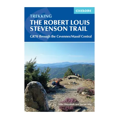
Trekking the Robert Louis Stevenson Trail (Cicerone)
Cicerone’s guide to the GR70, third edition reprinted in 2025: the 272 km from Le Puy to Alès, with route descriptions, accommodation listings and maps, in Stevenson’s footsteps.
View on Amazon (opens in a new tab)
FAQs
Does the Stevenson Trail have to take two weeks?
No. The association generally gives 12 to 14 days for the full route from Le Puy-en-Velay to Alès, but it also suggests one-week trips and shorter sectors. These are guides, not obligations. The time you really need depends on the split you choose and the nights available; add the outward and return journeys to your calendar separately. [3]
Can I finish at Saint-Jean-du-Gard?
Yes, for a partial route: Saint-Jean-du-Gard marks the end of the historic core described by the association. The current GR 70 continues to Alès, so stopping earlier means a different return. The access page mentions coaches between Saint-Jean-du-Gard and Alès; check their operating days for the day you choose. [2] [7]
Do I need to book all the lodging in advance?
The association strongly advises it, because some stages offer only one or two small establishments. Booking mainly lets you check that the split you want matches nights that are really available. Ask too whether dinner, breakfast and a packed lunch are offered: booking a bed does not guarantee all the meal services. [2] [6]
What is the best time of year to walk it?
May to September is the period both the FFRandonnée and the association recommend. The association extends its recommended period to October. A lodging being open does not guarantee conditions suited to walking, however: the association reminds you of the trail’s altitude and of how winter differs. Check conditions and services for your dates. [1] [5]
Can I get back from Alès to Le Puy without a private shuttle?
The association describes a return by train from Alès to Langogne, then by coach from Langogne to Le Puy-en-Velay. This principle must be checked against the timetables for the day you choose, especially the connection. It is not a guarantee of a daily link. Settle this before confirming the last stage and the nights around it. [7]
Is wild camping allowed everywhere on the GR 70?
No: the conditions given for the heart of the Cévennes National Park are not a permission for the whole trail. In that heart, hours, a distance from the GR and a type of shelter are imposed, with sectors excluded. The Park publishes, among others, a map for the Finiels sector. Check the exact location of the night you have in mind. [8]
Sources
- French Hiking Federation (FFRandonnée), GR 70 : le chemin de Stevenson, accessed 3 November 2026. mongr.fr https://www.mongr.fr/trouver-prochaine-randonnee/itineraire/gr-70-le-chemin-de-stevenson ↩
- Association Chemin de Stevenson, Voyage en Cévennes, brochure 2026, 2026 edition, 64-page PDF, checked on its printed pages, accessed 3 November 2026. chemin-stevenson.org https://www.chemin-stevenson.org/wp-content/uploads/2026/01/WEB_-CHEMINS-STEVENSON-2026-FR.pdf ↩
- Association Chemin de Stevenson, Choisir ses étapes, accessed 3 November 2026. chemin-stevenson.org https://www.chemin-stevenson.org/choisir-ses-etapes/ ↩
- La Malle Postale, Le Chemin de Stevenson (GR 70), accessed 3 November 2026. lamallepostale.com https://www.lamallepostale.com/fr/itineraires/chemin-de-stevenson ↩
- Association Chemin de Stevenson, Quand partir, accessed 3 November 2026. chemin-stevenson.org https://www.chemin-stevenson.org/quand-partir/ ↩
- Association Chemin de Stevenson, Réserver ses hébergements, accessed 3 November 2026. chemin-stevenson.org https://www.chemin-stevenson.org/reserver-ses-hebergements/ ↩
- Association Chemin de Stevenson, Accès / Transport, accessed 3 November 2026. chemin-stevenson.org https://www.chemin-stevenson.org/acces-transport/ ↩
- Cévennes National Park, Les règles pour tous, accessed 3 November 2026. cevennes-parcnational.fr https://www.cevennes-parcnational.fr/fr/le-parc-national-des-cevennes/la-reglementation-du-coeur/les-regles-pour-tous ↩

Nature, photography, walks and travel
Joséphine loves nature for its beauty: walks, photography, travel, nights in a campervan or glamping. Neither an expert nor particularly sporty, she writes and reviews with a newcomer’s eye, which is invaluable for all our content aimed at beginners.

 Guillaume Hoarau

 Nolwenn Bastide

 Arnaud Couderc